The Edinburgh Realty Blog
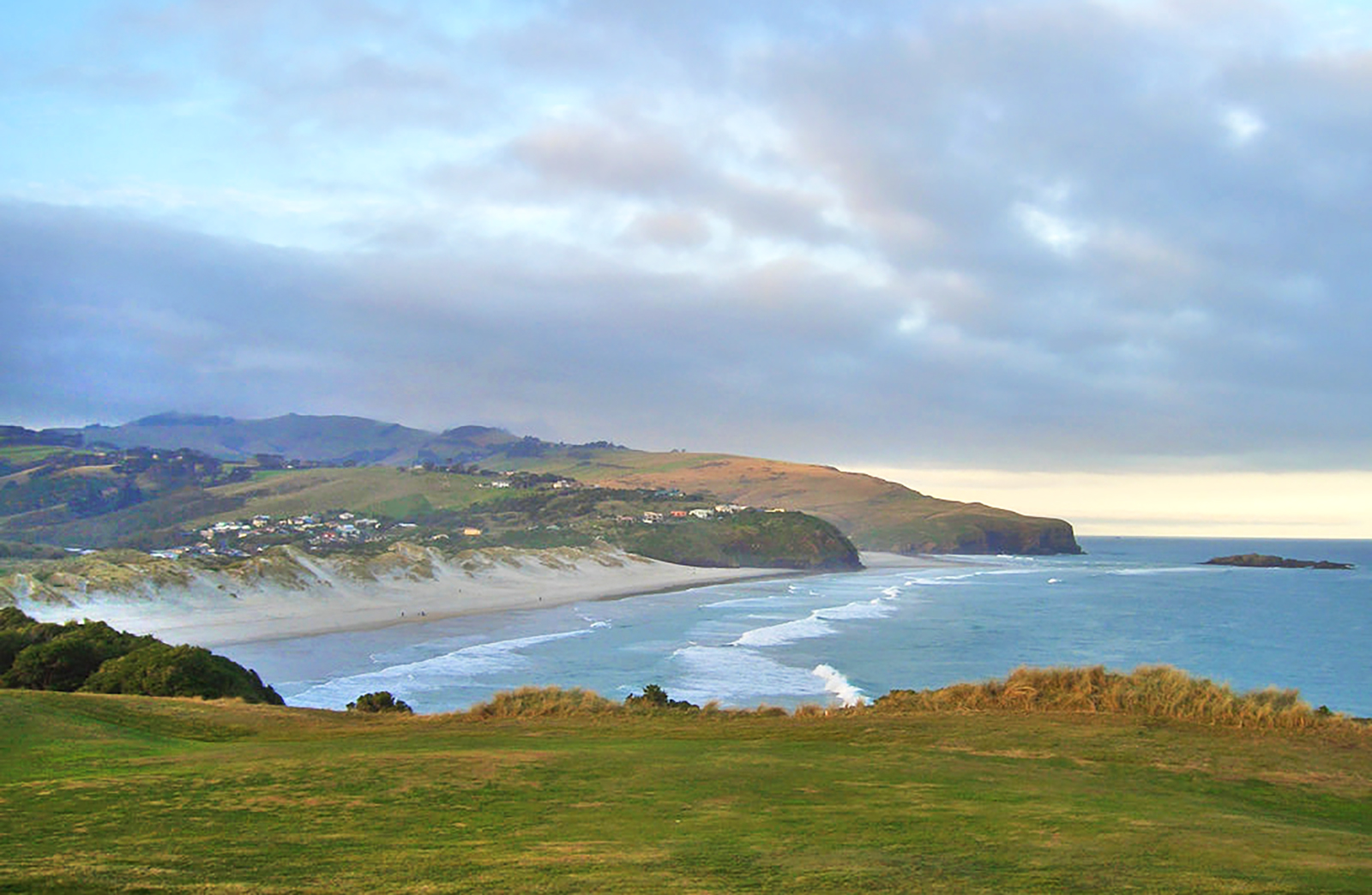
Ocean Grove
Ocean Grove is tucked beyond Lawyer’s Head at the east end of St Kilda Beach. Also known by its former name of Tomahawk, it is a small semi-rural community.
Ocean Grove is situated at the start of the Otago Peninsula and surrounded by natural features: the Pacific Ocean, Tomahawk and Smaill’s beaches, Tomahawk Lagoon and its associated wildlife and the Ocean Grove Recreational Reserve. It feels a world away from the city, yet it’s only 6.5km – a 12-minute drive – from central Dunedin.
There are two clubs based at Ocean Grove: Grants Braes Association Football Club, which has its home at the reserve; and the Tautuku Fishing Club, which occupies a large two-story stone homestead. Glencairn was built in the 1870s for the Smaill family, who farmed the area up until 1952. The fishing club purchased the homestead in 1972 and it serves as both its clubrooms and a function venue.
Photo credit: Will Ellis, www.flickr.com
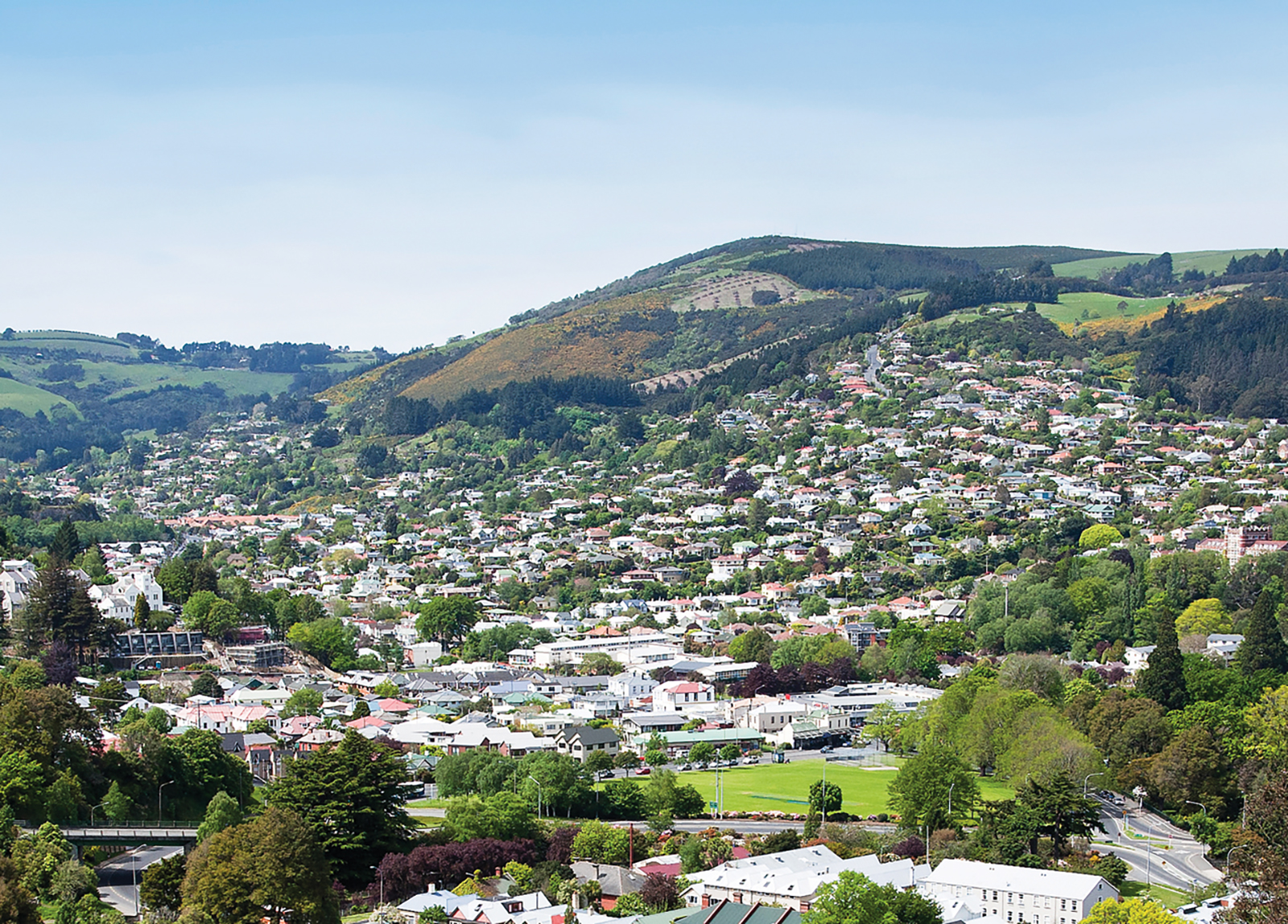
North East Valley
North East Valley is a suburb rich with history and community spirit, which sits in the valley between Pine Hill and Opoho, 3 kilometres to the northeast of Dunedin's city centre. A residential suburb, North East Valley is also home to a mix of students from the University of Otago and Otago Polytechnic, which lie to the south beyond the Dunedin Botanic Garden.
The Dunedin Botanic Garden is New Zealand's first botanic garden and holds the status of Garden of International Significance. It has hill views from sunny lawns, more than 6,800 plant species and the song of wild native bellbirds, wood pigeons and tui. The Garden celebrates its 150th anniversary this year marking its position as New Zealand’s first botanic garden. It occupies 28 hectares in North Dunedin at an altitude of 25 – 85 metres above sea level. Its wide range of horticultural and botanical collections includes roses, the herbaceous and perennial borders, a rock garden, New Zealand native plants and four hectares of Rhododendron Dell with more than 3,000 rhododendrons. An important aspect of The New Zealand Native plant collection is the cultivation of rare and endangered native plant species.
One long road, North Road, spans the entire length of the valley. Starting at the Gardens Corner, named after the Dunedin Botanic Garden which sit at this intersection, North Road runs relatively straight for 2.2 kilometres with side roads branching off it, many of which are notoriously steep. One of these, Baldwin Street, is known as the world's steepest street. The street's steepness was unintentional. As with many other parts of early Dunedin, and indeed New Zealand, streets were laid out in a grid pattern with no consideration for the terrain, usually by planners in London. In the case of Baldwin Street (and much of the Dunedin street plan), the layout was surveyed by Charles Kettle in the mid-19th century. The street is named after William Baldwin, an Otago Provincial Councillor and newspaper founder, who subdivided the area. The street is the venue for an annual event in Dunedin, the Baldwin Street Gutbuster. Every summer since 1988, athletes run from the base of the street to the top and back down again. The event attracts several hundred competitors annually. Since 2002, a further charity event has been held annually in July, which involves the rolling of over 30,000 Jaffas. Each Jaffa is sponsored by one person, with prizes to the winner and funds raised going to charity. This event follows a tradition started in 1998, when 2,000 tennis balls were released in a sponsored event raising money for Habitat for Humanity.
Dotted along the valley sit several notable buildings and gardens, among them North East Valley Normal School, the Quarry Gardens, Ross Home, Chingford Park and stables, Forrester Park, and Bethune’s Gully. North East Valley Normal School is the second oldest school in Dunedin, opened in 1851, predating the establishment of the Otago Education Board by 5 years. At this time North East Valley was thickly bushed with little clearings along its length. The school was barn-like, thatched, with small window spaces and an open fireplace. It was divided into living quarters for the teacher and a single classroom. Later in 1882 a large stone building was built. The stone building was eventually demolished and the school buildings are now all wooden.
The Quarry Gardens are a park created from the former Palmer's Quarry. The quarry was closed in 1980, and was thoroughly landscaped from 1989 into a terraced garden area. The amphitheatre of the old quarry pit has been used as an outdoor music venue, especially during the late 1990s. The gardens are privately owned, but are open to the public year-round.
Chingford Park is a recreational reserve containing historic stone stables, located towards the northern end of North Road. It surrounded Chingford House, which had been built in 1862 but no longer exists. The property was built and landscaped in the 1870s and 1880s by businessman P.C. Neill, a major Dunedin businessman. Among improvements made by Neill to the property include the historic bluestone stables, built in the 1870s, which still stand as a centre for the park and is still used for events. This is one of the larger stone stables built in the neo-Gothic style in New Zealand. It is two storied with six gables and the equivalent of a large house in size. Chingford Park is popular with walkers, and also contains soccer and cricket grounds, and the city's main archery club. Lindsay Creek, a small stream which runs the length of North East Valley, runs through the park.
Past Chingford Park, the suburban part of the road ends at the junction with Norwood Street, and North Road starts to climb and wind around the end of the valley. Forrester Park is a sports ground at the end of Norwood Street. It contains football and rugby pitches and the city's BMX circuit, as well as a dog park and kennel club. Bethune's Gully is also accessed from Norwood Street. From here, walking tracks ascend the slopes of Cargill. The reserve was originally the site of sawmills and brick kilns operated by David Bethune in the 1880s, and became city council property in 1955.
Normanby is the name of the northern end of North East Valley, at which point Dunedin's urban area gives way to open countryside. The land here is steeply sloping, as it is the foothills of Mount Cargill. Both North Road and Norwood Street run through rural farmland, connecting with roads to Port Chalmers and Waitati. Until the construction of the Dunedin Northern Motorway this was a major route out of Dunedin to the north, but is now only lightly used.
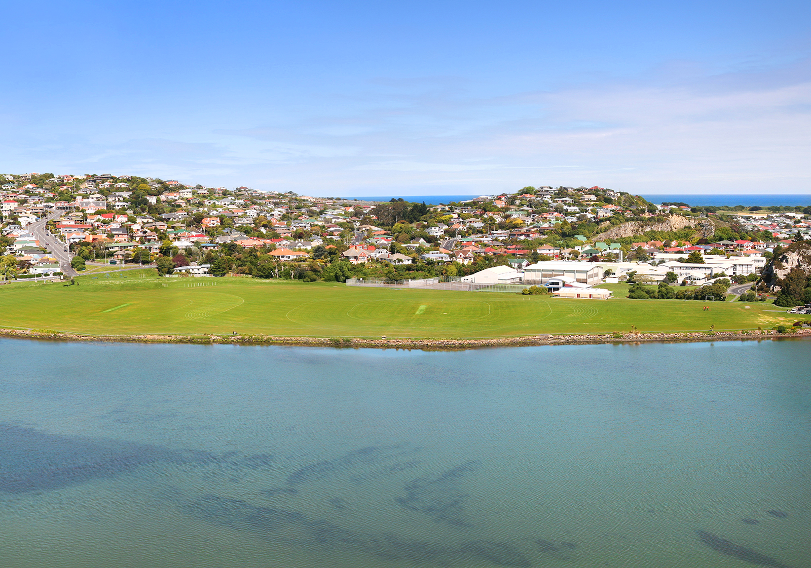
Musselburgh
Musselburgh is a sunny suburb located in the southeast of the city centre, at the narrowest point where the Otago Peninsula joins to the rest of the South Island.
Taking its name from the similarly named town in Scotland, Musselburgh's most distinctive feature is a rocky outcrop called Musselburgh Rise, which rises prominently above the eastern end of "The Flat", the local name for the broad coastal plain which stretches across the suburbs of Saint Kilda and South Dunedin.
Musselburgh is an easy 5 - 6 minute drive to the central city, University, and Hospital, 5 - 6 minutes drive to local beaches, right at the beginning of the Otago Peninsula and within 2 - 5 minutes walking distance of other amenities.
The rise lends its name to the suburb's main street, Musselburgh Rise, which contains the suburb's small retail area, consisting of a dairy, a takeaway shop, hairdresser, doctor, dentist, pharmacy, fish shop and a florist. This shopping area and the southern flank of the Rise is sometimes considered a separate suburb, Sunshine, formerly known as Goat Hill.
The northern side of the Musselburgh Rise is skirted by another main thoroughfare, Portobello Road. This road joins with the southern end of Portsmouth Drive close to the northeastern point of the rise, and continues across the causeway at Andersons Bay Inlet. Close to the junction is a large memorial stone to the Taranaki Māori prisoners of the New Zealand Land Wars who were transported south to Dunedin, many of whom constructed the causeway and much of Dunedin's foreshore roads as forced labour. A branch railway ran along Portobello Road in this area from the 1870s until 1912, and rail links continued to the suburb until the track were lifted in 1928.
Close to the eastern edge of the rise is one of Dunedin's main secondary schools, Bayfield High School. This school lies close to the boundary of the suburbs of Musselburgh and Andersons Bay. The top of Musselburgh Rise includes several larger homes, notably including Belmont, built in the 1860s for politician and newspaper editor William Cutten. Belmont was later owned by Sidney Neill, and became famed for its gardens Neill was the son of Percy Neill, founder of Neill & Co, which was to become New Zealand's largest importer of spirits.
Image courtesy of Open2View
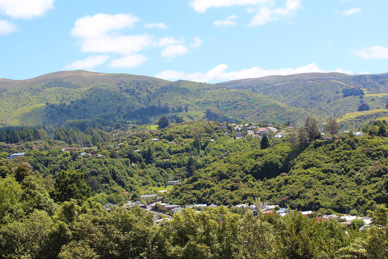
Leith Valley
The Leith Valley sits on the northwest edge of Dunedin and incorporates three suburbs: Woodhaugh at the base of Pine Hill; peaceful Glenleith; and the semi-rural Leith Valley.
The valley is home to about 1500 people across the three suburbs. It’s about 14km long and follows the Water of Leith stream, as it makes its way from Mount Cargill, through north Dunedin, the University of Otago campus and out to the harbour.
Woodhaugh is best known for the popular Woodhaugh Gardens and also includes many historical buildings. Being right on George Street, the suburb is popular with students and is also enjoyed by families, with George Street Normal School a popular primary school.
Glenleith has generous pockets of bush, the much-loved Ross Creek walking track and an historically-significant reservoir. Glenleith gives way to a more rural setting, as the valley climbs upwards into Leith Valley, proper.
The Leith Valley Scenic Reserve – home to Nicols Falls and glow worms – can be found 350m up from the Malvern Street intersection.
The Leith Valley Touring Park is another notable feature in the area. Highly-rated by travellers, the park accommodation covers campers, motels, cabins and tents.
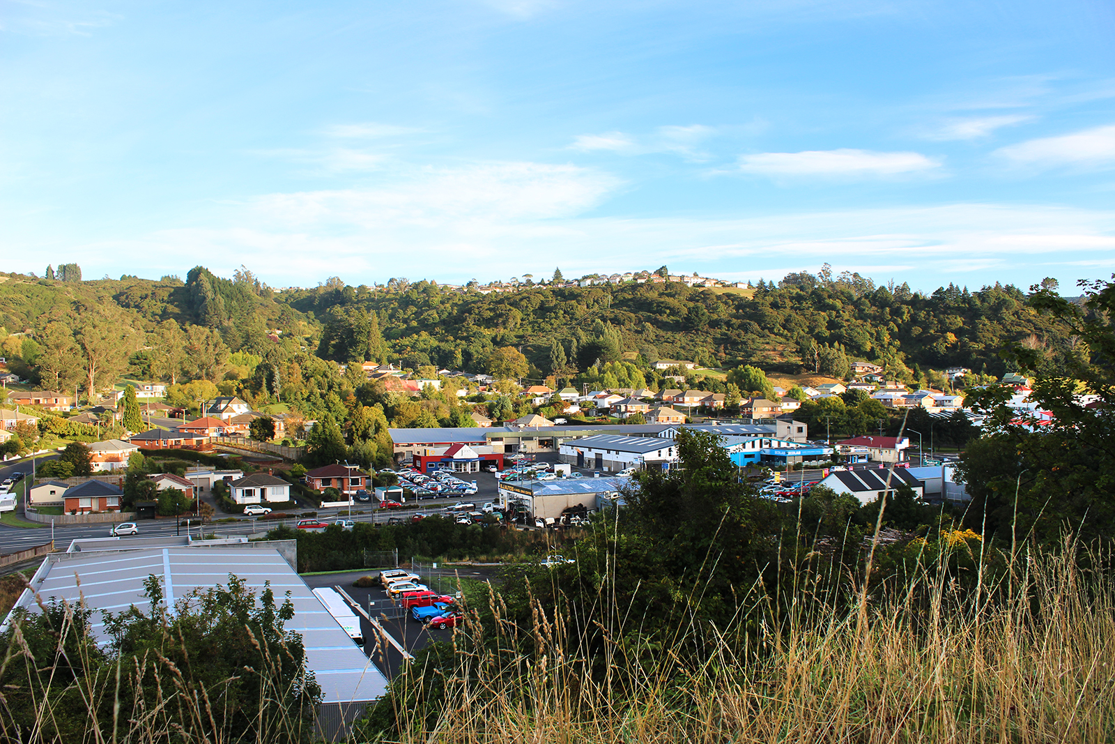
Kaikorai Valley
Kaikorai Valley describes the wide valley that runs from the southern motorway’s Burnside junction, through to Stuart Street.
It incorporates three Dunedin suburbs – Kenmure at the bottom of the valley, Bradford in the centre and Kaikorai at the top.
The valley includes a mix of light industrial businesses and residential homes. It is well serviced by schools, with Bradford Primary and Kaikorai Valley College – a co-ed school, which caters for Year 7 through to Year 13 students. The college is set in an attractive park-like setting and provides a community focal point.
There is a popular Top 10 Holiday Park towards the top of the valley, which attracts a steady stream of visitors into the area.