Mark Miller
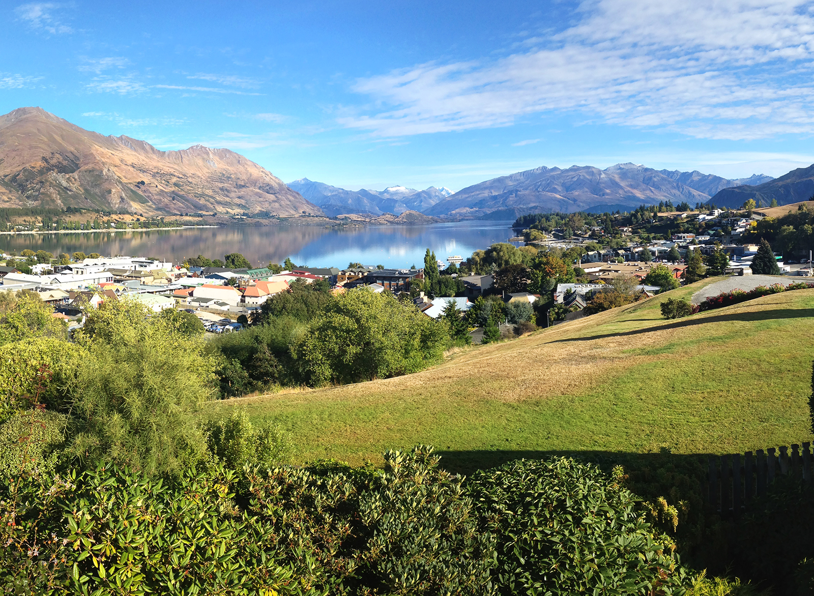
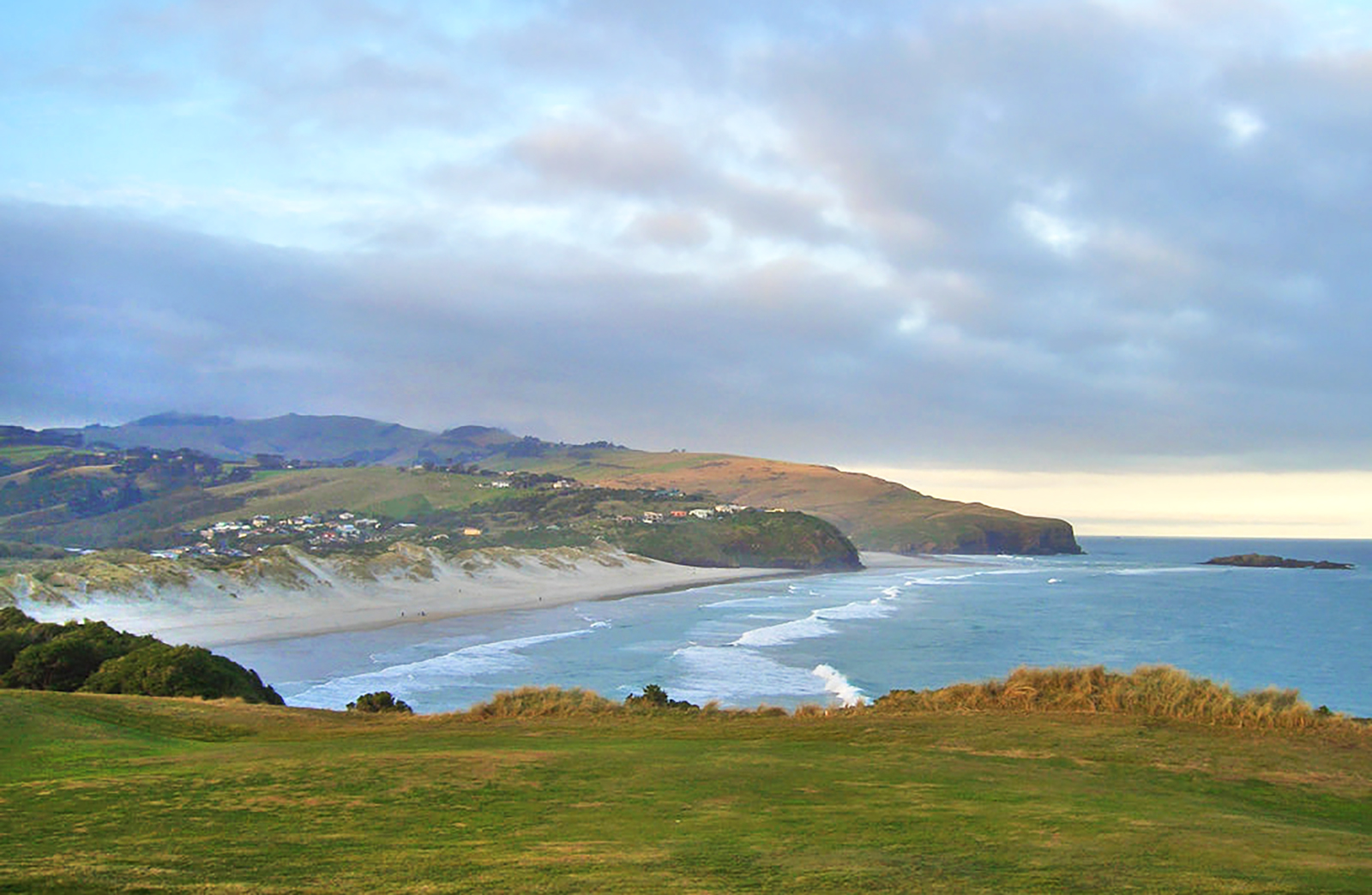
Wanaka
45 kilometres long and covering 193 square kilometres, the crystal clear waters of Lake Wanaka are perfect for jetboaters, sailors and kayakers to explore.
Nestled below towering mountains, Wanaka is the most tranquilly set of the South Island lakes. In winter, skiers flock here from all over the world for superb skiing and snowboarding at Cardrona and Treble Cone, cross-country skiing at Snow Farm and heli-skiing high in the Harris Mountains. But Wanaka, is much more than a winter destination. Year round activities include fishing, hiking, canyoning, climbing and skydiving. Visit the nearby towns of Queenstown, Cromwell and Alexandra, go shopping, or simply sit in a café and watch the world pass by.
One of the attractions of a stay in Lake Wanaka is that it combines the warmth of small town living with the quality and attention to detail you’d expect of an international holiday destination. Accommodation ranges from luxury lodges and boutique B&Bs to backpacker lodges and family holiday parks. It’s an easy walk to shops and restaurants from most accommodation and taxis cars and bikes are readily available. And if you want to head out of town, transport providers offer daily services to most popular destinations.
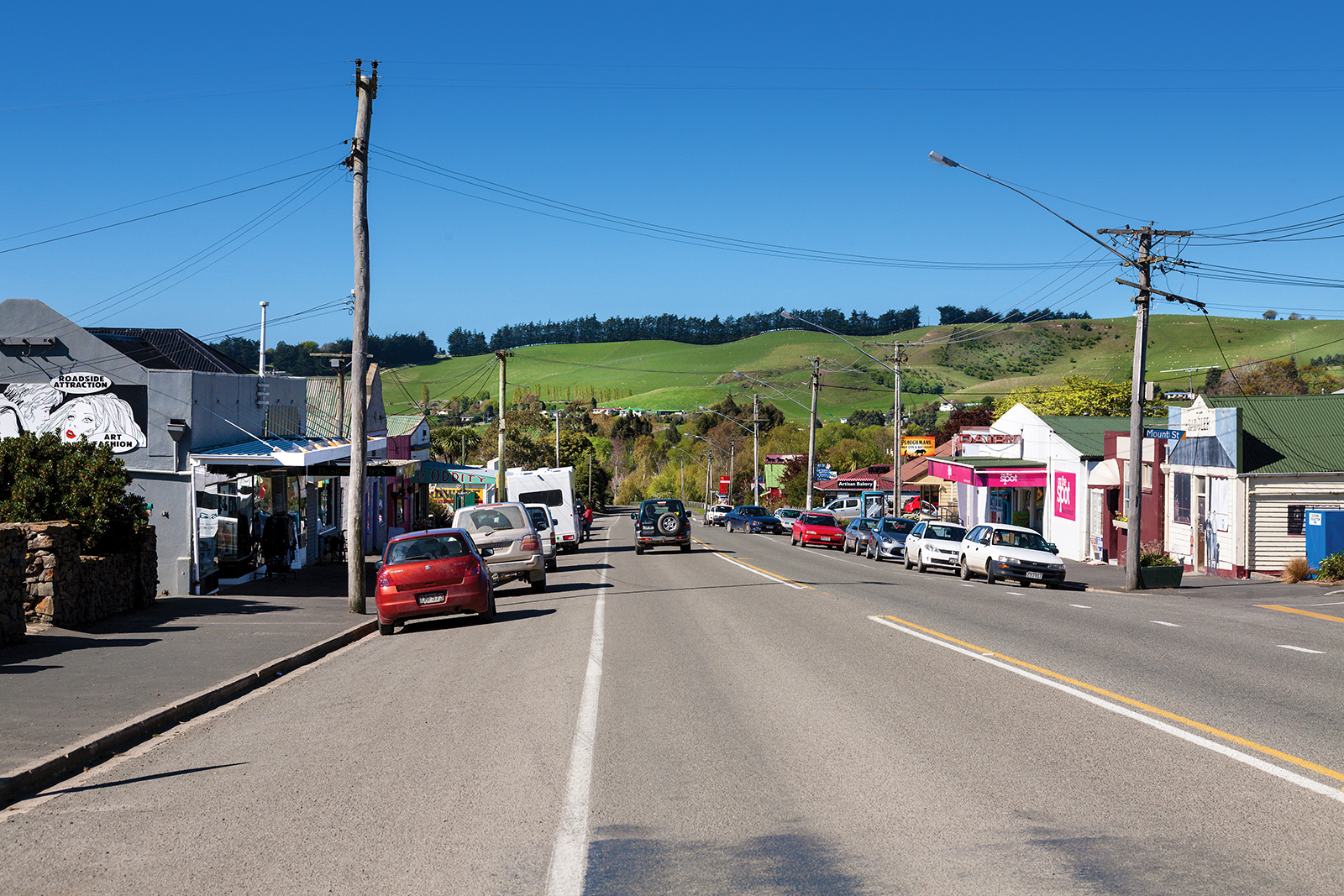
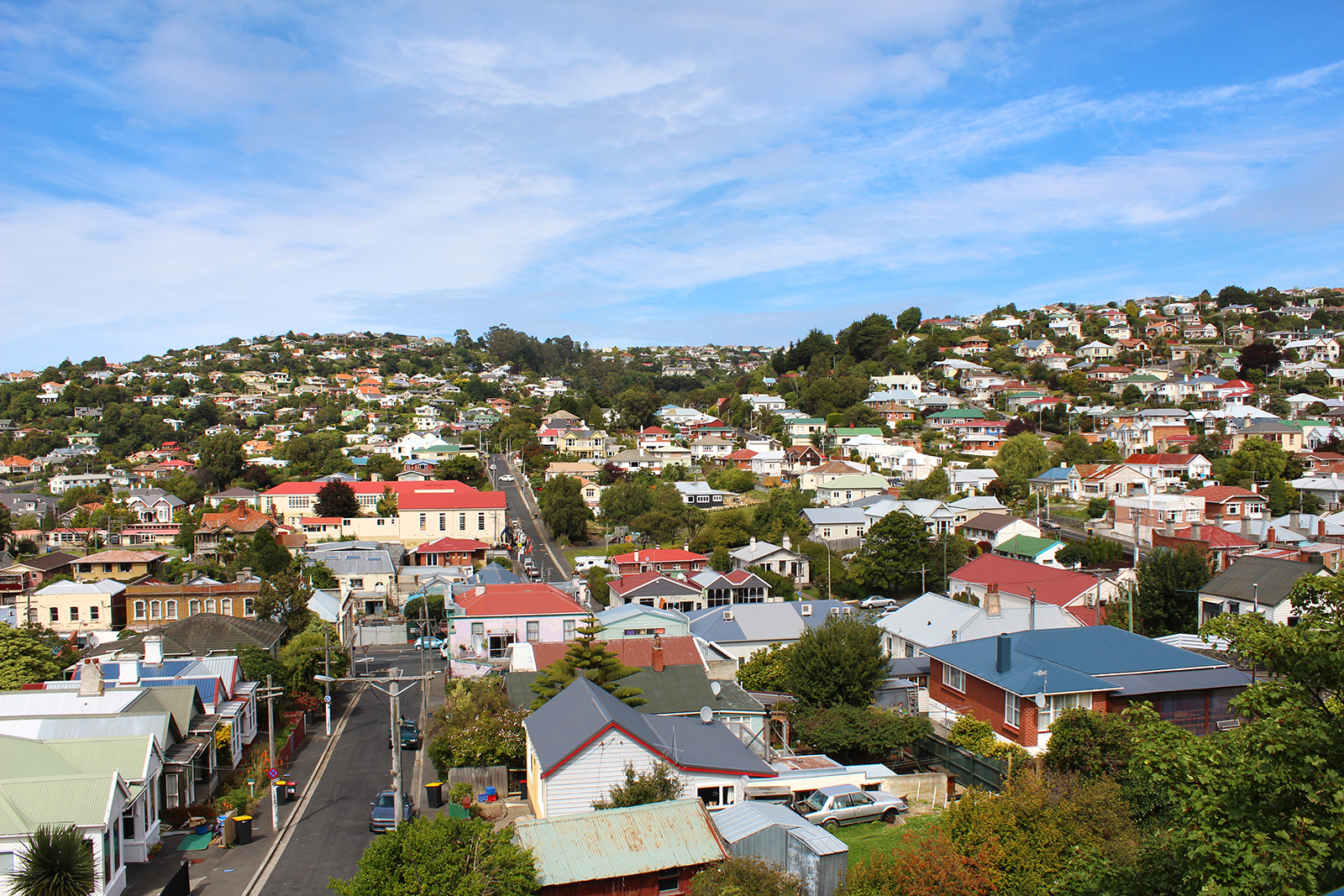
With its lake and mountain views, Wanaka has become a popular tourist resort, considered less commercialised than Queenstown. Wanaka boasts a growing number of restaurants, cafes and a diverse nightlife. Other attractions in the town include Puzzling World and the Paradiso Cinema. Puzzling World contains a maze, optical illusions and a leaning clocktower. The Paradiso is a classic old cinema, with seating consisting of old couches and an in-theatre Morris Minor. There are a number of wineries in the area.
Wanaka, situated at the southern end of Lake Wanaka, is the gateway to Mount Aspiring National Park. Wanaka is primarily a resort town but has both summer and winter seasons and is based around the many outdoor opportunities. Due to the growing tourism business and the increasing number of retirees in Wanaka, large growth is occurring, with a population increase of up to 50% in the past 10 years.
The town is part of the Queenstown-Lakes District and was originally settled during the gold rush of the 19th century. The first European in the area was Nathaniel Chalmers, who was guided inland by Chief Reko in 1853. Maori knowledge of the region is evidenced by an earlier sketch map from Chief Te Huruhuru at Waimate.
European settlement began in the Upper Clutha River Valley in the 1850s, with the establishment of sheep stations by runholders. The first station was at Albert Town, the only place where settlers could ford the Clutha River. The present site of Wanaka was first surveyed in 1863, and settlement increased in Pembroke (the old name for Wanaka) during the 1870s because of timber milling in the Matukituki Valley and the use of Lake Wanaka for transport. Tourism in the town began in 1867 with the opening of the first hotel, by Theodore Russell. Wanaka proved a very popular tourist destination because of its borderline continental climate and easy access to snow and water. The world's first sheepdog trials were reportedly held in Wanaka in 1867. Pembroke was renamed Wanaka in 1940.
A number of mountains surrounding Wanaka can be climbed, including Roys Peak, Mount Iron, Mount Grand and the Pisa Range, all of which provide views of the surrounding area. The biennial Warbirds over Wanaka airshow, has become a major attraction for national and international guests.
Wanaka is host to outdoor recreation and tourism activities with hiking, mountain biking, mountaineering, fishing, paragliding, kayaking, rafting, jetboating, and environmental activities. Wanaka has a sunny climate and serves as an access point to the highest New Zealand mountain outside of the Mount Cook region: Mount Aspiring/Tititea. Mount Aspiring National Park is popular for mountaineering and hiking. Tourists enjoy day trips into the park and many tourists go hiking in the park for up to a week at a time. Parts of the Matukituki Valley on the road to the park are popular for rock climbing, and for day walks. Lake Wanaka itself is popular for waterskiing, wakeboarding and sailing. This along with the local rivers provide many opportunities for fishing. There is a dedicated mountain biking area made by volunteers in a local pine forest. All the local ski resorts are open for mountain biking and hiking in the summer.
Wanaka has the broadest range of snow activity choices of any town in NZ. These include Treble Cone, Cardrona Alpine Resort, Snow Park and Snow Farm, some of New Zealand's premier commercial ski fields. Wanaka is the main accommodation provider for these resorts and so is very busy in high season (July–September). Treble Cone has good lift-accessed terrain and for this reason has become popular amongst visitors, 'ConeHeads'. It also catches some of the better snow in the area, with its location and orientation getting more snow from NW storms. Cardrona is more attractive to families and beginners, though an attempt has been made at the park riding population in competition with SnowPark. Snowpark is a dedicated 100% artificial terrain park for advanced riders. Snow Farm is New Zealand's only commercial cross-country ski field. Cardrona also hosts one of the few Olympic sized halfpipes in the world and has been used for practice for Olympic competition.
Pisa Moorings
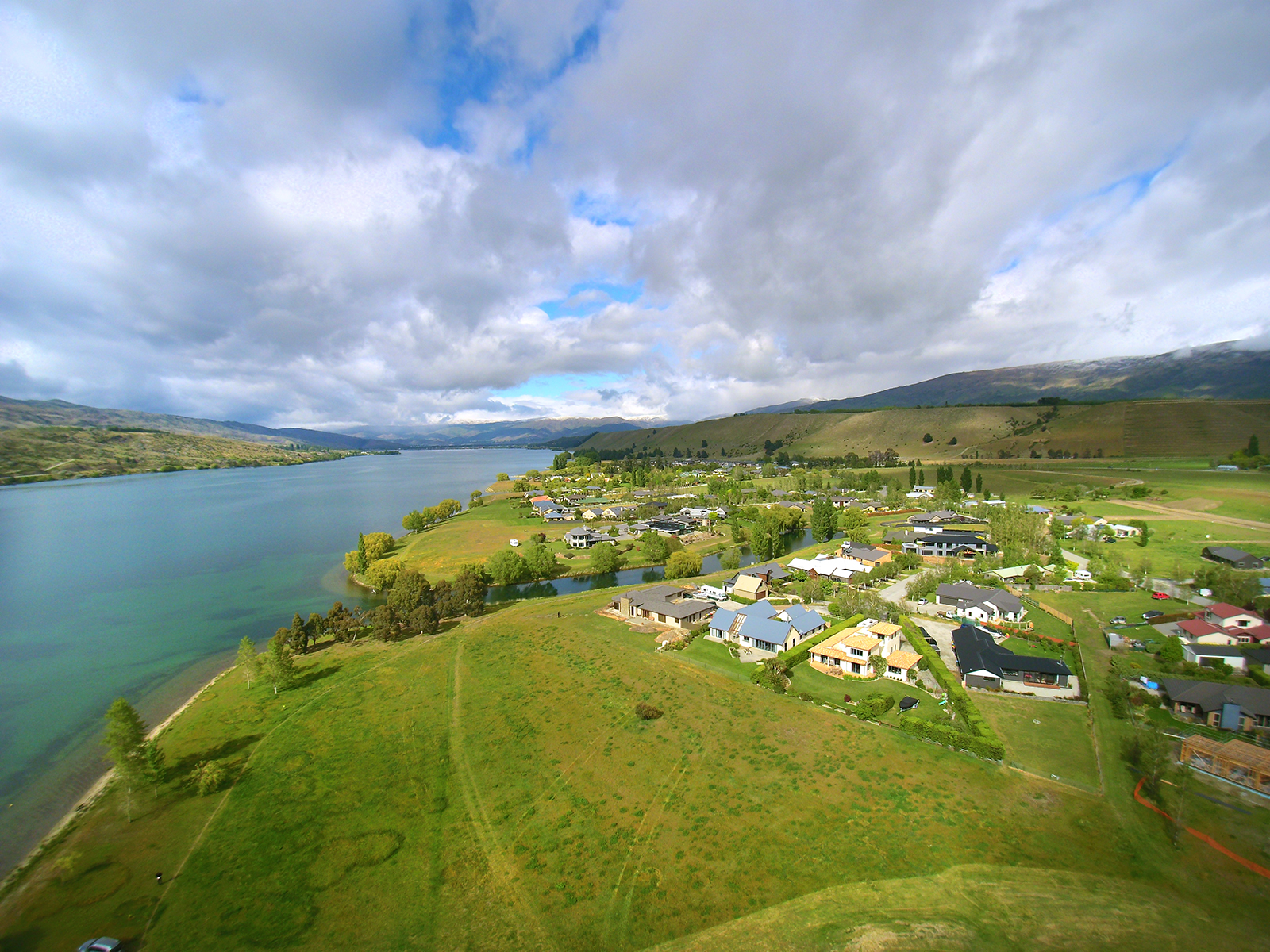
Pisa Moorings is a lakeside community, situated 10km north of Cromwell, on the road to Wanaka.
Its small population has Lake Dunstan on its eastern doorstep and the Pisa Range and the iconic Sugarloaf Terrace to the west. To the north and south are vineyards and farmland.
The subdivision was surveyed in the 1990s and has since grown into the strong community that it is today. Families, in particular, enjoy the proximity to the lake – for swimming, walking and boating.
There is a café and boat ramp in the settlement, with other services and shops only minutes away in Cromwell. Queenstown is within an hour’s drive and Wanaka is 35 minutes away.
Pisa Moorings is handy to the region’s ski fields, as well as Highlands Motorsport Park and Central Otago’s many vineyards.
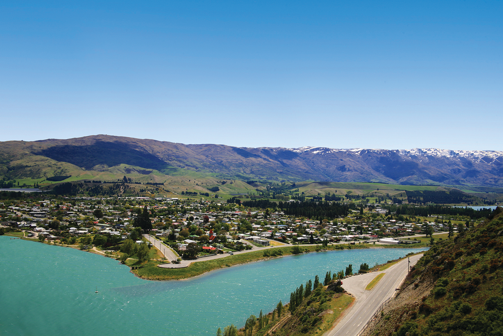
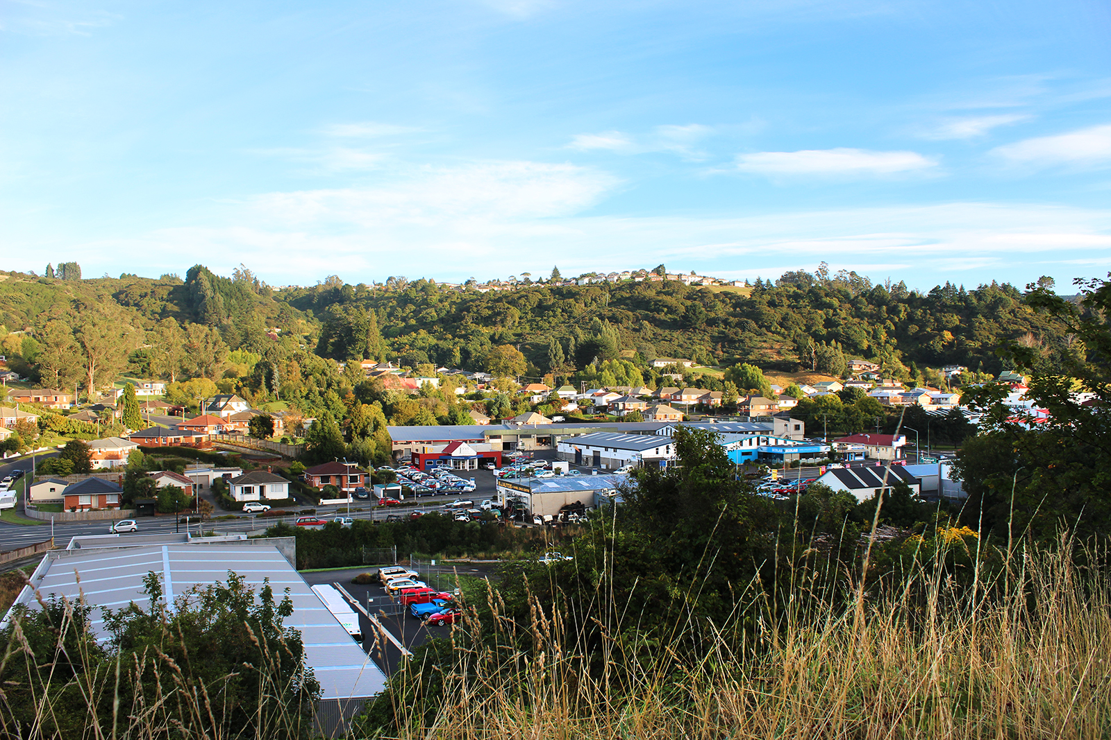
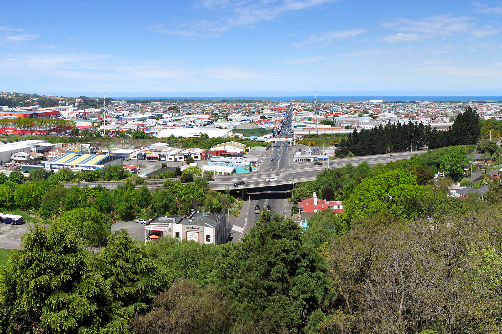
Cromwell
Cromwell was originally known as "The Junction", being at the confluence of the Clutha and Kawarau Rivers. In 1862, gold was discovered below the Junction by two miners, Hartley and Reilly. Once the word of a gold strike was out, there was an influx of several thousand miners to the area.
The first Chinese arrived in Cromwell via Dunedin in 1866, some four years after the founding of the township. They initially set up camp near Gibraltar Roack in the Cromwell Gorge but by 1870 some Chinese storekeepers had established themselves at the upper (west) end of Cromwell’s main street, Melmore Terrace on the (true left) banks of the Kawarau River. This gradually formed the nucleus of Cromwell’s ‘Chinatown’.
As gold ran out, Cromwell became the service centre for an extensive farming and stone fruit growing area. It has a strategic location between the Lindis and the Haast Passes and acts as a hub between the towns of Wanaka, Queenstown and Alexandra. The former is commemorated with the giant sculpture of stone fruit, which stands outside the northern end of the town.
With the construction of the Clyde Dam, Cromwell became the residential and administrative centre for the development. A new suburb was joined onto the old town to house hydro workers. The former business centre in Melmore Terrace was relocated adjacent to the State Highway in a new mall. Other sporting, educational and cultural facilities were upgraded to a high standard.
The decision to build Clyde Dam and use Cromwell as the accommodation base brought many changes to the town. Approximately one-third of the town was rebuilt on higher ground. The changes included the doubling of the residential area, relocation of the old town centre (now called "Old Cromwell Town"), upgrading of services, and the provision of modern educational and sports facilities, and a new bridge. The relocated town centre, or "The Mall," now houses the main retail, service and civic buildings in Cromwell. Several of the old buildings of the town which escaped the flooding have been retained as a historic precinct close to the shore of the Kawarau.
Before it was destroyed to make way for Lake Dunstan behind the Clyde Dam, Cromwell’s Chinatown was the best preserved example of a New Zealand Chinese urban settlement. It also had the greatest longevity of some fifty years. Shops were established along Melmore Terrace, while a residential area was formed below on the steep banks of the Kawarau River.
Cemetery records indicate the last Chinese burial in Cromwell was in 1924 – probably representing the end of the Cromwell Chinese era. Between 1863 and 1938, there were 85 deaths of Chinese registered out of a total of 1300.
Cromwell’s Chinatown was excavated in 1980 by a team of archaeologists from the New Zealand Historic Places Trust. The site was programmed for destruction as part of the lakeshore works associated with the formation of Lake Dunstan. The excavation uncovered 20 huts, 6 suspected huts, several sections of stone revetted terraces, a spring, and two possible shafts. The excavations concentrated on the interiors and immediate surrounds of the huts, with smaller sampling undertaken on garden terraces and dumps. A wealth of structural and material remains was uncovered, catalogued and recorded.
Cromwell has maintained its function as a service base for a large rural hinterland. The continued growth of orcharding and the emergence of the wine industry will enhance the town's future regional importance. Lake Dunstan has added to the growing list of attractions and opportunities for the area with activities such as picnicking, fishing, boating, sight-seeing, cruising etc.
Cromwell is strategically placed as a holiday centre for the whole of Central Otago. It is only 50-60 kilometres from the lake and ski resort towns of Queenstown and Wanaka. Apart from its location as a hub of three major gorges, Cromwell's other attractions include its pleasant and dry climate with sparse rainfall.
Cromwell College is the town's Form 1 to 7 high school and boasts a magnificent auditorium and gymnasium. Two other primary schools service the younger children. Other major facilities for the town include a comprehensive greenway and reserves system, golf, squash and bowls clubs, and Town and Country Club, and the 25 metre, twin covered pools at the Cromwell Swim Centre. An artificial turf hockey field was completed in 1997. There are three camp grounds in the district: Cromwell Holiday Park, Cairnmuir Camping Ground, and Bannockburn Domain Camping Ground.
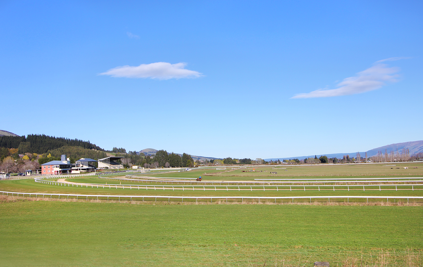
Wingatui
Wingatui is one of those magic spots that allows you to enjoy the best of both worlds. Its proximity to Mosgiel means you’re only a short drive away from shops and a good supermarket, yet the vibe is pleasantly semi-rural.
Situated 15km west of Dunedin, its 1550 people live in a mix of residential houses and on lifestyle blocks. It enjoys long sunny evenings, being the last corner of Mosgiel to see the sun go down.
The Wingatui Racecourse and the nearby historic railway station are both popular attractions – particularly on the first Tuesday of November, with its Melbourne Cup Day race meet. The train delivers happy punters out to the course at the start of the day and delivers them home again after the last race on the card.
The racecourse naturally attracts a horsey set to the suburb – both racehorse and pleasure riders. Motorists often pass horses being exercised on the wide roadside verges.
According to rail heritage enthusiasts, the Wingatui Station – built in 1914 – is second only to Remuera Station as an outstanding example of an “island platform” construction, built to accommodate tracks on both sides.
East Taieri
East Taieri sits discreetly on the edge of the Taieri Plain. It’s only 4 minutes drive into Mosgiel and 15 minutes into the Octagon, making it a great semi-rural address for those who appreciate some extra space, yet the convenience of nearby supermarkets and a hop, skip and a jump over the hill to connect with city life.
There is a pre-school and a primary school. East Taieri Primary School is one of Otago’s oldest, opening in 1853. It teaches years 1 through to 6 and has a current roll of about 320 children.
On the outskirts of town, the East Taieri Presbyterian Church is a local landmark and an active parish.
Mosgiel
Mosgiel, "the pearl of the plain", lies fifteen kilometres west of the Dunedin City Centre, lit up by the infamous sign perched on the hillside.
Mosgiel and Dunedin are separated by Three Mile Hill and Scroggs Hill, which form part of the crater-wall of a long-extinct volcano, the crater being the Otago Harbour. One of the many peaks that formed part of the volcano is Saddle Hill, a prominent landmark, which Captain James Cook helped to name in 1770. Mosgiel takes its name from Mossgiel in Ayrshire, the farm of the poet Robert Burns, the uncle of Reverend Thomas Burns, the co-founder of the Otago Settlement in 1848. The 1861 Otago gold rush saw the development of the first Mosgiel road — leading west to the interior — which intersected the site.
Thomas Burns' only son, Arthur John Burns, erected a flour mill and large house on what is now known as Factory Road in 1862, selling his ‘best colonial flour’ to the goldminers flooding into Central Otago at the time. The flour mill building was then utilised as part of The Mosgiel Woollen Company and mill which was established in 1871, bringing the settlement of workers in cottages. The building is the oldest remaining on-site. The factory opened in September 1871 with 180 tonnes of steam-powered machines successfully installed.
The Mosgiel Woollen Factory was one of the earliest mills in New Zealand to produce machine-woven cloth, second only to the woollen factory established in Nelson in 1858. Given the outside occupations at the time, strong fabric that could withstand farming, mining and sawmilling was vital. 1875 saw the north-south road paralleled by a railway, with a branch to the west constructed in 1877.The factory was the first in New Zealand to use electric lighting when this was installed in October 1885. The factory played an important role in Mosgiel, being the major reason the town developed in the first place, and remaining the major employer in the area for most of the twentieth century. The significance of transport for the area grew with the establishment of the Taieri Aerodrome, just north of Mosgiel, in the late 1920s and the development of Momona Airport, now Dunedin International Airport, further south on the plain in 1962. In 1948, more than one-third of Mosgiel’s working population was employed in the factory. The Mosgiel Woollen Factory continued to expand during the twentieth century, continually updating and expanding the plant and buildings at Mosgiel as well as acquiring the Roslyn Mill (1969) and Kaiapoi Textiles Limited (1972).
Mosgiel Ltd, as the company had been known since 1974, collapsed in 1980, under pressure from the restructuring of the textile industry and its recent purchases of Kaiapoi and Ashburton mills. Alliance Textiles bought the Mosgiel Factory in August 1980. Alliance sold the Mosgiel factory in 1993 to Caspex, who in 1997 combined with Coates Viyella to create Coats Spencer Crafts, based in the Mosgiel factory. The mill finally closed in February 2000 with the loss of 141 jobs. It took a year to dispose of all of the old but very well-maintained machinery, with 90% being sold to purchasers all over the world. Tony Offen purchased the mill and grounds in September 2001, and has developed the factory site into the Mill Park Industrial Estate, housing up to 30 individual businesses, as well as a large self-storage facility of over 350 units. Manager Dave Anderson now runs the self-storage business as well as looking after the 11ha of grounds and buildings, having worked at the Mosgiel Woollen Factory as an apprentice from the age of fifteen. The self-storage business was started up in 2003, with the first 22 units built and filled just as quickly. 2003 saw the second stage built, and filled again. Nearly at capacity again, Dave and Tony are currently planning to build more units. The massive amount of space in the old mill buildings means housing hundreds of units, as well as cars, boats, buses, caravans is an easy task.
In recent years, the Mosgiel population has expanded rapidly and continues to grow, with many people moving from Dunedin’s inner suburbs and the development of numerous subdivisions and retirement villages. Mosgiel’s retail sector has expanded also, with newer establishments opening up and older ones refurbishing, to cater for the younger market.
Sawyers Bay
Sawyers Bay is one of those delightful Dunedin suburbs, which enjoys a semi-rural vibe, but is only 13km from the city.
Home to 1200 people, Sawyers Bay sits on the western side of the Otago Harbour and many houses enjoy spectacular views across the harbour.
The suburb has its own primary school – Sawyers Bay School, established in 1861 – and a play centre. It is only 3km from Port Chalmers’ shops, supermarket and cafes. There is also the Port Chalmers Golf Course on the edge of the bay and an attractive bush walk, Grahams Bush, which goes from the end of Hall Road, up to Mount Cargill Road.
As its name suggests, Sawyers Bay was where much of Dunedin’s timber originated in the early days of the city. Today, there is little sign of industry and it is most definitely a residential settlement. Homes sit either side of a long road, which starts as Station Road at the coast and becomes Hall Road at the top.
Photo credit: Samuel Mann, www.flickr.com
Ravensbourne
Settled in 1854, Ravensbourne is one of Dunedin’s oldest suburbs, by virtue of its proximity to Otago Harbour.
In fact, while Port Chalmers was home to the sailors and wharfies of the day, the captains and their contemporaries lived further afield, on the road towards town. This included Rothesay, as Ravensbourne was then known. For this reason, there are a good number of older impressive houses still to be found in the suburb.
Ravensbourne is situated on the south-eastern slopes of Signal Hill and enjoys views across the harbour. Its steep streets – the same ones that allow that view – can be explained. They were designed in Edinburgh. For the most part, however, Ravensbourne sits out on a plateau beyond Signal Hill and enjoys its share of sunshine.
With the Stadium and new Emerson’s Brewery, it is a corner of Dunedin that’s enjoying a resurgence in activity. And it is only a 4.5 kilometres – a 7-minute drive along SH 88 – into central Dunedin.
The West Harbour Cycleway goes through Ravensbourne, creating an alternative transport link into town and also opportunity for social interactions.
The suburb includes the Ravensbourne School (established 1877), a boating club and a rugby club.
Insider’s perspective
Mike Moroney has lived at Ravensbourne for the past 30 years. Together with wife Bernadette, they purchased a two-acre lifestyle block high on the hill at the top end of Ravensbourne – for a little over $40,000.
While the property was run down at the time, the garden had once been a showpiece. So, the couple proceeded with caution. All these years later, they can clear a new corner of the section and be surprised by bulbs they have never seen before. The property’s position affords it views across the water to Harbour Cone and St Clair.
What’s the best part about living in Ravensbourne? “We have good neighbours and we’re on the surburban/rural fringe,” says Mike. And he enjoys the interest that comes with a harbour – ships, rowing crews, yachts and changes in the weather.
Mike also appreciates the location’s proximity to both town and “out of town”. “People don’t appreciate that Ravensbourne backs right onto the Burns Park Scenic Reserve and you can bike and walk into there.”
Meanwhile – thanks to the harbour-side cycleway – Mike can be in the CBD within 15 minutes, although the hill to home makes it a 25-minute trip in the opposite direction.
The Rothesay News
The Rothesay News is the West Harbour’s monthly community newspaper. It was started in 1989 by Ravensbourne residents and is still going strong. In 1998, the paper published business with “Dusting Off … West Harbour the first 150 years”, which has been reprinted several times.
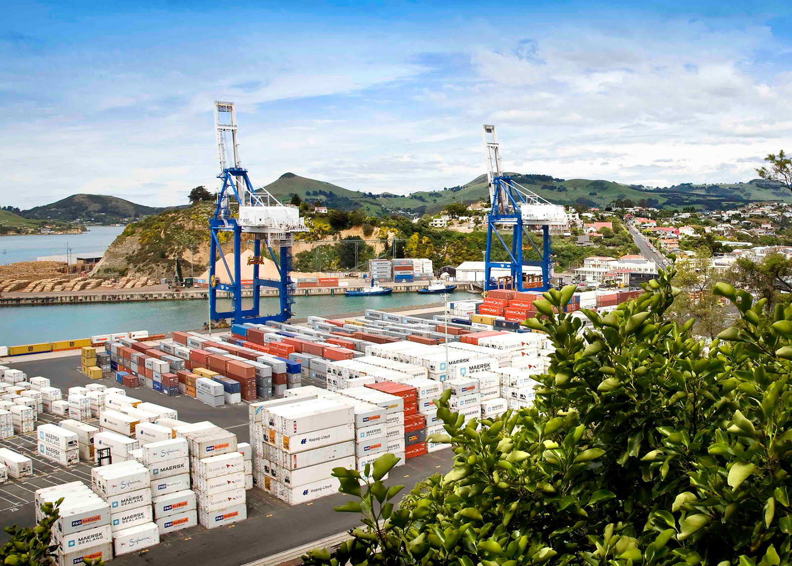
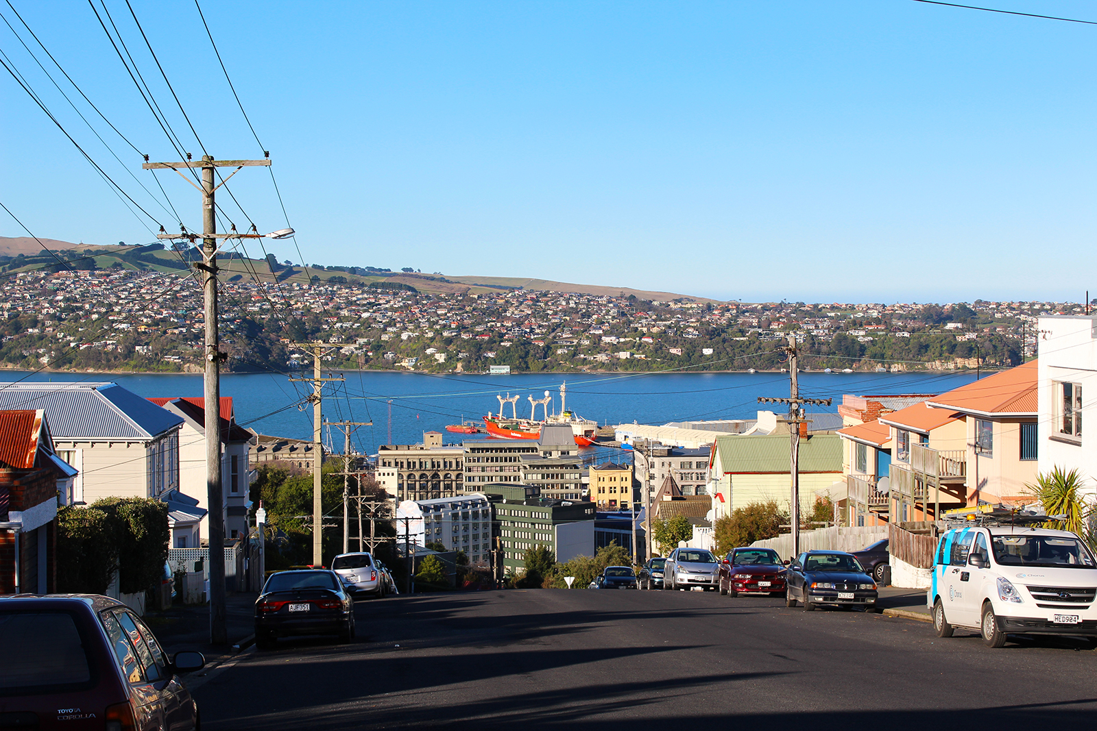
Port Chalmers
Situated 10 kilometres inside Otago Harbour, 15 kilometres northeast of Dunedin’s city centre, is the small hilly peninsula suburb of Port Chalmers. Port Chalmers is the site of Dunedin’s container port, at the northern end of the suburb on a large reclaimed area.
Although the harbour beyond Port Chalmers is regularly dredged, most of the port activity is centred on Port Chalmers rather than on central Dunedin. Part of the reason for this is the narrowness of the Victoria Channel, the one part of the Otago Harbour navigable by large ships, which makes it far easier for berthing to take place at Port Chalmers, closer to the open sea. Any big ships venturing into the upper harbour wharfs need to be piloted in with the help of tugs.
Port Chalmers was also the appellation of a ship which sailed between England, Australia and New Zealand at the beginning of the 20th century. It was torpedoed in mid-October 1940 and sunk, with some crew surviving 14 days at sea on the lifeboat.
In 1844 Captain Wing anchored the Deborah in the bay now bearing its name where he was joined by Frederick Tuckett who selected an adjoining block of land (the Otago Block) as the site for the Scottish New Edinburgh settlement. He nominated Koputai as its deep water port to be called 'Port Chalmers' after the Presbyterian Free Church leader Thomas Chalmers. The sale of the Otago Block from Māori to the Otago Association was concluded at Port Chalmers 31 July 1844. In December 1844 Alexander McKay and his wife arrived to open the first public house, the 'Surveyors' Arms'. The town was surveyed by Charles Kettle in 1846 and a Town Board was formed in that year. The first ships of Otago Association settlers, the John Wickliffe and the Philip Laing, anchored at Port Chalmers in March and April 1848.
Thereafter the town developed as a port for the city and the province, superseding the earlier Otago (modern Otakou) as the harbour's international port. It was first connected by lighter with Dunedin at the head of the harbour, then also by a steep road from North East Valley to Sawyers Bay, a spur of the main road north. By the 1860s a harbourside road from the central city had been formed. In 1866 the Town Board was superseded by a Borough. On 1 January 1873, the first 1,067 mm narrow gauge railway in New Zealand opened: the Port Chalmers Branch, linking Dunedin and Port Chalmers. It was subsequently incorporated into the national rail network through a connection to the Main South Line, which was opened through to Christchurch on 7 September 1878 and Invercargill on 22 January 1879. 1881 saw the opening of the Victoria Ship Channel allowing ocean-going vessels passage up the harbour to central Dunedin. 1882 saw the inauguration of New Zealand's refrigerated meat trade when the ship Dunedin left Port Chalmers with the first such cargo.
Port Chalmers was a port of call for several notable expeditions during the heroic era of Antarctic exploration, including Robert Falcon Scott before heading south on his final expedition to Antarctica. A large stone monument now stands above the town dedicated to Scott's final expedition. Following the 1923 transfer of the Ross Dependency (Antarctica) to New Zealand, and the New Zealand Government's lease of rights, the giant Norwegian whaler, C.A. Larsen, became the largest vessel serviced in the Otago Dock, Port Chalmers, in April 1928.
A harbourside road from the city was completed in 1965. Passenger services from the port ended in 1967. However the selection of Port Chalmers as the South Island's first container terminal in 1971 demonstrated its advantages over Lyttelton and gave Dunedin the major South Island container port. In 1979, passenger trains between Port Chalmers and the west harbour suburbs to the city centre ceased after 106 years of operation.
The container traffic has continued to expand and a new expanding trade in timber developed in parallel but the greatly reduced labour needs of these trades saw the town's population contract. The Otago Harbour Board, established in 1874, was replaced by a quasi-autonomous local government entity, Port Otago Ltd, in 1988. In 1989 the borough of Port Chalmers and the whole surrounding district were absorbed into an enlarged City of Dunedin.
From the 1970s an artists' colony grew up in Port Chalmers and Carey's Bay contributing to tensions over the port's continuing industrial development and giving a different flavour to the town. In the 1990s a new trade in visiting cruise ships added another element and continues to expand.
The creative arts are also important to the area's economy; Port Chalmers and the surrounding suburbs of Careys Bay, Roseneath and Sawyers Bay have a thriving arts community, and the town is regarded as a haven for alternative lifestylers.
Many artists and musicians call or have called Port Chalmers their home, most notably late Māori artist Ralph Hotere. Hotere's former studio was on land at the tip of Observation Point, the large bluff overlooking the container terminal. When the port's facilities were expanded, part of the bluff was removed, including the area of Hotere's studio (after strenuous objection from many of the town's residents). Part of the bluff close to the removed portion is now an award-winning sculpture garden, organised in 2005 by Hotere and featuring works by both him and by other noted New Zealand modern sculptors.
Image courtesy of Open2View
Portobello
The small village of Portobello sits halfway down the Otago Peninsula, surrounded by some of the country’s most spectacular scenery and only 25 minutes from central Dunedin.
Despite its small resident population, Portobello punches above its weight for amenities, bolstered by the steady flow of visitors heading out to see the peninsula’s wildlife up close. There’s a restaurant, pub, art gallery, museum, boating club, camping ground and motels. The University of Otago’s marine research station occupies the end of the Portobello Peninsula and the landmark, Quarantine Island, sits directly out in the harbour.
Established in 1857, Portobello School teaches primary school children, from years 1 to 8, and has a strong relationship with the local Maori community.
More details:
www.portobello.org.nz
Photo credit: Christopher Crouzet, www.flickr.com
Broad Bay
Broad Bay sits halfway down the south side of Otago Peninsula, looking out over the harbour.
About 1100 people call Broad Bay home. Most value the fact it is only 15km to the Octagon, yet the 20-minute drive along the peninsula provides a buffer between the settlement and city.
Lala Frazer moved to Broad Bay about 40 years ago and finds the drive one of the upsides of living in the bay. “I always found that it gave me time to leave work concerns behind, before I arrived home – as I watched the changes in the harbour, the light and the birdlife through the seasons.”
When she made the move to the bay, Lala was looking for a north-facing suburb, with a view of the harbour from her kitchen sink. “Broad Bay looks out on the most picturesque parts of the harbour. The view changes daily with the tides, time of year, wind and weather.”
She says the bay’s “bounded edges” provide a real sense of being a village community within the city.
Broad Bay started out as a summer resort. In the days when ferries provided the main means of access, many wealthy families owned summer residences in Broad Bay. Some of these splendid summer homes still exist. They are complemented by small cribs and permanent family homes. Houses in Broad Bay are generally set back off the road – a remnant of the bay’s past, when the roads needed to be wide enough to allow two horse-drawn carriages to pass.
The suburb is known for the historic Fletcher House, and the much-loved Broad Bay China shop (which is sadly to close on 21 February). There is a well-used community centre and small primary school.
Dunedin’s longest running fruit and vegetable co-operative means locals can source produce at the weekends, without having to go into town. Or, by assisting with weeding and planting, they can also enjoy produce from the community garden.
There are plenty of good walks to be enjoyed, as well as walking along or swimming in the bay. An active group of volunteers are helping restore Smiths and Styles Creeks, for future generations to enjoy.
More details:
www.broadbay.co.nz
Photo credit: Zwennie, www.flickr.com
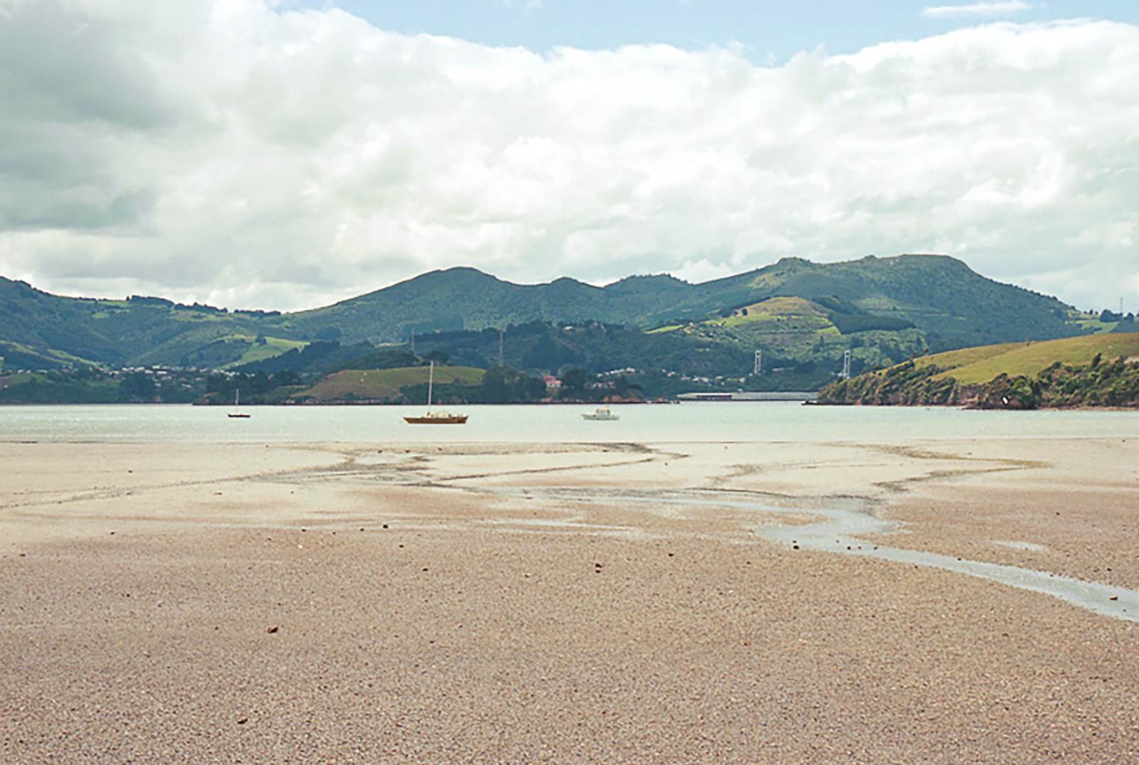
Waitati
Waitati is a seaside settlement of about 500 people, situated 20km north of Dunedin. It sits on the southern edges of the tidal Blueskin Bay, at the end of the Northern Motorway. It has a primary school, library, café, nursery, general store and even its own film society.
Waitati is a community-minded and friendly village, with a reputation for attracting environmentally-aware individuals.
The Orokonui Ecosanctuary sits on 300 hectares above Waitati. The area is protected by an 8.7km-long predator fence, keeping pests out and the sanctuary’s precious animals in. Within the fence grows New Zealand’s tallest tree – an 80m tall eucalyptus.
Waitati – a variation on its Maori name, Waitete – is named for the small river, which flows past the settlement and into the bay.
Photo credit: Allison Brown, www.flickr.com
Waikouaiti
Waikouaiti is a quiet coastal village around 40 minutes’ drive north of Dunedin city. The first European settlers arrived on the beach, carried ashore by local Maori off the ship “Magnet” in 1840, making it the birthplace of the Otago province, as we know it today.
Waikouaiti was the first European settlement in southern New Zealand to be mainly based on farming and one of the first enduring European settlements in Otago. From 1837 there had been a whaling station confusingly also called "Waikouaiti" nearby on the south side of the estuary at what is now called "Karitane".
Matanaka Farm was founded by the Australian whaler Johnny Jones, who had bought the land and an adjoining whaling station in 1838. In April 1840, he brought out about twelve families from Sydney on the Magnet to settle the farm. The first buildings, including the stables, were built in 1840 using materials brought from Sydney. This was the first farm in the Otago region, eight years before the foundation of the Otago Association’s settlement. There are accounts from 1841 that mention a collection of barns and accommodation buildings, which allows researchers to date the buildings to that period. Jones himself moved into the farm's homestead in 1843.
When the settlement of Dunedin began in 1848, Jones supplied the new settlers with produce at a "good price". The Jones family moved to Dunedin for the better education opportunities for their children in 1854. The wooden shingle roofed St. John's Anglican Church in Waikouaiti proper opened in 1858, was funded by Jones. It was designed by Benjamin Mountfort of Christchurch, who also designed the Provincial Council Building there. It is the oldest church building in Otago and Southland.
In the 1858 Gold Rush, prospectors from all over the world swarmed ashore from Port Waikouaiti. Present day Waikouaiti developed from the township that Jones established in Beach Street in the 1860s. Before a road was built from Dunedin, goods from Dunedin destined for the goldfields of Central Otago were landed at the Waikouaiti Beach and taken on by wagon to Palmerston and then through the Maniototo to Central Otago. At this time, Beach Street in Waikouaiti had nine general stores, four hotels, a blacksmith’s shop, a timber yard, a watchmaker, two drapers, two butchers, three bakers and a printing press.
Johnny Jones' son William Jones lived at Matanaka Farm until 1858 and it was passed on to the next generation, John Richard Jones and his wife Mary Orbell, who had Matanaka Farm as their home until 1871. Mary Orbell's brother, McLeod Orbell, then leased the farm until 1878. Ownership of the farm passed a further five times before finally being given to the New Zealand Historic Places Trust in 1976, and the setting gazetted as a historic reserve in 1981. The five buildings are the oldest surviving farm buildings that are still in their original position in the country.
In 1861 Dr. William Chapman, at Jones request, became the first GP for the district. The Presbyterians built a wooden church in 1863. It was moved to Kildare Street in 1876 and still remains. A Government township was established north of the lagoon in 1862 and a third settlement was laid out along the main road and the municipality of West Hawksbury was established there in 1866. It continued to be called West Hawksbury until 1909.
After the road to Dunedin was opened in 1864, businesses began to move from Beach Street to the newly established township on the main road, the site of the present business centre in Waikouaiti. The railway to Dunedin opened in 1877, which expanded the township. The eight hotels in Waikouaiti had all lost their licenses by 1908 and the area was “dry” until 1963, when the Golden Fleece Hotel was established. The Bank of New Zealand opened in 1864 and was the last bank to operate in the town. The Post Office closed in 1989.
Cherry Farm Hospital, a psychiatric hospital serving the Dunedin area opened in 1952 and patients from Seacliff Mental Hospital at Seacliff were relocated there. Cherry Farm Hospital epitomised the village-asylum atmosphere in name and design, contrasting with the harsh conditions in the fortress-like Seacliff hospital. While at its peak Cherry Farm had many hundreds of patients, in latter years this number had dropped to below 400. When the hospital closed in 1992, psychogeriatric patients were either transferred to a unit at Wakari Hospital or to residential care in the community and people with intellectual disability moved to new lives in the community provided by a range of community agencies. General adult psychiatric patients were either transferred to new services at Wakari Hospital or into supported accommodation in the community. The closure of Cherry farm Hospital was a key milestone in the policy of successive governments to implement "deinstitutionalisation".
Part of a family with five generations of Waikouaiti heritage, Alan and Hazel Hagan have seen many changes in and around their beloved suburb. Now both in their 90s and having lived in Waikouaiti their entire lives, Alan and Hazel recall riding ponies to school, the four different houses in the area that they have lived in, the shops that have opened and closed and enjoy comparing their experiences to that of their children and grandchildren, who are also Waikouaiti locals.
Waikouaiti is ideally situated between the popular beach resorts of Karitane and Moeraki and only one hour from the vast expanses of Central Otago. By the turn of the 19th century, it was a popular holiday destination for people from Dunedin. Today it still has that holiday feel but is an increasingly popular commuter residential area for both Dunedin people and those working at the Macraes gold-mine inland from Palmerston.
The area boasts two churches, an excellent library, medical centre and primary school. A bus takes children to nearby East Otago High School for intermediate and secondary education, and there is a heated swimming pool nearby. The main feature is an uncrowded white sand ocean beach, overlooked by reserves, so there will never be beachfront development here. Behind the dunes is a wildlife lake/lagoon abundant with bird life, with lovely walks around the lagoon. Sea lions often bask on the sand and increasingly, yellow-eyed penguins come ashore to moult.
Overlooking both the lagoon and the beach is a delightful 18 hole golf course that is never crowded. Visit the local sports ground to watch a game of rugby, play lawn bowls or tennis, have a beer at the pub, surf cast, swim and of course stroll round the lagoon or on the beach. If photography appeals as a hobby, opportunities for wild life shots are immense. The Main South Line railway between Christchurch and Invercargill passes through Waikouaiti. It was constructed in the 1870s, and daily passenger trains passed through Waikouaiti until the cancellation of the Southerner in February 2002.
Karitane
Only 35km north of Dunedin, Karitane has long been a popular holiday spot for Dunedinites.
The seaside village has a wonderfully relaxed vibe about it, with plenty of recreational activity to keep you occupied (should you wish to be). In summer, the beach is a popular swimming spot – while surfing, fishing and walking are popular, no matter what the time of year.
Karitane’s permanent population of 360 people swells to about 1000 over the summer holidays, when families – particularly with younger children – recognise the healthy, inexpensive fun to be had by holidaying at the beach. And it’s close enough to the city, that one parent can sneak back to work during the day and leave the family holidaying a little longer.
Gary Kent has lived in Karitane since he was 18 months old. Now 65, he says he has no intention of moving anywhere else. “My father moved here in 1947 to manage a fish factory that was being started up. I did go away for four years, to do a carpentry apprenticeship in Dunedin, but once I was out of my time, I went fishing with my brother.”
Two years later, Gary bought the boat from his brother and carried on to fish from Karitane for his working life. “I’d walk out the door and down to the boat and away for work. It’s a good place to live. You’ve got a river area and then the surf beach – and it’s so handy to Dunedin.”
When asked what he values most about Karitane, Gary says: “Probably the low key, easy lifestyle. There’s no pressure.”
Sir Truby King – founder of the Plunket Society – lived at Karitane and it is from this base that he established the Karitane hospitals and nursing movement.
Karitane has a strong Maori community, focused around the Puketeraki Marae, which sits up above the village and looks out over the beach and the much-loved Huriawa Peninsula.
Waldronville
About 500 Dunedinites call Waldronville “home” – generally a mix of younger families and retired people. They describe it as an easy place to live. A supermarket and the Green Island shops are only a three-minute drive away and Dunedin central is a zippy 13-kilometre drive on the southern motorway.
Waldronville is known for being warmer than Dunedin proper - being on the south side of Lookout Point - and is surrounded by green spaces and the ocean. The Kaikorai Lagoon, Island Park Recreation Reserve and the popular Island Park Golf Course all border the suburb. For families, primary schooling options are plentiful and high school is a short bus trip into town.
Originally developed by Bill Waldron in the 1950s, the suburb was expanded in the 1970s and again in the 1990s. Each street is named after aircraft and include colourful names, like Vulcan Road, Dakota Place and Friendship Drive.
Well-known Dunedin artist Geoff Williams has a 25-year history with Waldronville, having worked from a studio in the suburb for 10 years, before moving with the family from Green Island in 2000. Together with wife Richelle, he lives on a two-acre property on Friendship Drive, surrounded by native bush and bird life.
Geoff says the beach has always been Waldronville’s main attraction for him. A 10-minute walk through the reserve allows him to slip from an urban environment, out into another world. “I’ve been living and working here for 25 years now and, in all that time, the beach has changed little and it is still as inspiring as ever.”
Geoff also draws inspiration from walks along the estuary. “We’ve got the rural lifestyle, but it’s only a hop, skip and a jump into town.”
Wakari
Situated on the upper-reaches of Kaikorai Valley is Wakari, a quiet residential suburb north-west of the City Centre which hosts one of Dunedin's prominent healthcare facilities.
Wakari's name is likely to be a corruption of the Māori Whakaari, which translates as "a raised view". This was the name for the hill, Flagstaff, which lies 2.5 kilometres (1.6 mi) to the northwest.
The suburb lies on one of the main routes which links central Dunedin with the Taieri Plains. West of Halfway Bush, the road becomes Three Mile Hill Road, crossing the hill to reach the Taieri Plain northeast of Mosgiel.
Wakari's most prominent structure is the Wakari Hospital, one of Dunedin's main health care centres, which specialises in psychiatric services. This hospital is located in the west of the suburb, close to its boundary with Halfway Bush. The hospital is operated by the Southern District Health Board (formerly Otago District Health Board) and is closely associated with Dunedin Public Hospital.
It contains specialised psychiatric services but also cares for people with intellectual disability and people undergoing physical rehabilitation. It has units for forensic psychiatry, psychiatric emergency services, long- and short-term secure psychiatric units, Māori mental health, physical rehabilitation and increasingly community out-reach services such as public health and district nursing.
From 1915 the site was initially an infectious diseases centre, and later a sanatorium. In 1957 it was redeveloped as a general hospital, serving as the main Otago hospital while the Dunedin Hospital was being redeveloped in the 1970s. In the early 1980s, the Nurses' home was leased to the University for use as a student hostel, this being taken back with the closure of the Cherry Farm Hospital in 1992.
Wakari continued as a geriatric and psychiatric care facility, the geriatric wards gradually being wound down through the nineties with government reforms to privatise long-term care. The care of the elderly assessment and rehabilitation wards were transferred back to Dunedin Hospital. Attempts were made to sell the main block of the hospital, which found occasional use as a facility for live-in drug trials and even a temporary accommodation during important rugby tests.
Along with Wakari Hospital, notable establishments are Wakari Kindergarten and Wakari School. The Roslyn Wakari football club is one of NZ's oldest, established in 1888. One of the founding clubs in Otago, the club recently celebrated their 125th Jubilee during Queens Birthday weekend 2013.
St Clair
You only have to look at the quality of the grand old houses in St Clair to recognise the seaside suburb has always been a desirable Dunedin address.
The ocean views, beach access, sunny aspect and locality to town have always been a draw card. These days, St Clair’s Esplanade hosts a buzzing café, bar and restaurant scene that makes the suburb both a dynamic neighbourhood for its 4300 residents to live within, but also a popular weekend destination for the rest of Dunedin.
Only in St Clair
For many, “St Clair” means “great surf”. The beach is a long-time favourite for surfers because of its consistent surf break. The St Clair Surf Life Saving Club – established 105 years ago – is an active and popular club that provides a vital role in the community.
At the western end of the beach is the St Clair Hot Salt Water Pool – outdoors, yet heated to a toasty 28 degrees. Opened in 1884, the pool is a Dunedin treasure.
The St Clair Golf Club sits on top of 159 metre high Forbury Hill and enjoys stunning views of Dunedin, the harbour and the Pacific Ocean.
Nearby, lie the ruins of Cargill’s Castle – built in 1877 for former Dunedin mayor and MP Edward Cargill. A Trust now owns the ruins and plans to incorporate the site into a scenic walkway, so the public can enjoy the majestic views and slice of Dunedin history.
The environment
Having the Pacific Ocean as your neighbour to the south does bring its challenges. Erosion of the beach and dunes is nothing new. The first attempts to keep the ocean at bay were made in 1904, when the landmark wooden piles were erected. Protection work is ongoing – the stark reality of ocean vs sand.
Primary and secondary schools
The highly regarded King’s and Queen’s High Schools fall within St Clair, as does St Clair Primary School – a popular Years 1-6 school of 450 peoples.
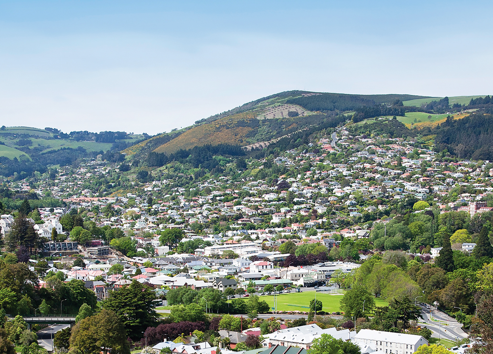
Roslyn
Only a couple of kilometres directly up the hill from the Octagon and perched on the top of a hill, it is easy to see why Roslyn is a firm favourite with both Dunedin locals and newcomers alike.
Sunny and capable of dishing up stunning views to the north, south, east or west, Roslyn is equally valued for its busy village-like hub. The compact shopping area includes restaurants, cafes, a florist, bakery, pharmacy and supermarket.
Helen Wright is co-owner of the popular café and wine bar, Rhubarb, and is lucky enough to live and work in Roslyn. “It’s proximity to everywhere is great. Roslyn is a lively area and the people are friendly. There’s that wonderful sense of community up here that you find in ‘sub villages’ in any city.”
Rhubarb celebrates its 10th birthday this month – testimony to Roslyn’s vibrancy and the locals’ appreciation of their own little village.
Many of Dunedin’s top schools are within walking distance or a short drive and the town belt sits just below Roslyn, on the route into town.
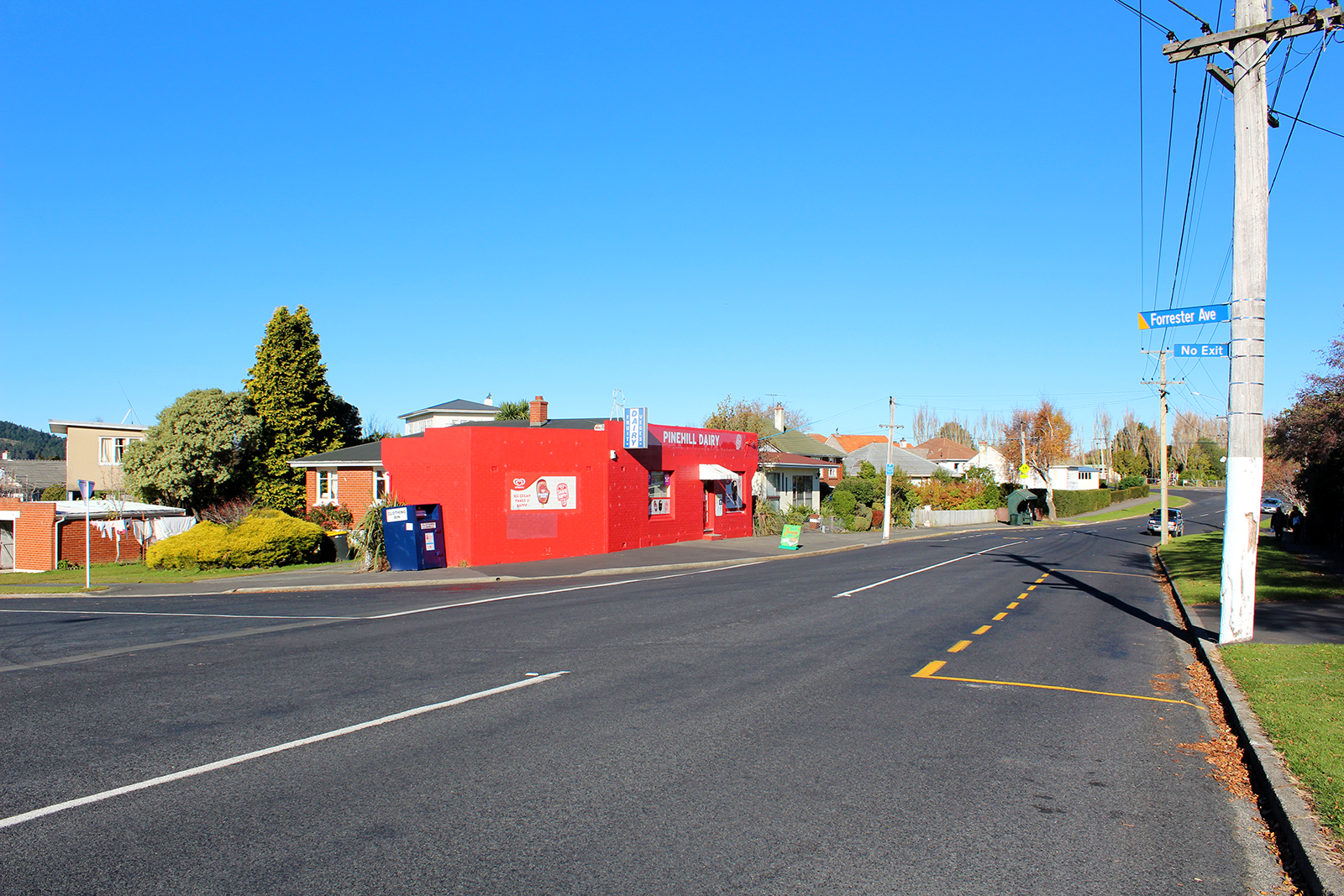
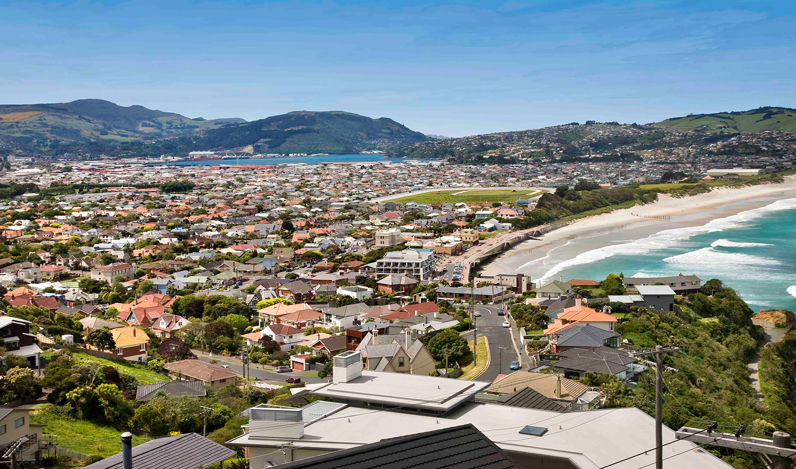
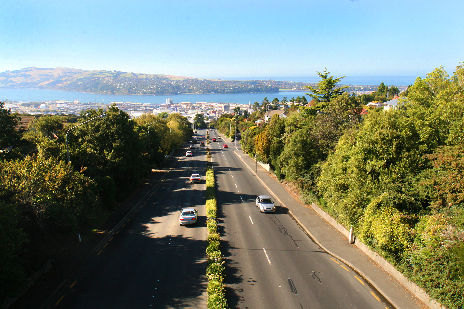
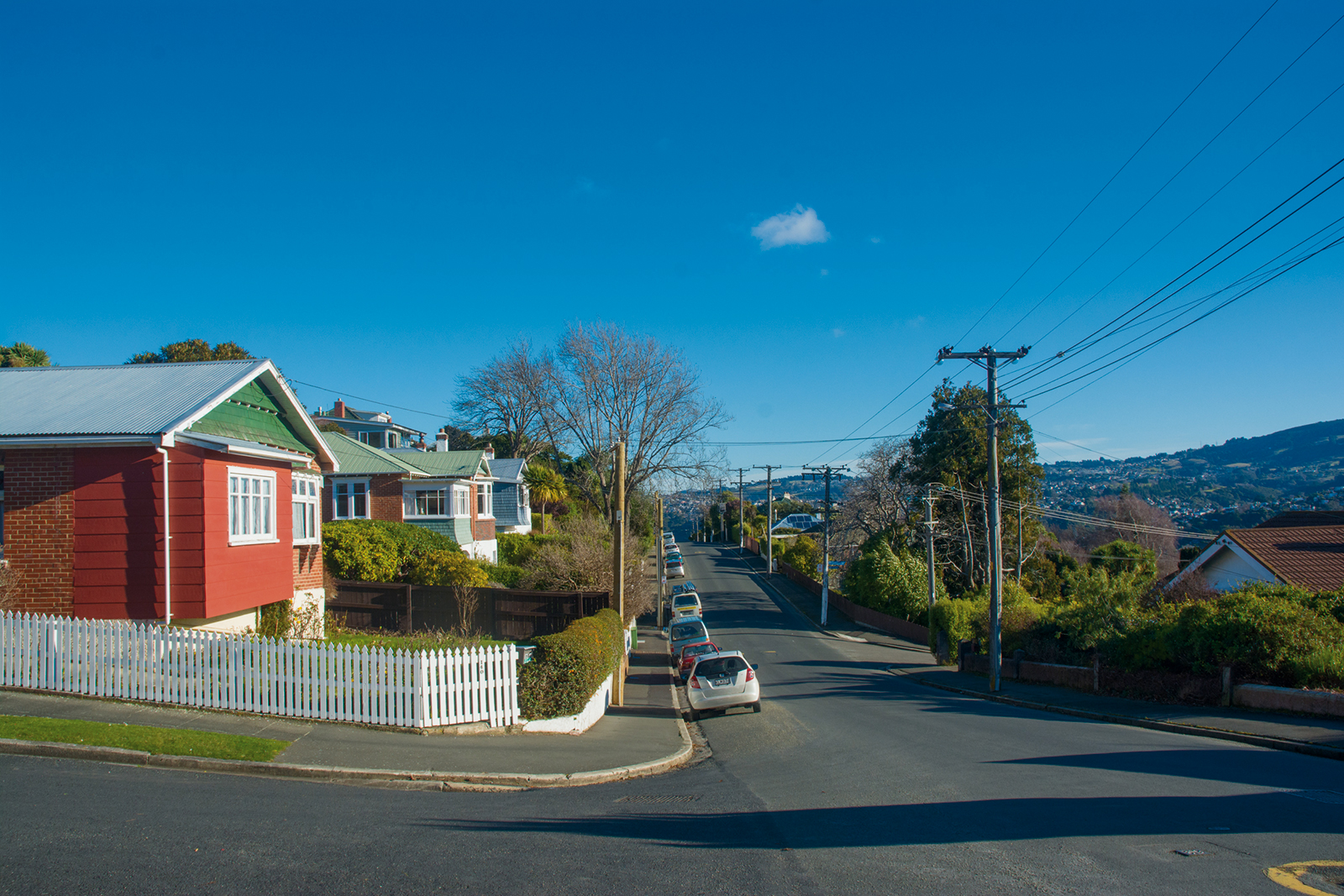
Pine Hill
The 2340 residents of Pine Hill are sitting on a well-kept secret.
A quick zip down the hill sees you in North Dunedin, where there is a lively cluster of shops, a supermarket, bank and a couple of eateries. And, it’s only a four-kilometre stroll into Dunedin Central. The suburb is well serviced by buses and an inexpensive taxi fare home, if you find yourself out late.
Pine Hill incorporates Dalmore on its lower slopes and Liberton partway up the hill. Further up, Campbells Road takes you into the countryside proper, with a selection of semi-rural properties sitting right on the outskirts of the city.
There are two schools – Pine Hill and Liberton Christian – as well as the University of Otago residential accommodation Aquinas College.
The outlook from Pine Hill is the biggest secret of all. Depending a home’s aspect, there are some stunning, panoramic views of the city to be had from this corner of the city.
Pine Hill is home to Dunedin’s first state house, built in Wilkinson Street in 1937 and still there today. There are therefore quality houses and good-sized sections worth keeping an eye out for. The streets are attractive, with green areas and the Dunedin Botanic Gardens and Woodhaugh Garden are both right there, at the base of the hill.
Opoho
Opoho is a sunny residential suburb, situated on the western flank of Signal Hill, 3 kilometres to the northeast of the city centre, overlooking North East Valley and the Dunedin Botanic Gardens.
Opoho is one of Dunedin's more prestigious residential suburbs however still has somewhat mixed demographics, containing student flats, significant numbers of elderly citizens, and the houses of many in the academic community. There was a former retail area in the southern part of Signal Hill Road, but this has long gone and the area is now largely occupied by student flats. Above the suburb sits the Centennial Lookout, a memorial built on the top of Signal Hill to mark the centenary of New Zealand in 1940. Impressive views over the city can be gained from here.
Opoho takes its name from the small stream, Opoho Creek (also known as Stony Creek). This stream runs south along the western flank of Signal Hill, past Logan Park High School in Dunedin North, before being diverted through culverts and flowing into the Water of Leith close to it outflow into the Otago Harbour. Opoho is a Māori word, simply meaning "The place of Poho", Poho being an 18th-century Ngati Wairua chief who lived close to the stream's outflow, which at that time was into Pelichet Bay (the bay has since been reclaimed and is now part of Logan Park).
Opoho's is largely concentrated around two long streets, Evans Street and Signal Hill Road, which run across the flanks of Signal Hill. Signal Hill Road continues to wind to the Centennial memorial close to the hill's summit. Several steep streets connect these two streets or descend to North East Valley. Chief among these are Blacks Road and Opoho Road, the latter of which is the main route to and from the suburb. It runs along the northern edge of Dunedin Botanic Gardens and connects with Dunedin's main arterial streets at the Gardens Corner. A further street, Lovelock Avenue (named for Dunedin Olympic gold medallist Jack Lovelock), winds through the upper reaches of the Botanic Gardens, emerging close to the University.
The first European settlers in the area were farmers, and the suburb remained semi-rural until the 1940s. There are still some farms close to the top of Signal Hill Road, though much of the top of Signal Hill is now a scenic reserve, Burns Park. Early farmers in the area included John Switzer, John Broome, and John Black. The area was at first administered by the Signal Hill Roads Board, which became part of the new North East Valley municipality in 1877. This amalgamated with the city of Dunedin in 1910.
As with many parts of Dunedin, Opoho was initially composed of many smaller named townships, the names of some of which are still used by local residents. In 1873, the first residential subdivision of Opoho began with Opoho Township (the area south of Blacks Road), followed soon after by Maybank Township immediately to the north and, later, by Grandview Township, to the north of Maybank (the names of Maybank and Grandview survive in two of Opoho's streets). By the 1890s, most of the subdivisions of Opoho Township were occupied and Maybank was growing. Grandview was developed during the 1920s. Other township names occasionally encountered include St James' Park, a small area including Grey Street and James Streets on the lower slopes between Opoho and North East Valley.
The suburb of Opoho has numerous prominent landmarks, most prominently the Dunedin Botanic Gardens and Centennial Monument (see Signal Hill, New Zealand). Other landmarks of note include the Northern Cemetery, which occupies a low spur of Signal Hill on Lovelock Avenue, next to the Botanic Gardens and above Logan Park. One of Dunedin's earliest cemeteries (begun in 1872), many of Dunedin's notable early citizens are buried here, among them William Larnach and Thomas Bracken. Larnach's Gothic mausoleum is the most prominent structure in the cemetery, which commands impressive views across central Dunedin.
Also of note are two university halls of residence which lie close to the southern end of Opoho. Knox College is a prominent towered red brick building on the lower slopes. Established as a theological hall in 1907, Knox is still a centre of the University of Otago's religious studies courses. Below this hall, close to the Gardens Corner, lies the smaller Salmond College, built in 1971. Also of note within the suburb is the Dunedin branch of the Society for the Prevention of Cruelty to Animals, which has its headquarters in the suburb, and Tannock Glen, a public gardens which is notable for its rhododendrons. Sports clubs based in the suburb include the Alhambra Union Rugby Club, based at Opoho Park near the junction of Opoho Road and Lovelock Avenue.
Numerous walking tracks cross the Botanic Gardens, Signal Hill, and the slopes between. These include a track across the summit of Signal Hill to link up with Cleghorn Street above the northern end of North East Valley, and tracks connecting the Centennial Memorial with Logan Park and the harbourside suburb of Ravensbourne.
Noted Opoho residents have included artist Arthur Merric Boyd, athlete Jack Lovelock, Celebrity Chef Alison Holst and Opera Singer Patricia Payne.
Ocean Grove
Ocean Grove is tucked beyond Lawyer’s Head at the east end of St Kilda Beach. Also known by its former name of Tomahawk, it is a small semi-rural community.
Ocean Grove is situated at the start of the Otago Peninsula and surrounded by natural features: the Pacific Ocean, Tomahawk and Smaill’s beaches, Tomahawk Lagoon and its associated wildlife and the Ocean Grove Recreational Reserve. It feels a world away from the city, yet it’s only 6.5km – a 12-minute drive – from central Dunedin.
There are two clubs based at Ocean Grove: Grants Braes Association Football Club, which has its home at the reserve; and the Tautuku Fishing Club, which occupies a large two-story stone homestead. Glencairn was built in the 1870s for the Smaill family, who farmed the area up until 1952. The fishing club purchased the homestead in 1972 and it serves as both its clubrooms and a function venue.
Photo credit: Will Ellis, www.flickr.com
North East Valley
North East Valley is a suburb rich with history and community spirit, which sits in the valley between Pine Hill and Opoho, 3 kilometres to the northeast of Dunedin's city centre. A residential suburb, North East Valley is also home to a mix of students from the University of Otago and Otago Polytechnic, which lie to the south beyond the Dunedin Botanic Garden.
The Dunedin Botanic Garden is New Zealand's first botanic garden and holds the status of Garden of International Significance. It has hill views from sunny lawns, more than 6,800 plant species and the song of wild native bellbirds, wood pigeons and tui. The Garden celebrates its 150th anniversary this year marking its position as New Zealand’s first botanic garden. It occupies 28 hectares in North Dunedin at an altitude of 25 – 85 metres above sea level. Its wide range of horticultural and botanical collections includes roses, the herbaceous and perennial borders, a rock garden, New Zealand native plants and four hectares of Rhododendron Dell with more than 3,000 rhododendrons. An important aspect of The New Zealand Native plant collection is the cultivation of rare and endangered native plant species.
One long road, North Road, spans the entire length of the valley. Starting at the Gardens Corner, named after the Dunedin Botanic Garden which sit at this intersection, North Road runs relatively straight for 2.2 kilometres with side roads branching off it, many of which are notoriously steep. One of these, Baldwin Street, is known as the world's steepest street. The street's steepness was unintentional. As with many other parts of early Dunedin, and indeed New Zealand, streets were laid out in a grid pattern with no consideration for the terrain, usually by planners in London. In the case of Baldwin Street (and much of the Dunedin street plan), the layout was surveyed by Charles Kettle in the mid-19th century. The street is named after William Baldwin, an Otago Provincial Councillor and newspaper founder, who subdivided the area. The street is the venue for an annual event in Dunedin, the Baldwin Street Gutbuster. Every summer since 1988, athletes run from the base of the street to the top and back down again. The event attracts several hundred competitors annually. Since 2002, a further charity event has been held annually in July, which involves the rolling of over 30,000 Jaffas. Each Jaffa is sponsored by one person, with prizes to the winner and funds raised going to charity. This event follows a tradition started in 1998, when 2,000 tennis balls were released in a sponsored event raising money for Habitat for Humanity.
Dotted along the valley sit several notable buildings and gardens, among them North East Valley Normal School, the Quarry Gardens, Ross Home, Chingford Park and stables, Forrester Park, and Bethune’s Gully. North East Valley Normal School is the second oldest school in Dunedin, opened in 1851, predating the establishment of the Otago Education Board by 5 years. At this time North East Valley was thickly bushed with little clearings along its length. The school was barn-like, thatched, with small window spaces and an open fireplace. It was divided into living quarters for the teacher and a single classroom. Later in 1882 a large stone building was built. The stone building was eventually demolished and the school buildings are now all wooden.
The Quarry Gardens are a park created from the former Palmer's Quarry. The quarry was closed in 1980, and was thoroughly landscaped from 1989 into a terraced garden area. The amphitheatre of the old quarry pit has been used as an outdoor music venue, especially during the late 1990s. The gardens are privately owned, but are open to the public year-round.
Chingford Park is a recreational reserve containing historic stone stables, located towards the northern end of North Road. It surrounded Chingford House, which had been built in 1862 but no longer exists. The property was built and landscaped in the 1870s and 1880s by businessman P.C. Neill, a major Dunedin businessman. Among improvements made by Neill to the property include the historic bluestone stables, built in the 1870s, which still stand as a centre for the park and is still used for events. This is one of the larger stone stables built in the neo-Gothic style in New Zealand. It is two storied with six gables and the equivalent of a large house in size. Chingford Park is popular with walkers, and also contains soccer and cricket grounds, and the city's main archery club. Lindsay Creek, a small stream which runs the length of North East Valley, runs through the park.
Past Chingford Park, the suburban part of the road ends at the junction with Norwood Street, and North Road starts to climb and wind around the end of the valley. Forrester Park is a sports ground at the end of Norwood Street. It contains football and rugby pitches and the city's BMX circuit, as well as a dog park and kennel club. Bethune's Gully is also accessed from Norwood Street. From here, walking tracks ascend the slopes of Cargill. The reserve was originally the site of sawmills and brick kilns operated by David Bethune in the 1880s, and became city council property in 1955.
Normanby is the name of the northern end of North East Valley, at which point Dunedin's urban area gives way to open countryside. The land here is steeply sloping, as it is the foothills of Mount Cargill. Both North Road and Norwood Street run through rural farmland, connecting with roads to Port Chalmers and Waitati. Until the construction of the Dunedin Northern Motorway this was a major route out of Dunedin to the north, but is now only lightly used.
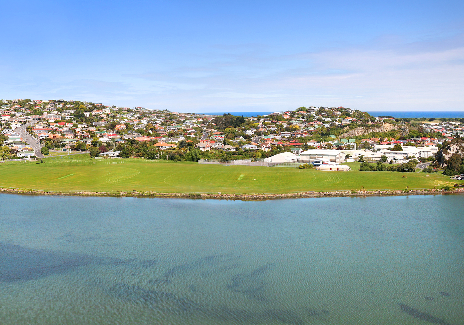
Musselburgh
Musselburgh is a sunny suburb located in the southeast of the city centre, at the narrowest point where the Otago Peninsula joins to the rest of the South Island.
Taking its name from the similarly named town in Scotland, Musselburgh's most distinctive feature is a rocky outcrop called Musselburgh Rise, which rises prominently above the eastern end of "The Flat", the local name for the broad coastal plain which stretches across the suburbs of Saint Kilda and South Dunedin.
Musselburgh is an easy 5 - 6 minute drive to the central city, University, and Hospital, 5 - 6 minutes drive to local beaches, right at the beginning of the Otago Peninsula and within 2 - 5 minutes walking distance of other amenities.
The rise lends its name to the suburb's main street, Musselburgh Rise, which contains the suburb's small retail area, consisting of a dairy, a takeaway shop, hairdresser, doctor, dentist, pharmacy, fish shop and a florist. This shopping area and the southern flank of the Rise is sometimes considered a separate suburb, Sunshine, formerly known as Goat Hill.
The northern side of the Musselburgh Rise is skirted by another main thoroughfare, Portobello Road. This road joins with the southern end of Portsmouth Drive close to the northeastern point of the rise, and continues across the causeway at Andersons Bay Inlet. Close to the junction is a large memorial stone to the Taranaki Māori prisoners of the New Zealand Land Wars who were transported south to Dunedin, many of whom constructed the causeway and much of Dunedin's foreshore roads as forced labour. A branch railway ran along Portobello Road in this area from the 1870s until 1912, and rail links continued to the suburb until the track were lifted in 1928.
Close to the eastern edge of the rise is one of Dunedin's main secondary schools, Bayfield High School. This school lies close to the boundary of the suburbs of Musselburgh and Andersons Bay. The top of Musselburgh Rise includes several larger homes, notably including Belmont, built in the 1860s for politician and newspaper editor William Cutten. Belmont was later owned by Sidney Neill, and became famed for its gardens Neill was the son of Percy Neill, founder of Neill & Co, which was to become New Zealand's largest importer of spirits.
Image courtesy of Open2View
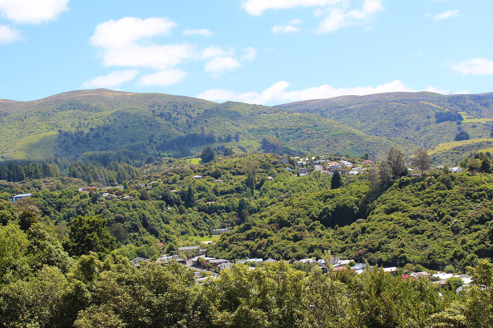
Leith Valley
The Leith Valley sits on the northwest edge of Dunedin and incorporates three suburbs: Woodhaugh at the base of Pine Hill; peaceful Glenleith; and the semi-rural Leith Valley.
The valley is home to about 1500 people across the three suburbs. It’s about 14km long and follows the Water of Leith stream, as it makes its way from Mount Cargill, through north Dunedin, the University of Otago campus and out to the harbour.
Woodhaugh is best known for the popular Woodhaugh Gardens and also includes many historical buildings. Being right on George Street, the suburb is popular with students and is also enjoyed by families, with George Street Normal School a popular primary school.
Glenleith has generous pockets of bush, the much-loved Ross Creek walking track and an historically-significant reservoir. Glenleith gives way to a more rural setting, as the valley climbs upwards into Leith Valley, proper.
The Leith Valley Scenic Reserve – home to Nicols Falls and glow worms – can be found 350m up from the Malvern Street intersection.
The Leith Valley Touring Park is another notable feature in the area. Highly-rated by travellers, the park accommodation covers campers, motels, cabins and tents.
Kaikorai Valley
Kaikorai Valley describes the wide valley that runs from the southern motorway’s Burnside junction, through to Stuart Street.
It incorporates three Dunedin suburbs – Kenmure at the bottom of the valley, Bradford in the centre and Kaikorai at the top.
The valley includes a mix of light industrial businesses and residential homes. It is well serviced by schools, with Bradford Primary and Kaikorai Valley College – a co-ed school, which caters for Year 7 through to Year 13 students. The college is set in an attractive park-like setting and provides a community focal point.
There is a popular Top 10 Holiday Park towards the top of the valley, which attracts a steady stream of visitors into the area.
Helensburgh
Helensburgh sits on the outskirts of the city, with countryside only a couple of blocks away, plenty of bush and birdlife and great views across Balmacewen towards Mt Cargill and North East Valley. The result is that the 1000 residents have a wonderful feeling of space and nature.
Bordered by Wakari and Balmacewen Golf Course, Helensburgh is an easy 10 minute drive from Central Dunedin. It’s a quiet suburb, where the streets are mostly crescents and therefore not overly busy.
There is a small neighbourhood shopping centre, which includes a veterinary clinic and pet groomers, as well as a hairdresser and a catering company. Within walking distance, there is also a bakery, fish and chip shop, dairy and the Helensburgh Medical Centre.
Public transport is plentiful and some of Dunedin’s top schools are within walking distance.
From an insider
We chatted to a settled resident, happy to share her love for the suburb. “It’s very close to some of the best outdoor activities in Dunedin. We’re a five-minute drive to the Frasers Gully Track, the Redwoods and Whare Flat mountain-biking tracks, Ross Creek and both ends of the Pineapple Track."
“It’s quiet and a neighbourhood where I know my neighbours and will stop and chat.”
Halfway Bush
At 280m above sea level, Halfway Bush lies at the edge and top of Dunedin city – the last suburb before you hit Three Mile Hill at the end of Taieri Road.
It sits alongside lifestyle blocks, farmland and scenic reserve areas, with about 1860 people living in its quiet crescents.
Halfway Bush Primary School provides a community focal point. It has 51 pupils and proudly describes itself as “a small country school, located within the city limits”. Its large grounds also house a Kohanga Reo, playgroup and community hall.
Halfway Bush has its own dairy, situated at the top end of Taieri Road, and there is also a takeaways back towards town.
Green Island
Home to about 2,500 people, this outer suburb of Dunedin lies only eight kilometres west of the Octagon and is a quick drive into town along State Highway 1.
Green Island was first settled in 1848 and prospered, thanks to being on the main road to the Taieri and Otago Goldfields. It enjoyed another boom in the 1950s and 1960s, when new state housing developments saw families move into the area. These quality state-built houses remain a feature of the suburb today.
Green Island’s shopping centre includes a well-patronised supermarket, health services, cafes and a handful of retail shops.
With the Sunnyvale Park close by, the suburb boasts its own football, cricket and rugby club.
In case you’re wondering, the name “Green Island” relates to Green Island bush – an area of forest between the suburb and Blackhead.
Information courtesy of dunedinfamilyhistory.co.nz
Dunedin South
South Dunedin has a rich history, which reflects its early settlement and importance to Dunedin.
It’s situated about 2.5 kilometres south of the city centre and its imperfect boundaries are essentially the Otago Harbour to the south and east, Caversham to the west and a ridge of hills to the north.
Its make up includes residential homes, retail shops and light industrial activity. With big names like the Warehouse, Mitre 10 Mega, Pak’n Save and Countdown, South Dunedin is considered the city’s second largest retail area. But these big stores are complemented by a stretch of retail shops along King Edward Street. It’s a great destination for finding treasures in the many second-hand shops and is home to Alex Campbell Menswear and Thomas Shoes.
The impressive Dunedin Gasworks Museum is a gem, along with an array of impressive churches, the historic Mayfair Theatre and, of course, the Hillside Railway Workshops.
Today, about 2400 people live in South Dunedin. In line with being one of Dunedin’s early suburbs, many of the homes are older, but therefore also more affordable. It has a strong sense of community, enhanced by the King Edward Street shops, and offers a generally quieter pace of life, well away from the hustle of town and student activity.
The Dunedin City Council is working with the suburb to further develop the area, including the establishment of a cycleway.
Dunedin North
From an outsider’s perspective, North Dunedin defines the city.
With the University of Otago in the heart of the suburb, the area is home to most of the institution’s students. And, along with students, comes “colour”. Whether it be the famous student flats, groups of people wandering around dressed in theme, or the sheer number of young people in a concentrated area – North Dunedin is a dynamic few blocks of the city.
The suburb sits 1.5km north east of the Octagon and includes the hospital, Otago Museum, Knox Church, Otago Polytechnic, Logan Park High School and Dunedin North Intermediate. The Dunedin Botanic Gardens, Forsyth Barr Stadium and University Oval also sit within its boundaries.
About 3400 people call North Dunedin home, according to the 2013 census. Reflecting the high percentage of student accommodation, only 3% of those people are over 65 and 1% are under 15 – compared to 14% and 18%, respectively, for Otago as a whole. Tellingly, only 5% of households are private dwellings, compared to 54% Otago-wide. Yes, student flats are the dominant dwellings.
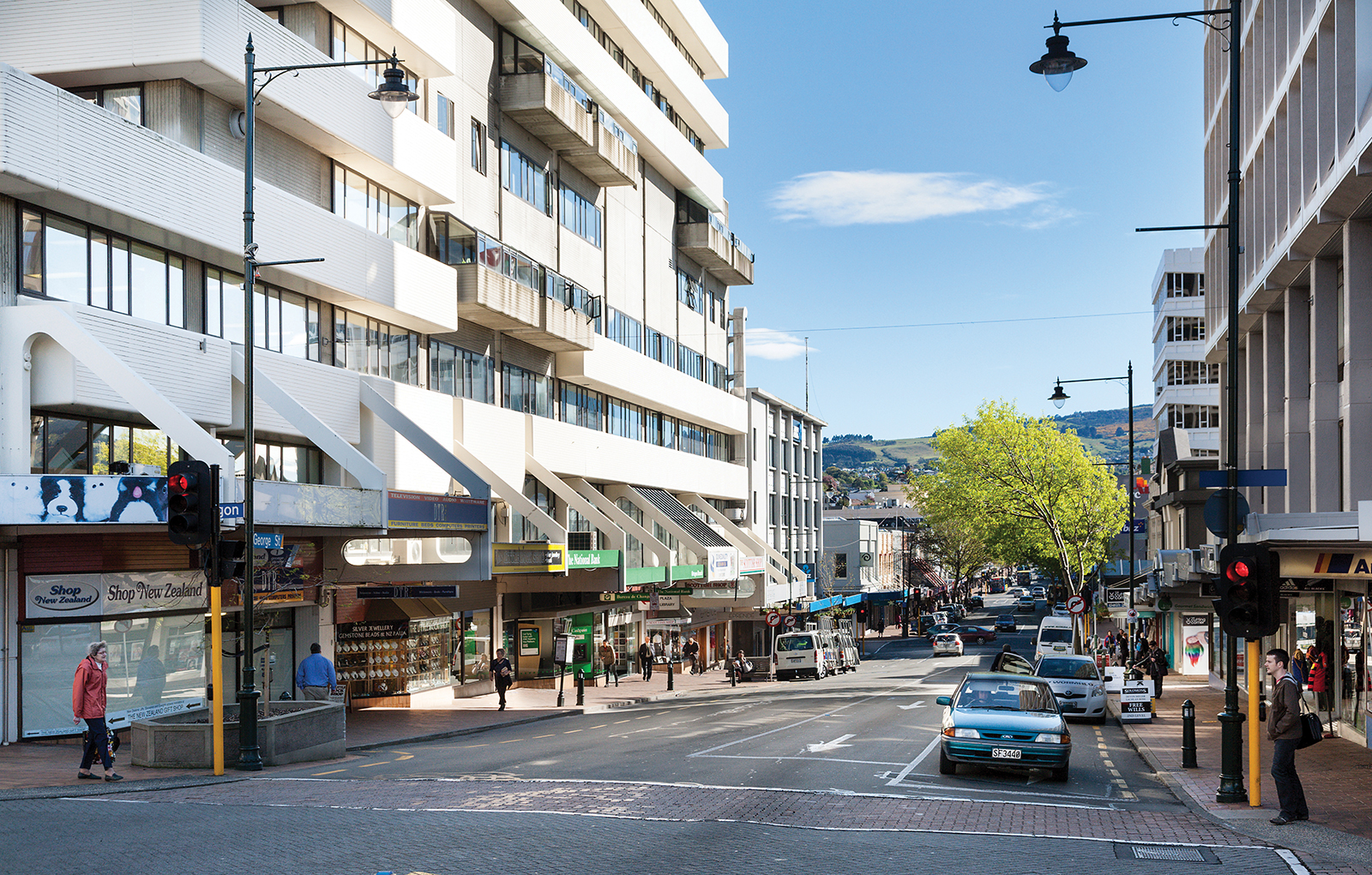
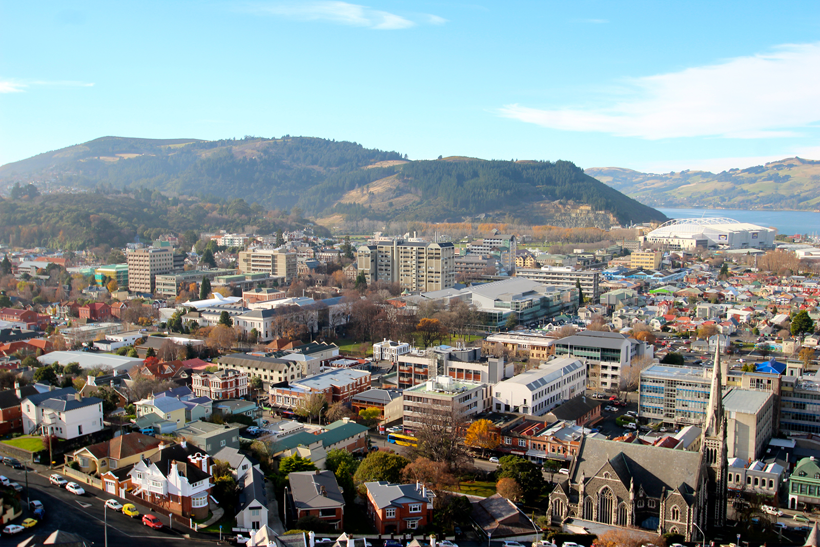
Dunedin Central
In the early years of Dunedin's settlement, much of the city's growth was on two areas of reasonably flat land close to the harbour, separated by the large Bell Hill and an area of low swampy land. As the city grew the swamp was drained to become the new city's centre, and the hill was lowered by excavation to allow access between the two areas of settlement. A street grid was set up with the main road split in two by the city centre (now The Octagon) - Princes Street to the south and George Street to the north. Both these names, along with many of the city's other street names, reflect those in Edinburgh, Scotland.
Bell Hill proved a major obstacle to travel south of the city centre, and major excavation work was carried out to provide access to the south. A cutting was made in the hill in 1858, and during the 1860s the hill was lowered by some 14 metres. Once the cut was completed, allowing for the passage of transport between the two parts of town, Princes Street quickly became the city's central business district, especially the area between the original docks (now the Exchange area).
Consequently, Princes Street is one of New Zealand's most historic streets, with about 70 buildings in close proximity listed on the New Zealand Historic Places Trust Register. Several notable companies have either been founded or had their headquarters in Princes Street. Notable among these were The Drapery and General Importing Company of New Zealand, later simply known as The D.I.C., Hallenstein's, and H.E. Shacklock. The first New Zealand headquarters of Briscoes were also located on Princes Street. Princes Street was at one point the location of a bridge across a small stream, the Toitu Stream, now diverted underground. A spring which fed the stream is still used as the source of water for Speight's Brewery, on Rattray Street.
The southern flank of the hill was also completely removed (that area now being occupied by Queen's Gardens). The stone removed from the hill was used as construction material for many of the city's first permanent buildings, and also to form the Southern Endowment, a large area of land reclaimed from the Otago Harbour. This reclamation work added a considerable area to the central city; the original docks, close to the Exchange area of Princes Street, are now several hundred metres inland.
A combination of money, good building stones and the then Scottish international pre-eminence in architecture saw a remarkable flowering of substantial and ornamental buildings, unusual for such a young and distant colony. R.A. Lawson's First Church of Otago and Knox Church are notable examples. Maxwell Bury's clock tower complex for the University (University of Otago Clocktower complex) and F.W. Petre's St Joseph's Roman Catholic Cathedral are others started in this time. Merchants like Edward Theomin built his grand town house Olveston and the Dunedin Railway Station was an opulent building, both completed in 1906. More companies and institutions were founded in these years, the Dunedin Public Art Gallery in 1884, the Otago Settlers Museum in 1898 and the Hocken Collections in 1910, all first of their types in New Zealand. After the war Modernist buildings appeared, such as the Dental School and Ted McCoy's Otago Boys' High School and Richardson building. By 1990 Dunedin had re-invented itself as the 'heritage city' with its main streets refurbished in Victorian style and R.A Lawson's Municipal Chambers in the Octagon handsomely restored.
The Octagon was first laid out during Charles Kettle's surveying of the city in 1846. The first major structure of any kind in the Octagon's reserve area was a monument erected in 1864 to the memory of Cargill. This was moved several hundred metres to The Exchange in 1872 to allow for the construction of a central roadway. In 1887 a statue of the poet Robert Burns was unveiled. In the early 1890s several improvements were made to The Octagon, including fencing, and the planting of plane trees along the edge of the central roadway.
In 1963, the council was given £5,000 by the Evening Star newspaper to build a fountain in the Octagon. The Star Fountain featured synchronised lighting, music and water displays, which played at regular times of the morning and evening. During the late 1980s, the Dunedin City Council substantially renovated the Octagon. The "new look" Octagon was in many ways an "old look", with covered walkways and Edwardian-style streetlights and fittings giving an antique look to the central city. The renovation of The Octagon, and particularly the addition of a plaza area, has seen an increase in al fresco dining in the Octagon, which is now a major hub for Dunedin's restaurant and cafe culture.
Image courtesy of Open2View
City Rise
City Rise is one of Dunedin’s oldest suburbs, as is evident by the number of grand old homes and established schools that fall within its boundaries. There are fabulous views to be enjoyed from many houses in this suburb – some of these views are as good as you will find anywhere in Dunedin.
Situated above The Exchange, City Rise sits on the upper side of Princes Street, with Stuart Street marking its northern boundary, and Maitland Street and the town belt defining its outermost southern and western points.
City Rise is predominantly residential, but – reflecting its age – it also includes Otago Boys’ and Girls’ High Schools, the old King Edward Technical College and Arthur Street Primary School.
Notable buildings include St Joseph’s Catholic Cathedral, Sew Hoy importers and, of course, Speight’s Brewery.
If you enjoy a window into history, the Arthur Street Cemetery is the oldest in Dunedin, discreetly situated alongside the townbelt.
Caversham
Caversham is one of New Zealand’s oldest suburbs and home to nearly 5,000 people.
The suburb grew out of the Central Otago gold rush, by virtue of its location on the way to the goldfields. For decades, it was a thriving hub of activity and industry. Today, the suburb is mostly residential, with a handful of retail shops on South Road and some light industrial business activity.
There are two primary schools – Caversham Primary and College Street School – and secondary schooling is also handy, at nearby St Clair.
Such an old suburb includes some gems of buildings. Among the most beautiful is Lisburn House, built in 1865 for a wealthy farming family and now run as a bed and breakfast. And, at the more curious end of the spectrum is the Donaghys building bordering Bathgate Park. The ropemakers’ building is 4m wide and 380m long.
The Caversham Project
The suburb’s historical significance is such that the University of Otago has a long-standing study – The Caversham Project – concentrating on the period between 1890 and 1940, when about 90,000 people lived in Dunedin’s southern suburbs. “These 50 years were a critical period in the country’s history, a time of rapid industrialisation and urbanisation. Dunedin led the way as New Zealand’s first major industrial centre. ‘Modern’ ways of organising work and society were pioneered here. The experience of the city's southern suburbs is a microcosm of what was happening across the country.”*
Major roading upgrade
The Caversham Valley road safety improvement project is nearing completion. It is designed to improve traffic flows, increase safety and reduce travel times for motorists using the three-kilometre arterial route between Andersons Bay Road and Lookout Point.
Phase one involved four-laning the stretch of road between the King Edward Street overbridge and Barnes Drive, while phase two has concentrated on Barnes Dive to Lookout Point. Construction work will be completed mid year, although final surfacing work may be held over until spring. The current show stopper for motorists is the construction of the large piles, which will support the Lookout Point overbridge. Pedestrians and cyclists are not forgotten and will share a looped pathway linking South Road and Riselaw Road.
*caversham.otago.ac.nz/resource
Brockville
Brockville lies about 5km north west of the Octagon and is home to 3300 people.
Brockville road runs from near the top of Kaikorai Valley Road, through to Dalziel Road.
The residential suburb includes a small cluster of shops, the Brockville Full Primary School and Bilingual Unit, a kindergarten and the Little Sisters of the Poor rest home.
Brockville has plenty of green areas, with two parks, a football and cricket ground and community park and playground.
Read Statistics New Zealand’s “Quick Stats” on Brockville
Brighton
About 16km south of central Dunedin, Brighton has long been a popular beach for both Dunedinites and holidaymakers alike.
The Brighton Surf Life Saving Club provides a strong community focus and just opened its new facility, which cost nearly $500,000 and was made possible thanks to five years of community fund raising. Reflecting the club’s position in the community, the building also serves as a multi-purpose community facility.
The small seaside village is also home to the Brighton Caravan Park and boat hire, a busy dairy and the South Seas Gallery.
Caravan Park owner Antony Burtenshaw has lived in Brighton for 18 months and loves the lifestyle that comes with living alongside a popular and safe swimming beach. “It’s a really friendly community, with everyone looking out for each other. It’s far enough from town, that it’s a nice drive home – and it’s warmer than in town. The lifestyle is great.”
Belleknowes
Belleknowes is a small, sought-after residential suburb perched high on the hill between Roslyn and Mornington, 150 metres above sea level, which enjoys expansive views across Dunedin.
Belleknowes is nestled within the Town Belt close to the points where City Rise, Mornington, and Roslyn meet. Its most notable feature is Belleknowes Golf Course, the closest golf course to the centre of Dunedin. Also of note within the suburb are several parks such as Jubilee Park and Robin Hood Park, the latter of which is home to the Beverly-Begg Observatory.
The Windle Settlement in Belleknowes has a well known history, designed by New Zealand's leading architects of that time, Basil Hooper, being early 1900's. Prime Minister Richard Seddon introduced the Workers' Dwellings Act in 1905 to provide well-built suburban houses for workers who earned less than £156 per annum. He argued that these houses would prevent the decline of living standards in New Zealand and increase the money available to workers without increasing the costs to employers. By breaking private landlords' control over rental housing, housing costs for everyone would decline. The bill passed by 64 votes to 2, despite criticism over the cost of the scheme, the distance the houses would be from workplaces, particularly ports. Seddon estimated that 5,000 houses would be built under the scheme.
The Act allowed for workers to rent weekly, lease for 50 years with a right of renewal, or lease with the right to buy over a period ranging between 25 and 41 years. In practice, the Government did not initially advertise the weekly rental, but emphasised the lease with the right to buy. The Act specified that workers could be male or female, but women were discouraged from applying for the houses because the Government was concerned that "houses of ill-repute" might be established.
The standard of materials and construction was high, because the Government was determined that the houses would not become slums. The Act specified that the rent was to be 5% per annum of the capital cost of the house and land, together with insurance and rates. The initial specification was that houses should cost no more than £300, but this was raised to £350-400, depending on construction materials, by the 1905 Amendment Act. This resulted in weekly rents ranging between 10s 6d and 12s 7d.All t he houses had five rooms—a living room, a kitchen/dining room, and three bedrooms—as well as a bathroom. This allowed boys and girls to be given separate bedrooms from each other. Some houses were built of wood, some of concrete, and some of brick.
Basil Hooper was commissioned to design the twenty homes in the Windle Settlement in Belleknowes, on Rosebery and Newport Streets. Hooper's work showed a restrained simplicity contrasted with prevalent late-Victorian taste, resulting in highly decorated villas. Such was the quality of the modest timber houses built dating from 1906, that some are still standing.
Twenty-five houses were built at Petone in 1905. Only four applications were received to lease them. Workers could reach Wellington with a 20 minute walk followed by a 30-minute train ride, but the train cost another two shillings a week. This left a family no better off than continuing to rent in Wellington. The Government was forced to allow weekly tenancies and to raise the maximum income level to attract families to the houses. Other settlements such as the one of twenty houses in Belleknowes, Dunedin also had trouble finding renters as they were too far from workers' places of employment. Houses built in central suburbs, such as the eight in Newtown and twelve in Sydenham, attracted tenants much more readily.
After Seddon's death in 1906, the Government Advances to Workers Act allowed urban landowners to borrow up to £450 from the Government at low interest rates to build their own houses. This proved much more popular than the state housing system. A total of only 126 houses were built under the Workers' Dwellings Act by 1910. A replacement Workers' Dwelling Act in that year allowed landless urban workers to build a house on a deposit of just £10. While it still allowed for workers to rent or lease their homes from the Government, applicants who were willing to buy were favoured. The state houses were sold by the Reform Government from 1912 onwards.
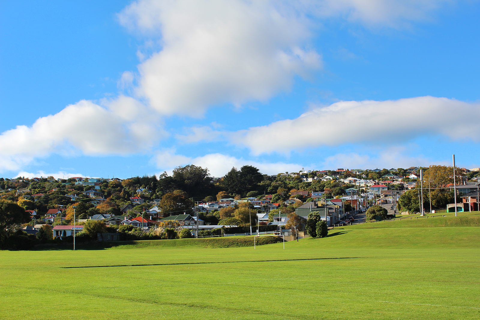
Andersons Bay
More commonly known by its endearing short-form name “Andy Bay”, this sunny suburb of Dunedin is home to about 2500 people.
Situated above the Andersons Bay inlet, most homes have a northerly aspect and many also have the advantage of a water view.
This very old suburb of Dunedin is only 2.8 kilometres from Dunedin central.
Andersons Bay is exceptionally well serviced for schools. There are two primary schools – Anderson’s Bay and St Brigid’s – and Bayfield High, as well as Tahuna Normal Intermediate to the south.
Speaking of convenience, Andersons Bay is home to a Filadelfio’s pizza/pasta restaurant and an Indian restaurant and takeaways, as well being next door to Musselburgh and the Brew café.