The Edinburgh Realty Blog
Wakari
Situated on the upper-reaches of Kaikorai Valley is Wakari, a quiet residential suburb north-west of the City Centre which hosts one of Dunedin's prominent healthcare facilities.
Wakari's name is likely to be a corruption of the Māori Whakaari, which translates as "a raised view". This was the name for the hill, Flagstaff, which lies 2.5 kilometres (1.6 mi) to the northwest.
The suburb lies on one of the main routes which links central Dunedin with the Taieri Plains. West of Halfway Bush, the road becomes Three Mile Hill Road, crossing the hill to reach the Taieri Plain northeast of Mosgiel.
Wakari's most prominent structure is the Wakari Hospital, one of Dunedin's main health care centres, which specialises in psychiatric services. This hospital is located in the west of the suburb, close to its boundary with Halfway Bush. The hospital is operated by the Southern District Health Board (formerly Otago District Health Board) and is closely associated with Dunedin Public Hospital.
It contains specialised psychiatric services but also cares for people with intellectual disability and people undergoing physical rehabilitation. It has units for forensic psychiatry, psychiatric emergency services, long- and short-term secure psychiatric units, Māori mental health, physical rehabilitation and increasingly community out-reach services such as public health and district nursing.
From 1915 the site was initially an infectious diseases centre, and later a sanatorium. In 1957 it was redeveloped as a general hospital, serving as the main Otago hospital while the Dunedin Hospital was being redeveloped in the 1970s. In the early 1980s, the Nurses' home was leased to the University for use as a student hostel, this being taken back with the closure of the Cherry Farm Hospital in 1992.
Wakari continued as a geriatric and psychiatric care facility, the geriatric wards gradually being wound down through the nineties with government reforms to privatise long-term care. The care of the elderly assessment and rehabilitation wards were transferred back to Dunedin Hospital. Attempts were made to sell the main block of the hospital, which found occasional use as a facility for live-in drug trials and even a temporary accommodation during important rugby tests.
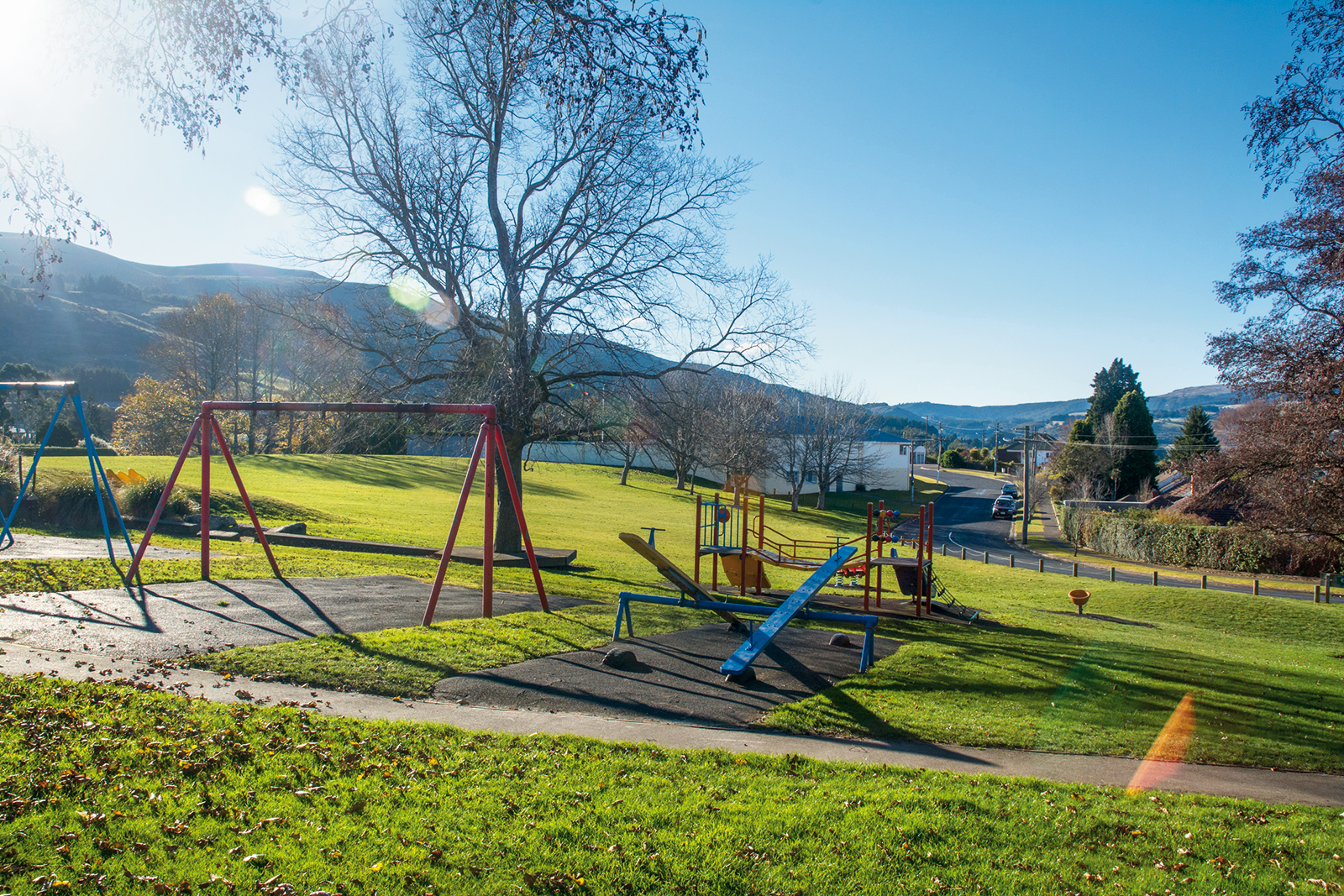
Along with Wakari Hospital, notable establishments are Wakari Kindergarten and Wakari School. The Roslyn Wakari football club is one of NZ's oldest, established in 1888. One of the founding clubs in Otago, the club recently celebrated their 125th Jubilee during Queens Birthday weekend 2013.
St Clair
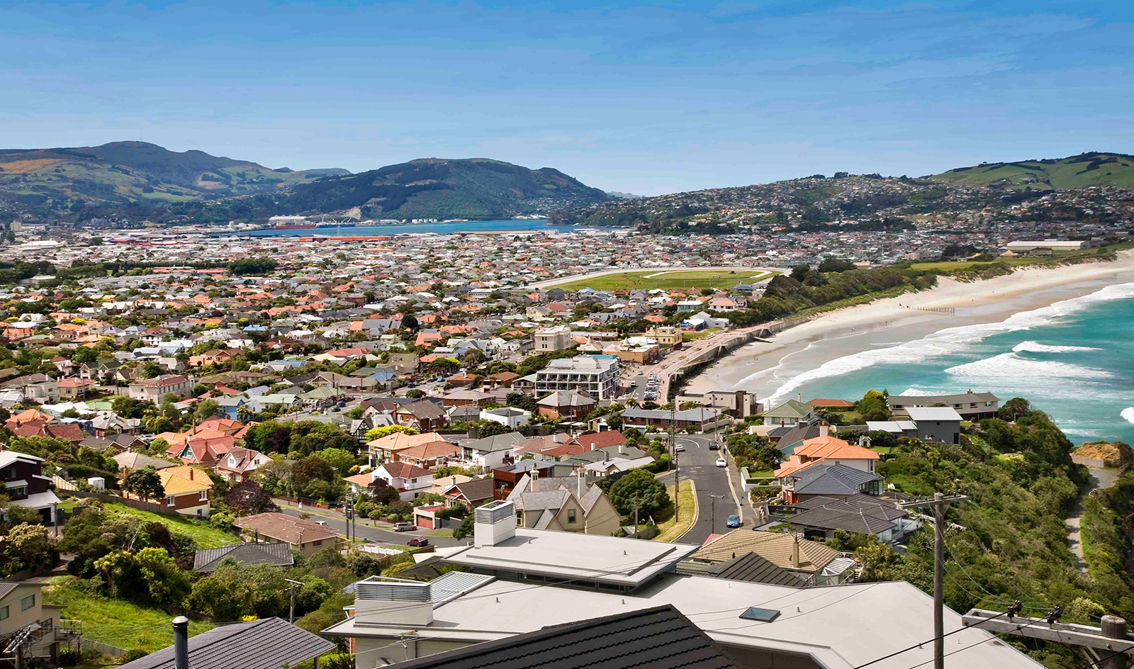
You only have to look at the quality of the grand old houses in St Clair to recognise the seaside suburb has always been a desirable Dunedin address.
The ocean views, beach access, sunny aspect and locality to town have always been a draw card. These days, St Clair’s Esplanade hosts a buzzing café, bar and restaurant scene that makes the suburb both a dynamic neighbourhood for its 4300 residents to live within, but also a popular weekend destination for the rest of Dunedin.
Only in St Clair
For many, “St Clair” means “great surf”. The beach is a long-time favourite for surfers because of its consistent surf break. The St Clair Surf Life Saving Club – established 105 years ago – is an active and popular club that provides a vital role in the community.
At the western end of the beach is the St Clair Hot Salt Water Pool – outdoors, yet heated to a toasty 28 degrees. Opened in 1884, the pool is a Dunedin treasure.
The St Clair Golf Club sits on top of 159 metre high Forbury Hill and enjoys stunning views of Dunedin, the harbour and the Pacific Ocean.
Nearby, lie the ruins of Cargill’s Castle – built in 1877 for former Dunedin mayor and MP Edward Cargill. A Trust now owns the ruins and plans to incorporate the site into a scenic walkway, so the public can enjoy the majestic views and slice of Dunedin history.
The environment
Having the Pacific Ocean as your neighbour to the south does bring its challenges. Erosion of the beach and dunes is nothing new. The first attempts to keep the ocean at bay were made in 1904, when the landmark wooden piles were erected. Protection work is ongoing – the stark reality of ocean vs sand.
Primary and secondary schools
The highly regarded King’s and Queen’s High Schools fall within St Clair, as does St Clair Primary School – a popular Years 1-6 school of 450 peoples.
Roslyn
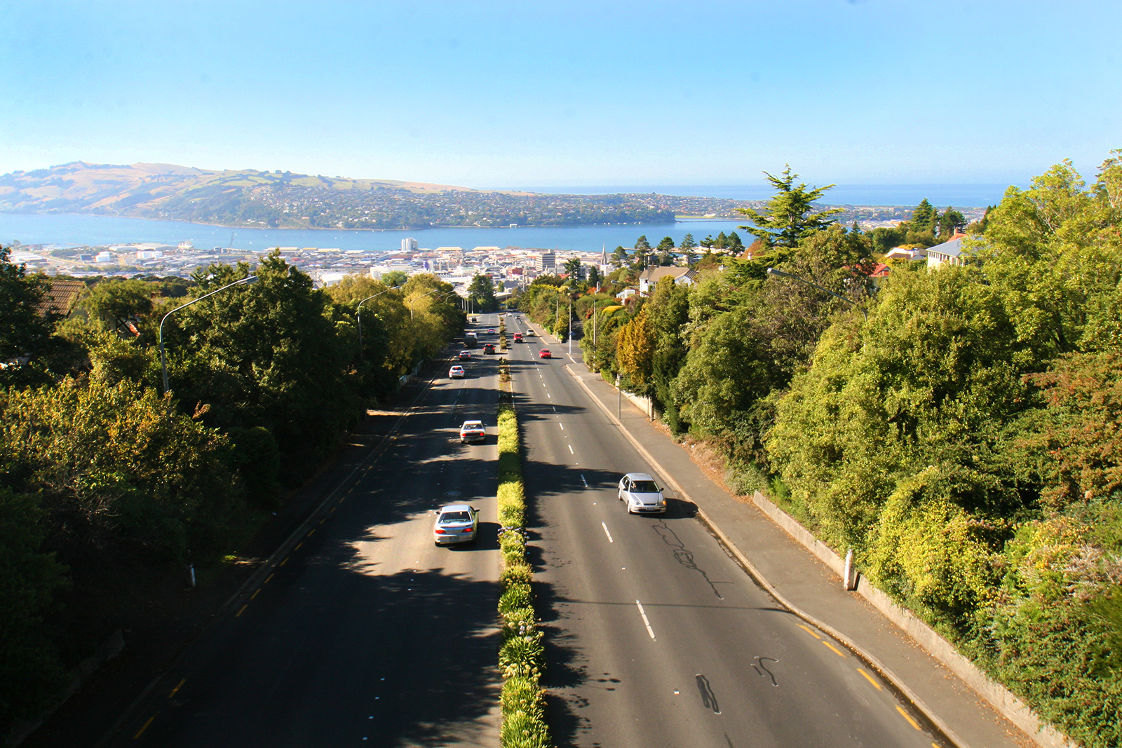
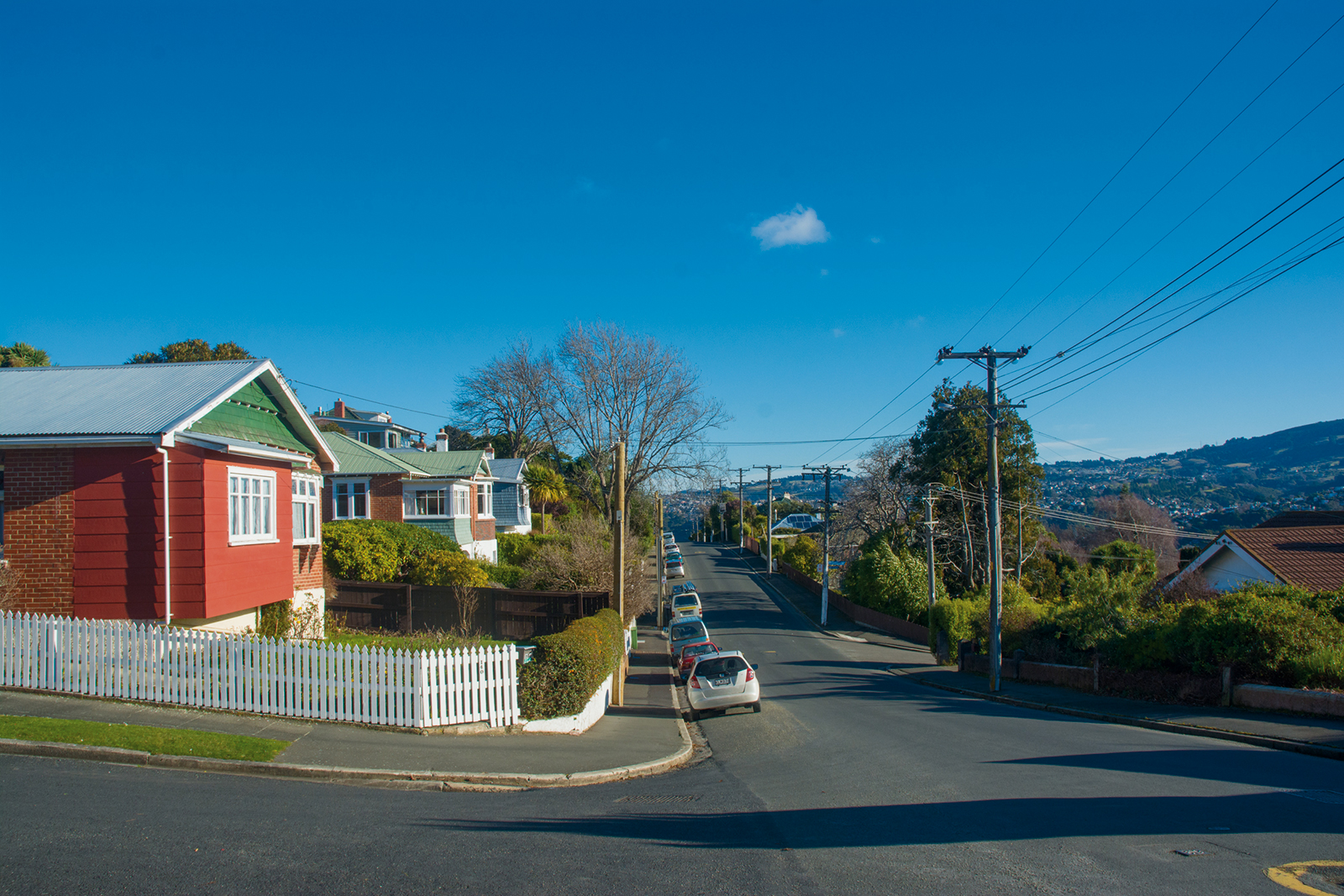
Only a couple of kilometres directly up the hill from the Octagon and perched on the top of a hill, it is easy to see why Roslyn is a firm favourite with both Dunedin locals and newcomers alike.
Sunny and capable of dishing up stunning views to the north, south, east or west, Roslyn is equally valued for its busy village-like hub. The compact shopping area includes restaurants, cafes, a florist, bakery, pharmacy and supermarket.
Helen Wright is co-owner of the popular café and wine bar, Rhubarb, and is lucky enough to live and work in Roslyn. “It’s proximity to everywhere is great. Roslyn is a lively area and the people are friendly. There’s that wonderful sense of community up here that you find in ‘sub villages’ in any city.”
Rhubarb celebrates its 10th birthday this month – testimony to Roslyn’s vibrancy and the locals’ appreciation of their own little village.
Many of Dunedin’s top schools are within walking distance or a short drive and the town belt sits just below Roslyn, on the route into town.
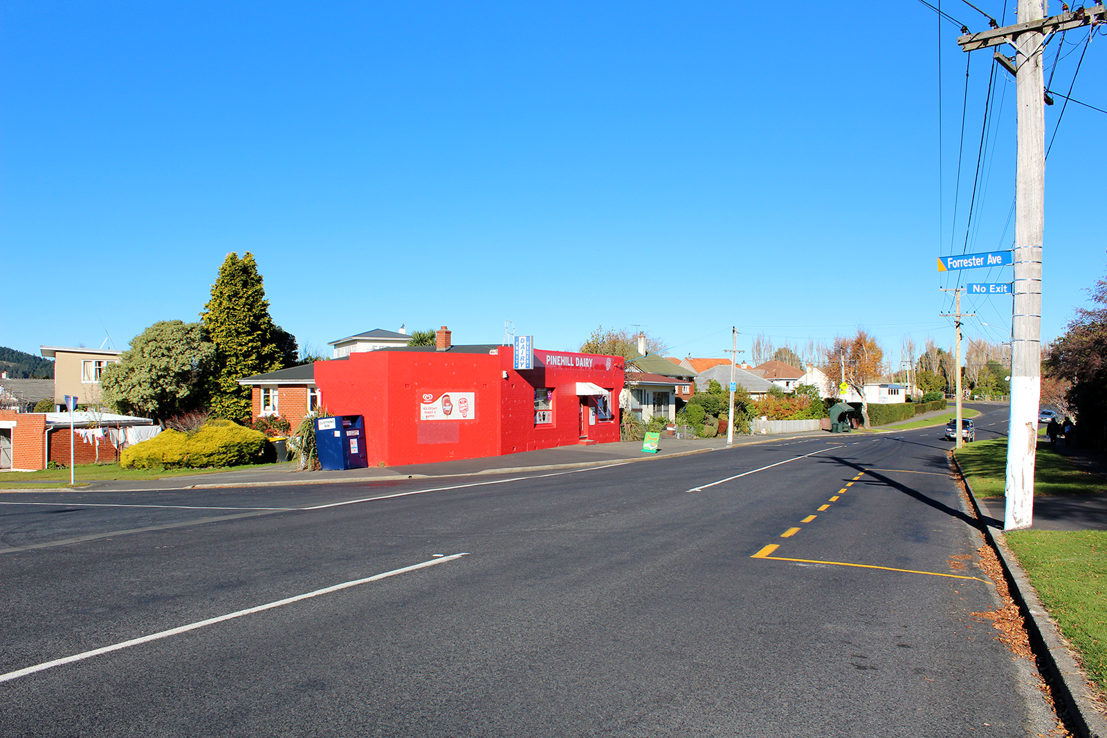
Pine Hill
The 2340 residents of Pine Hill are sitting on a well-kept secret.
A quick zip down the hill sees you in North Dunedin, where there is a lively cluster of shops, a supermarket, bank and a couple of eateries. And, it’s only a four-kilometre stroll into Dunedin Central. The suburb is well serviced by buses and an inexpensive taxi fare home, if you find yourself out late.
Pine Hill incorporates Dalmore on its lower slopes and Liberton partway up the hill. Further up, Campbells Road takes you into the countryside proper, with a selection of semi-rural properties sitting right on the outskirts of the city.
There are two schools – Pine Hill and Liberton Christian – as well as the University of Otago residential accommodation Aquinas College.
The outlook from Pine Hill is the biggest secret of all. Depending a home’s aspect, there are some stunning, panoramic views of the city to be had from this corner of the city.
Pine Hill is home to Dunedin’s first state house, built in Wilkinson Street in 1937 and still there today. There are therefore quality houses and good-sized sections worth keeping an eye out for. The streets are attractive, with green areas and the Dunedin Botanic Gardens and Woodhaugh Garden are both right there, at the base of the hill.
Opoho
Opoho is a sunny residential suburb, situated on the western flank of Signal Hill, 3 kilometres to the northeast of the city centre, overlooking North East Valley and the Dunedin Botanic Gardens.
Opoho is one of Dunedin's more prestigious residential suburbs however still has somewhat mixed demographics, containing student flats, significant numbers of elderly citizens, and the houses of many in the academic community. There was a former retail area in the southern part of Signal Hill Road, but this has long gone and the area is now largely occupied by student flats. Above the suburb sits the Centennial Lookout, a memorial built on the top of Signal Hill to mark the centenary of New Zealand in 1940. Impressive views over the city can be gained from here.
Opoho takes its name from the small stream, Opoho Creek (also known as Stony Creek). This stream runs south along the western flank of Signal Hill, past Logan Park High School in Dunedin North, before being diverted through culverts and flowing into the Water of Leith close to it outflow into the Otago Harbour. Opoho is a Māori word, simply meaning "The place of Poho", Poho being an 18th-century Ngati Wairua chief who lived close to the stream's outflow, which at that time was into Pelichet Bay (the bay has since been reclaimed and is now part of Logan Park).
Opoho's is largely concentrated around two long streets, Evans Street and Signal Hill Road, which run across the flanks of Signal Hill. Signal Hill Road continues to wind to the Centennial memorial close to the hill's summit. Several steep streets connect these two streets or descend to North East Valley. Chief among these are Blacks Road and Opoho Road, the latter of which is the main route to and from the suburb. It runs along the northern edge of Dunedin Botanic Gardens and connects with Dunedin's main arterial streets at the Gardens Corner. A further street, Lovelock Avenue (named for Dunedin Olympic gold medallist Jack Lovelock), winds through the upper reaches of the Botanic Gardens, emerging close to the University.
The first European settlers in the area were farmers, and the suburb remained semi-rural until the 1940s. There are still some farms close to the top of Signal Hill Road, though much of the top of Signal Hill is now a scenic reserve, Burns Park. Early farmers in the area included John Switzer, John Broome, and John Black. The area was at first administered by the Signal Hill Roads Board, which became part of the new North East Valley municipality in 1877. This amalgamated with the city of Dunedin in 1910.
As with many parts of Dunedin, Opoho was initially composed of many smaller named townships, the names of some of which are still used by local residents. In 1873, the first residential subdivision of Opoho began with Opoho Township (the area south of Blacks Road), followed soon after by Maybank Township immediately to the north and, later, by Grandview Township, to the north of Maybank (the names of Maybank and Grandview survive in two of Opoho's streets). By the 1890s, most of the subdivisions of Opoho Township were occupied and Maybank was growing. Grandview was developed during the 1920s. Other township names occasionally encountered include St James' Park, a small area including Grey Street and James Streets on the lower slopes between Opoho and North East Valley.
The suburb of Opoho has numerous prominent landmarks, most prominently the Dunedin Botanic Gardens and Centennial Monument (see Signal Hill, New Zealand). Other landmarks of note include the Northern Cemetery, which occupies a low spur of Signal Hill on Lovelock Avenue, next to the Botanic Gardens and above Logan Park. One of Dunedin's earliest cemeteries (begun in 1872), many of Dunedin's notable early citizens are buried here, among them William Larnach and Thomas Bracken. Larnach's Gothic mausoleum is the most prominent structure in the cemetery, which commands impressive views across central Dunedin.
Also of note are two university halls of residence which lie close to the southern end of Opoho. Knox College is a prominent towered red brick building on the lower slopes. Established as a theological hall in 1907, Knox is still a centre of the University of Otago's religious studies courses. Below this hall, close to the Gardens Corner, lies the smaller Salmond College, built in 1971. Also of note within the suburb is the Dunedin branch of the Society for the Prevention of Cruelty to Animals, which has its headquarters in the suburb, and Tannock Glen, a public gardens which is notable for its rhododendrons. Sports clubs based in the suburb include the Alhambra Union Rugby Club, based at Opoho Park near the junction of Opoho Road and Lovelock Avenue.
Numerous walking tracks cross the Botanic Gardens, Signal Hill, and the slopes between. These include a track across the summit of Signal Hill to link up with Cleghorn Street above the northern end of North East Valley, and tracks connecting the Centennial Memorial with Logan Park and the harbourside suburb of Ravensbourne.
Noted Opoho residents have included artist Arthur Merric Boyd, athlete Jack Lovelock, Celebrity Chef Alison Holst and Opera Singer Patricia Payne.