The Edinburgh Realty Blog
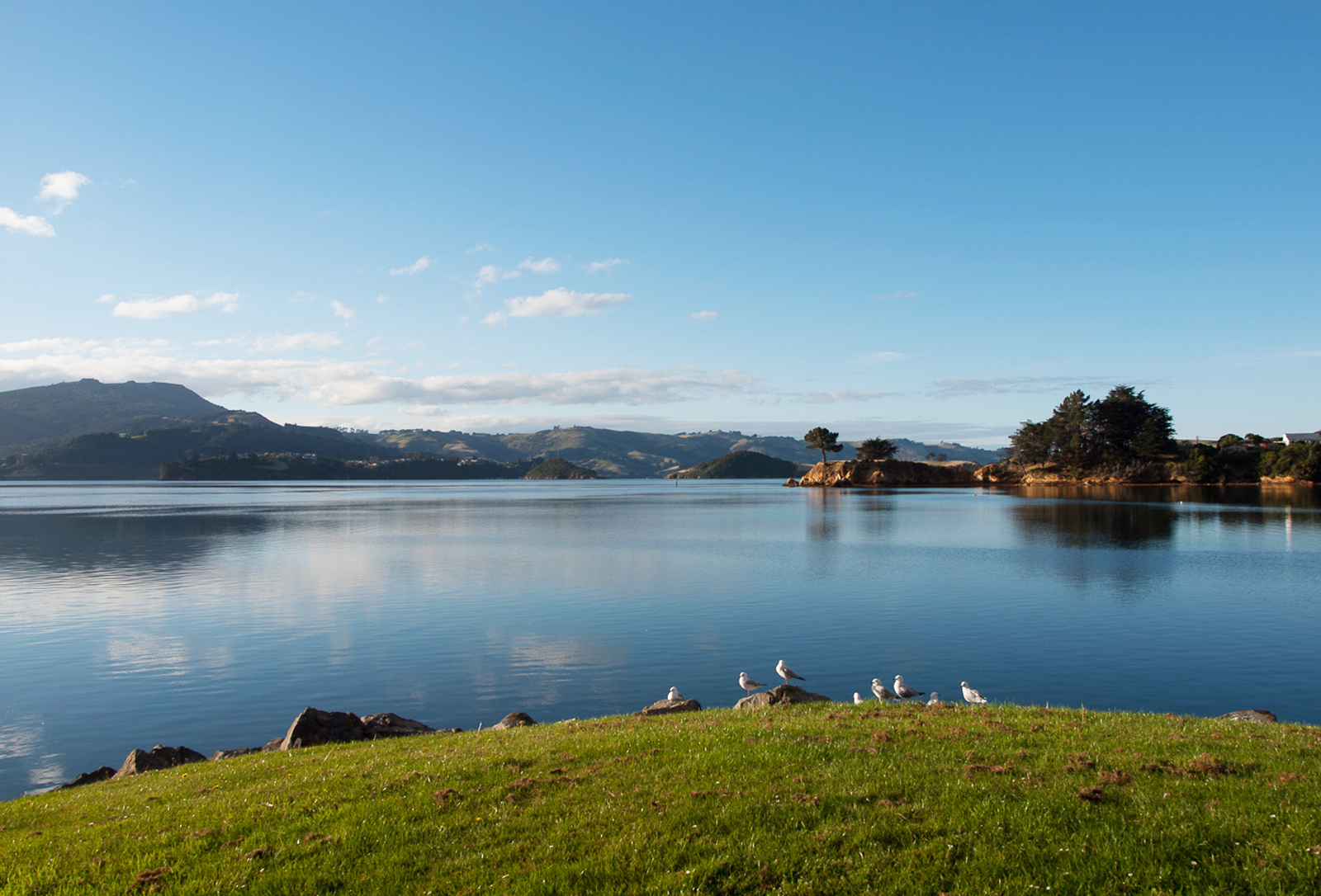
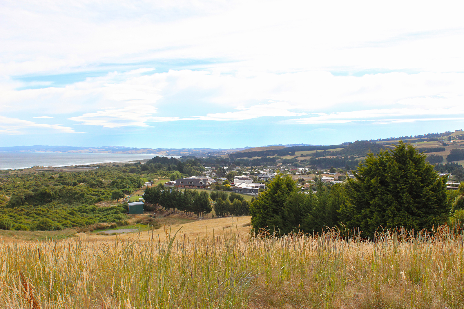
Broad Bay
Broad Bay sits halfway down the south side of Otago Peninsula, looking out over the harbour.
About 1100 people call Broad Bay home. Most value the fact it is only 15km to the Octagon, yet the 20-minute drive along the peninsula provides a buffer between the settlement and city.
Lala Frazer moved to Broad Bay about 40 years ago and finds the drive one of the upsides of living in the bay. “I always found that it gave me time to leave work concerns behind, before I arrived home – as I watched the changes in the harbour, the light and the birdlife through the seasons.”
When she made the move to the bay, Lala was looking for a north-facing suburb, with a view of the harbour from her kitchen sink. “Broad Bay looks out on the most picturesque parts of the harbour. The view changes daily with the tides, time of year, wind and weather.”
She says the bay’s “bounded edges” provide a real sense of being a village community within the city.
Broad Bay started out as a summer resort. In the days when ferries provided the main means of access, many wealthy families owned summer residences in Broad Bay. Some of these splendid summer homes still exist. They are complemented by small cribs and permanent family homes. Houses in Broad Bay are generally set back off the road – a remnant of the bay’s past, when the roads needed to be wide enough to allow two horse-drawn carriages to pass.
The suburb is known for the historic Fletcher House, and the much-loved Broad Bay China shop (which is sadly to close on 21 February). There is a well-used community centre and small primary school.
Dunedin’s longest running fruit and vegetable co-operative means locals can source produce at the weekends, without having to go into town. Or, by assisting with weeding and planting, they can also enjoy produce from the community garden.
There are plenty of good walks to be enjoyed, as well as walking along or swimming in the bay. An active group of volunteers are helping restore Smiths and Styles Creeks, for future generations to enjoy.
More details:
www.broadbay.co.nz
Photo credit: Zwennie, www.flickr.com
Waitati
Waitati is a seaside settlement of about 500 people, situated 20km north of Dunedin. It sits on the southern edges of the tidal Blueskin Bay, at the end of the Northern Motorway. It has a primary school, library, café, nursery, general store and even its own film society.
Waitati is a community-minded and friendly village, with a reputation for attracting environmentally-aware individuals.
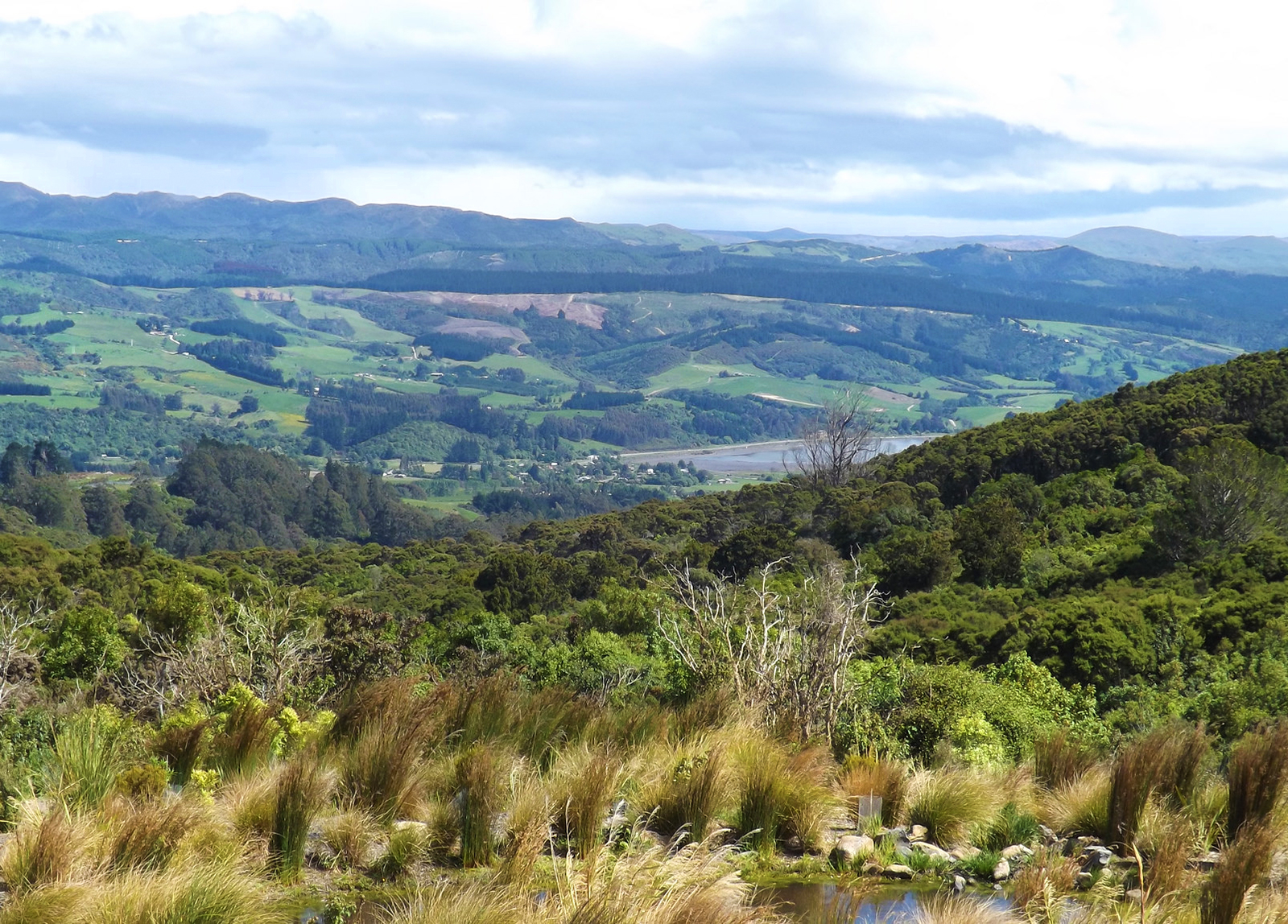
The Orokonui Ecosanctuary sits on 300 hectares above Waitati. The area is protected by an 8.7km-long predator fence, keeping pests out and the sanctuary’s precious animals in. Within the fence grows New Zealand’s tallest tree – an 80m tall eucalyptus.
Waitati – a variation on its Maori name, Waitete – is named for the small river, which flows past the settlement and into the bay.
Photo credit: Allison Brown, www.flickr.com
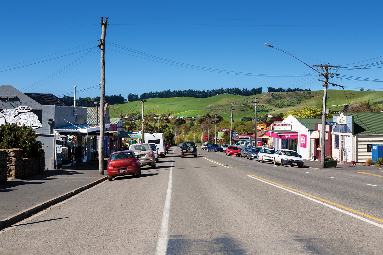
Waikouaiti
Waikouaiti is a quiet coastal village around 40 minutes’ drive north of Dunedin city. The first European settlers arrived on the beach, carried ashore by local Maori off the ship “Magnet” in 1840, making it the birthplace of the Otago province, as we know it today.
Waikouaiti was the first European settlement in southern New Zealand to be mainly based on farming and one of the first enduring European settlements in Otago. From 1837 there had been a whaling station confusingly also called "Waikouaiti" nearby on the south side of the estuary at what is now called "Karitane".
Matanaka Farm was founded by the Australian whaler Johnny Jones, who had bought the land and an adjoining whaling station in 1838. In April 1840, he brought out about twelve families from Sydney on the Magnet to settle the farm. The first buildings, including the stables, were built in 1840 using materials brought from Sydney. This was the first farm in the Otago region, eight years before the foundation of the Otago Association’s settlement. There are accounts from 1841 that mention a collection of barns and accommodation buildings, which allows researchers to date the buildings to that period. Jones himself moved into the farm's homestead in 1843.
When the settlement of Dunedin began in 1848, Jones supplied the new settlers with produce at a "good price". The Jones family moved to Dunedin for the better education opportunities for their children in 1854. The wooden shingle roofed St. John's Anglican Church in Waikouaiti proper opened in 1858, was funded by Jones. It was designed by Benjamin Mountfort of Christchurch, who also designed the Provincial Council Building there. It is the oldest church building in Otago and Southland.
In the 1858 Gold Rush, prospectors from all over the world swarmed ashore from Port Waikouaiti. Present day Waikouaiti developed from the township that Jones established in Beach Street in the 1860s. Before a road was built from Dunedin, goods from Dunedin destined for the goldfields of Central Otago were landed at the Waikouaiti Beach and taken on by wagon to Palmerston and then through the Maniototo to Central Otago. At this time, Beach Street in Waikouaiti had nine general stores, four hotels, a blacksmith’s shop, a timber yard, a watchmaker, two drapers, two butchers, three bakers and a printing press.
Johnny Jones' son William Jones lived at Matanaka Farm until 1858 and it was passed on to the next generation, John Richard Jones and his wife Mary Orbell, who had Matanaka Farm as their home until 1871. Mary Orbell's brother, McLeod Orbell, then leased the farm until 1878. Ownership of the farm passed a further five times before finally being given to the New Zealand Historic Places Trust in 1976, and the setting gazetted as a historic reserve in 1981. The five buildings are the oldest surviving farm buildings that are still in their original position in the country.
In 1861 Dr. William Chapman, at Jones request, became the first GP for the district. The Presbyterians built a wooden church in 1863. It was moved to Kildare Street in 1876 and still remains. A Government township was established north of the lagoon in 1862 and a third settlement was laid out along the main road and the municipality of West Hawksbury was established there in 1866. It continued to be called West Hawksbury until 1909.
After the road to Dunedin was opened in 1864, businesses began to move from Beach Street to the newly established township on the main road, the site of the present business centre in Waikouaiti. The railway to Dunedin opened in 1877, which expanded the township. The eight hotels in Waikouaiti had all lost their licenses by 1908 and the area was “dry” until 1963, when the Golden Fleece Hotel was established. The Bank of New Zealand opened in 1864 and was the last bank to operate in the town. The Post Office closed in 1989.
Cherry Farm Hospital, a psychiatric hospital serving the Dunedin area opened in 1952 and patients from Seacliff Mental Hospital at Seacliff were relocated there. Cherry Farm Hospital epitomised the village-asylum atmosphere in name and design, contrasting with the harsh conditions in the fortress-like Seacliff hospital. While at its peak Cherry Farm had many hundreds of patients, in latter years this number had dropped to below 400. When the hospital closed in 1992, psychogeriatric patients were either transferred to a unit at Wakari Hospital or to residential care in the community and people with intellectual disability moved to new lives in the community provided by a range of community agencies. General adult psychiatric patients were either transferred to new services at Wakari Hospital or into supported accommodation in the community. The closure of Cherry farm Hospital was a key milestone in the policy of successive governments to implement "deinstitutionalisation".
Part of a family with five generations of Waikouaiti heritage, Alan and Hazel Hagan have seen many changes in and around their beloved suburb. Now both in their 90s and having lived in Waikouaiti their entire lives, Alan and Hazel recall riding ponies to school, the four different houses in the area that they have lived in, the shops that have opened and closed and enjoy comparing their experiences to that of their children and grandchildren, who are also Waikouaiti locals.
Waikouaiti is ideally situated between the popular beach resorts of Karitane and Moeraki and only one hour from the vast expanses of Central Otago. By the turn of the 19th century, it was a popular holiday destination for people from Dunedin. Today it still has that holiday feel but is an increasingly popular commuter residential area for both Dunedin people and those working at the Macraes gold-mine inland from Palmerston.
The area boasts two churches, an excellent library, medical centre and primary school. A bus takes children to nearby East Otago High School for intermediate and secondary education, and there is a heated swimming pool nearby. The main feature is an uncrowded white sand ocean beach, overlooked by reserves, so there will never be beachfront development here. Behind the dunes is a wildlife lake/lagoon abundant with bird life, with lovely walks around the lagoon. Sea lions often bask on the sand and increasingly, yellow-eyed penguins come ashore to moult.
Overlooking both the lagoon and the beach is a delightful 18 hole golf course that is never crowded. Visit the local sports ground to watch a game of rugby, play lawn bowls or tennis, have a beer at the pub, surf cast, swim and of course stroll round the lagoon or on the beach. If photography appeals as a hobby, opportunities for wild life shots are immense. The Main South Line railway between Christchurch and Invercargill passes through Waikouaiti. It was constructed in the 1870s, and daily passenger trains passed through Waikouaiti until the cancellation of the Southerner in February 2002.
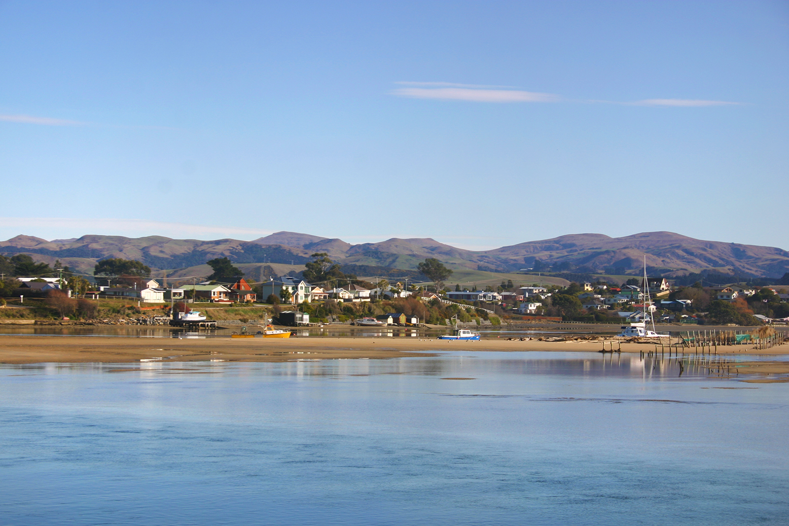
Karitane
Only 35km north of Dunedin, Karitane has long been a popular holiday spot for Dunedinites.
The seaside village has a wonderfully relaxed vibe about it, with plenty of recreational activity to keep you occupied (should you wish to be). In summer, the beach is a popular swimming spot – while surfing, fishing and walking are popular, no matter what the time of year.
Karitane’s permanent population of 360 people swells to about 1000 over the summer holidays, when families – particularly with younger children – recognise the healthy, inexpensive fun to be had by holidaying at the beach. And it’s close enough to the city, that one parent can sneak back to work during the day and leave the family holidaying a little longer.
Gary Kent has lived in Karitane since he was 18 months old. Now 65, he says he has no intention of moving anywhere else. “My father moved here in 1947 to manage a fish factory that was being started up. I did go away for four years, to do a carpentry apprenticeship in Dunedin, but once I was out of my time, I went fishing with my brother.”
Two years later, Gary bought the boat from his brother and carried on to fish from Karitane for his working life. “I’d walk out the door and down to the boat and away for work. It’s a good place to live. You’ve got a river area and then the surf beach – and it’s so handy to Dunedin.”
When asked what he values most about Karitane, Gary says: “Probably the low key, easy lifestyle. There’s no pressure.”
Sir Truby King – founder of the Plunket Society – lived at Karitane and it is from this base that he established the Karitane hospitals and nursing movement.
Karitane has a strong Maori community, focused around the Puketeraki Marae, which sits up above the village and looks out over the beach and the much-loved Huriawa Peninsula.
Waldronville
About 500 Dunedinites call Waldronville “home” – generally a mix of younger families and retired people. They describe it as an easy place to live. A supermarket and the Green Island shops are only a three-minute drive away and Dunedin central is a zippy 13-kilometre drive on the southern motorway.
Waldronville is known for being warmer than Dunedin proper - being on the south side of Lookout Point - and is surrounded by green spaces and the ocean. The Kaikorai Lagoon, Island Park Recreation Reserve and the popular Island Park Golf Course all border the suburb. For families, primary schooling options are plentiful and high school is a short bus trip into town.
Originally developed by Bill Waldron in the 1950s, the suburb was expanded in the 1970s and again in the 1990s. Each street is named after aircraft and include colourful names, like Vulcan Road, Dakota Place and Friendship Drive.
Well-known Dunedin artist Geoff Williams has a 25-year history with Waldronville, having worked from a studio in the suburb for 10 years, before moving with the family from Green Island in 2000. Together with wife Richelle, he lives on a two-acre property on Friendship Drive, surrounded by native bush and bird life.
Geoff says the beach has always been Waldronville’s main attraction for him. A 10-minute walk through the reserve allows him to slip from an urban environment, out into another world. “I’ve been living and working here for 25 years now and, in all that time, the beach has changed little and it is still as inspiring as ever.”
Geoff also draws inspiration from walks along the estuary. “We’ve got the rural lifestyle, but it’s only a hop, skip and a jump into town.”