The Edinburgh Realty Blog
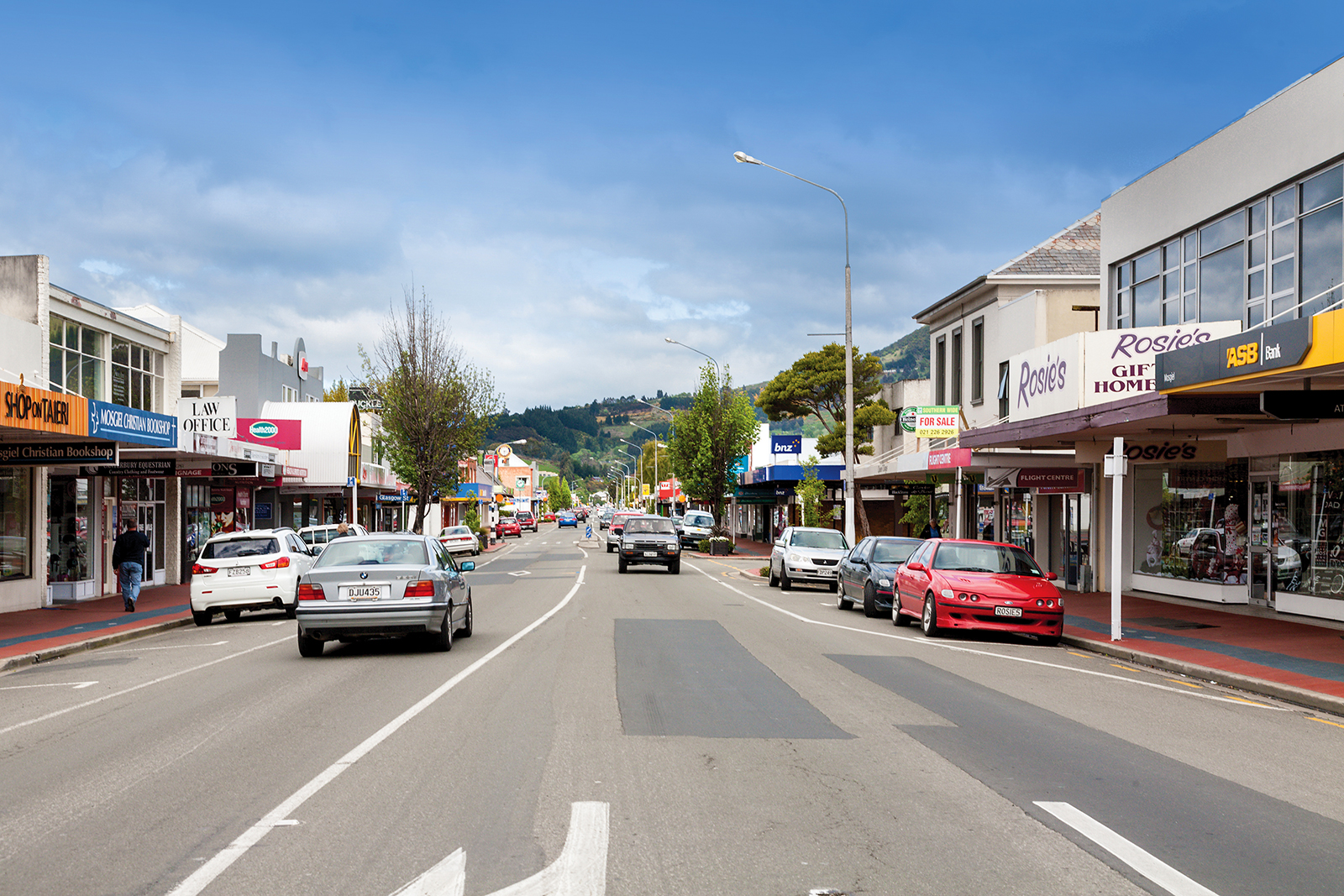
Mosgiel
Mosgiel, "the pearl of the plain", lies fifteen kilometres west of the Dunedin City Centre, lit up by the infamous sign perched on the hillside.
Mosgiel and Dunedin are separated by Three Mile Hill and Scroggs Hill, which form part of the crater-wall of a long-extinct volcano, the crater being the Otago Harbour. One of the many peaks that formed part of the volcano is Saddle Hill, a prominent landmark, which Captain James Cook helped to name in 1770. Mosgiel takes its name from Mossgiel in Ayrshire, the farm of the poet Robert Burns, the uncle of Reverend Thomas Burns, the co-founder of the Otago Settlement in 1848. The 1861 Otago gold rush saw the development of the first Mosgiel road — leading west to the interior — which intersected the site.
Thomas Burns' only son, Arthur John Burns, erected a flour mill and large house on what is now known as Factory Road in 1862, selling his ‘best colonial flour’ to the goldminers flooding into Central Otago at the time. The flour mill building was then utilised as part of The Mosgiel Woollen Company and mill which was established in 1871, bringing the settlement of workers in cottages. The building is the oldest remaining on-site. The factory opened in September 1871 with 180 tonnes of steam-powered machines successfully installed.
The Mosgiel Woollen Factory was one of the earliest mills in New Zealand to produce machine-woven cloth, second only to the woollen factory established in Nelson in 1858. Given the outside occupations at the time, strong fabric that could withstand farming, mining and sawmilling was vital. 1875 saw the north-south road paralleled by a railway, with a branch to the west constructed in 1877.The factory was the first in New Zealand to use electric lighting when this was installed in October 1885. The factory played an important role in Mosgiel, being the major reason the town developed in the first place, and remaining the major employer in the area for most of the twentieth century. The significance of transport for the area grew with the establishment of the Taieri Aerodrome, just north of Mosgiel, in the late 1920s and the development of Momona Airport, now Dunedin International Airport, further south on the plain in 1962. In 1948, more than one-third of Mosgiel’s working population was employed in the factory. The Mosgiel Woollen Factory continued to expand during the twentieth century, continually updating and expanding the plant and buildings at Mosgiel as well as acquiring the Roslyn Mill (1969) and Kaiapoi Textiles Limited (1972).
Mosgiel Ltd, as the company had been known since 1974, collapsed in 1980, under pressure from the restructuring of the textile industry and its recent purchases of Kaiapoi and Ashburton mills. Alliance Textiles bought the Mosgiel Factory in August 1980. Alliance sold the Mosgiel factory in 1993 to Caspex, who in 1997 combined with Coates Viyella to create Coats Spencer Crafts, based in the Mosgiel factory. The mill finally closed in February 2000 with the loss of 141 jobs. It took a year to dispose of all of the old but very well-maintained machinery, with 90% being sold to purchasers all over the world. Tony Offen purchased the mill and grounds in September 2001, and has developed the factory site into the Mill Park Industrial Estate, housing up to 30 individual businesses, as well as a large self-storage facility of over 350 units. Manager Dave Anderson now runs the self-storage business as well as looking after the 11ha of grounds and buildings, having worked at the Mosgiel Woollen Factory as an apprentice from the age of fifteen. The self-storage business was started up in 2003, with the first 22 units built and filled just as quickly. 2003 saw the second stage built, and filled again. Nearly at capacity again, Dave and Tony are currently planning to build more units. The massive amount of space in the old mill buildings means housing hundreds of units, as well as cars, boats, buses, caravans is an easy task.
In recent years, the Mosgiel population has expanded rapidly and continues to grow, with many people moving from Dunedin’s inner suburbs and the development of numerous subdivisions and retirement villages. Mosgiel’s retail sector has expanded also, with newer establishments opening up and older ones refurbishing, to cater for the younger market.
Sawyers Bay
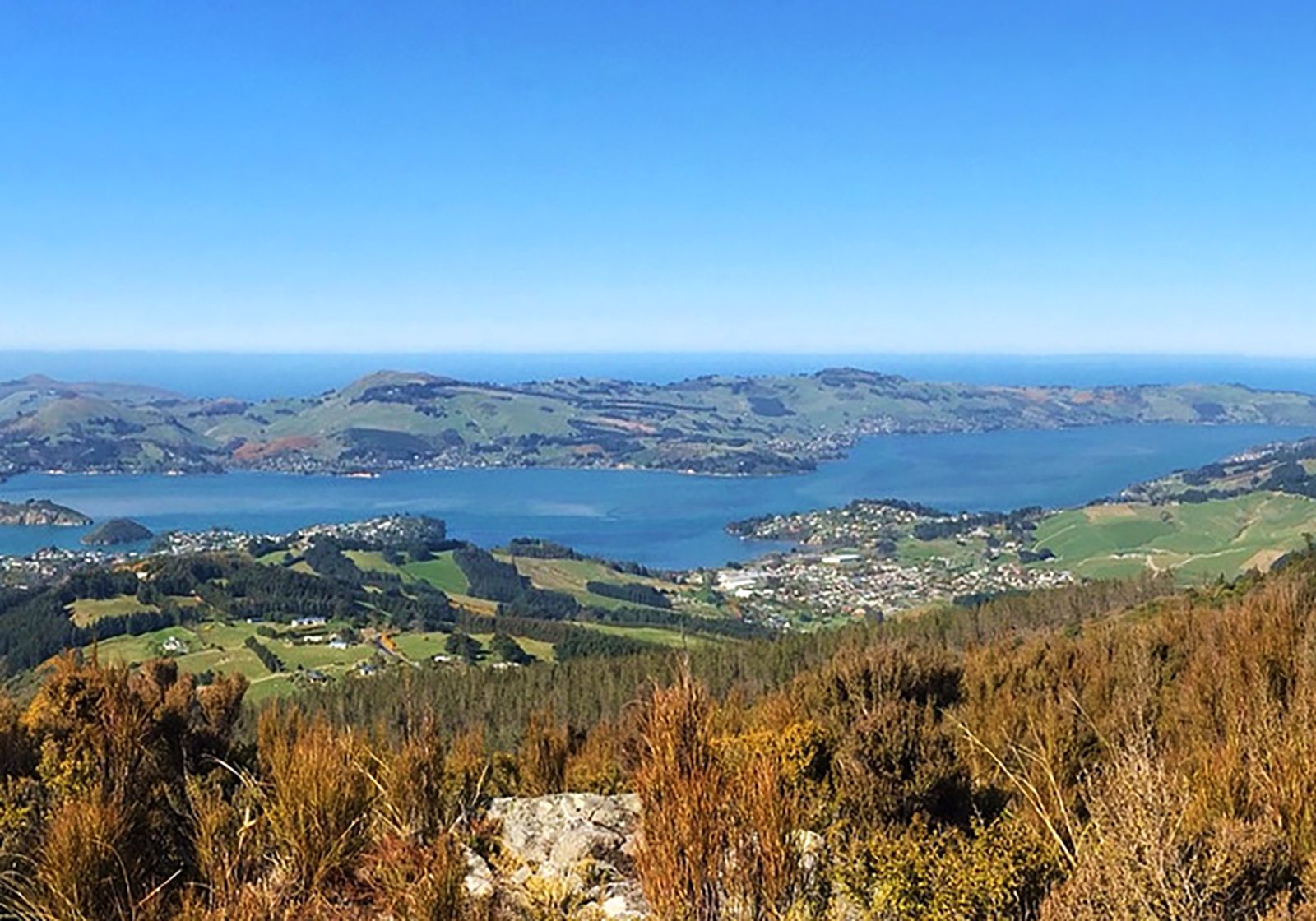
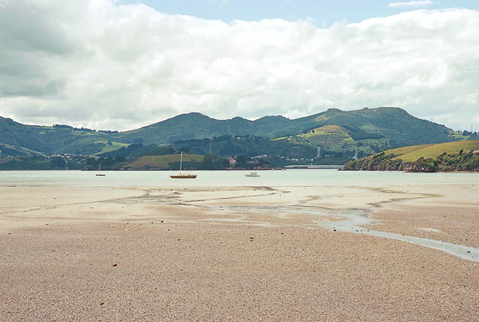
Sawyers Bay is one of those delightful Dunedin suburbs, which enjoys a semi-rural vibe, but is only 13km from the city.
Home to 1200 people, Sawyers Bay sits on the western side of the Otago Harbour and many houses enjoy spectacular views across the harbour.
The suburb has its own primary school – Sawyers Bay School, established in 1861 – and a play centre. It is only 3km from Port Chalmers’ shops, supermarket and cafes. There is also the Port Chalmers Golf Course on the edge of the bay and an attractive bush walk, Grahams Bush, which goes from the end of Hall Road, up to Mount Cargill Road.
As its name suggests, Sawyers Bay was where much of Dunedin’s timber originated in the early days of the city. Today, there is little sign of industry and it is most definitely a residential settlement. Homes sit either side of a long road, which starts as Station Road at the coast and becomes Hall Road at the top.
Photo credit: Samuel Mann, www.flickr.com
Ravensbourne
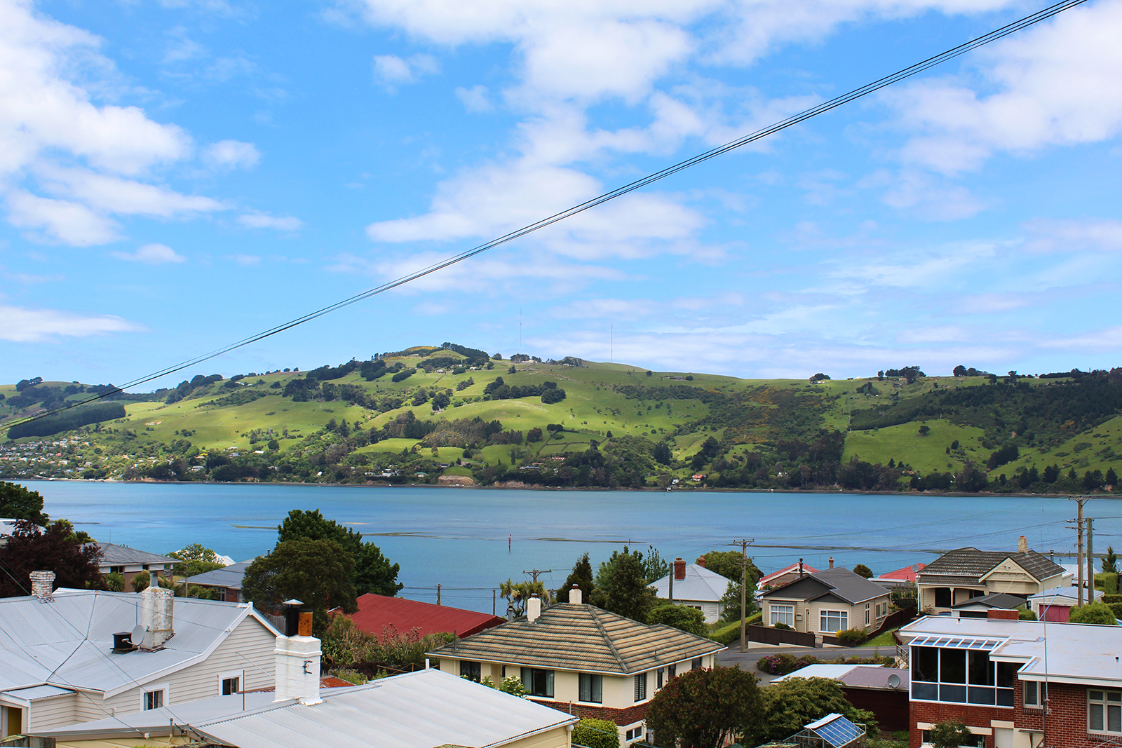
Settled in 1854, Ravensbourne is one of Dunedin’s oldest suburbs, by virtue of its proximity to Otago Harbour.
In fact, while Port Chalmers was home to the sailors and wharfies of the day, the captains and their contemporaries lived further afield, on the road towards town. This included Rothesay, as Ravensbourne was then known. For this reason, there are a good number of older impressive houses still to be found in the suburb.
Ravensbourne is situated on the south-eastern slopes of Signal Hill and enjoys views across the harbour. Its steep streets – the same ones that allow that view – can be explained. They were designed in Edinburgh. For the most part, however, Ravensbourne sits out on a plateau beyond Signal Hill and enjoys its share of sunshine.
With the Stadium and new Emerson’s Brewery, it is a corner of Dunedin that’s enjoying a resurgence in activity. And it is only a 4.5 kilometres – a 7-minute drive along SH 88 – into central Dunedin.
The West Harbour Cycleway goes through Ravensbourne, creating an alternative transport link into town and also opportunity for social interactions.
The suburb includes the Ravensbourne School (established 1877), a boating club and a rugby club.
Insider’s perspective
Mike Moroney has lived at Ravensbourne for the past 30 years. Together with wife Bernadette, they purchased a two-acre lifestyle block high on the hill at the top end of Ravensbourne – for a little over $40,000.
While the property was run down at the time, the garden had once been a showpiece. So, the couple proceeded with caution. All these years later, they can clear a new corner of the section and be surprised by bulbs they have never seen before. The property’s position affords it views across the water to Harbour Cone and St Clair.
What’s the best part about living in Ravensbourne? “We have good neighbours and we’re on the surburban/rural fringe,” says Mike. And he enjoys the interest that comes with a harbour – ships, rowing crews, yachts and changes in the weather.
Mike also appreciates the location’s proximity to both town and “out of town”. “People don’t appreciate that Ravensbourne backs right onto the Burns Park Scenic Reserve and you can bike and walk into there.”
Meanwhile – thanks to the harbour-side cycleway – Mike can be in the CBD within 15 minutes, although the hill to home makes it a 25-minute trip in the opposite direction.
The Rothesay News
The Rothesay News is the West Harbour’s monthly community newspaper. It was started in 1989 by Ravensbourne residents and is still going strong. In 1998, the paper published business with “Dusting Off … West Harbour the first 150 years”, which has been reprinted several times.
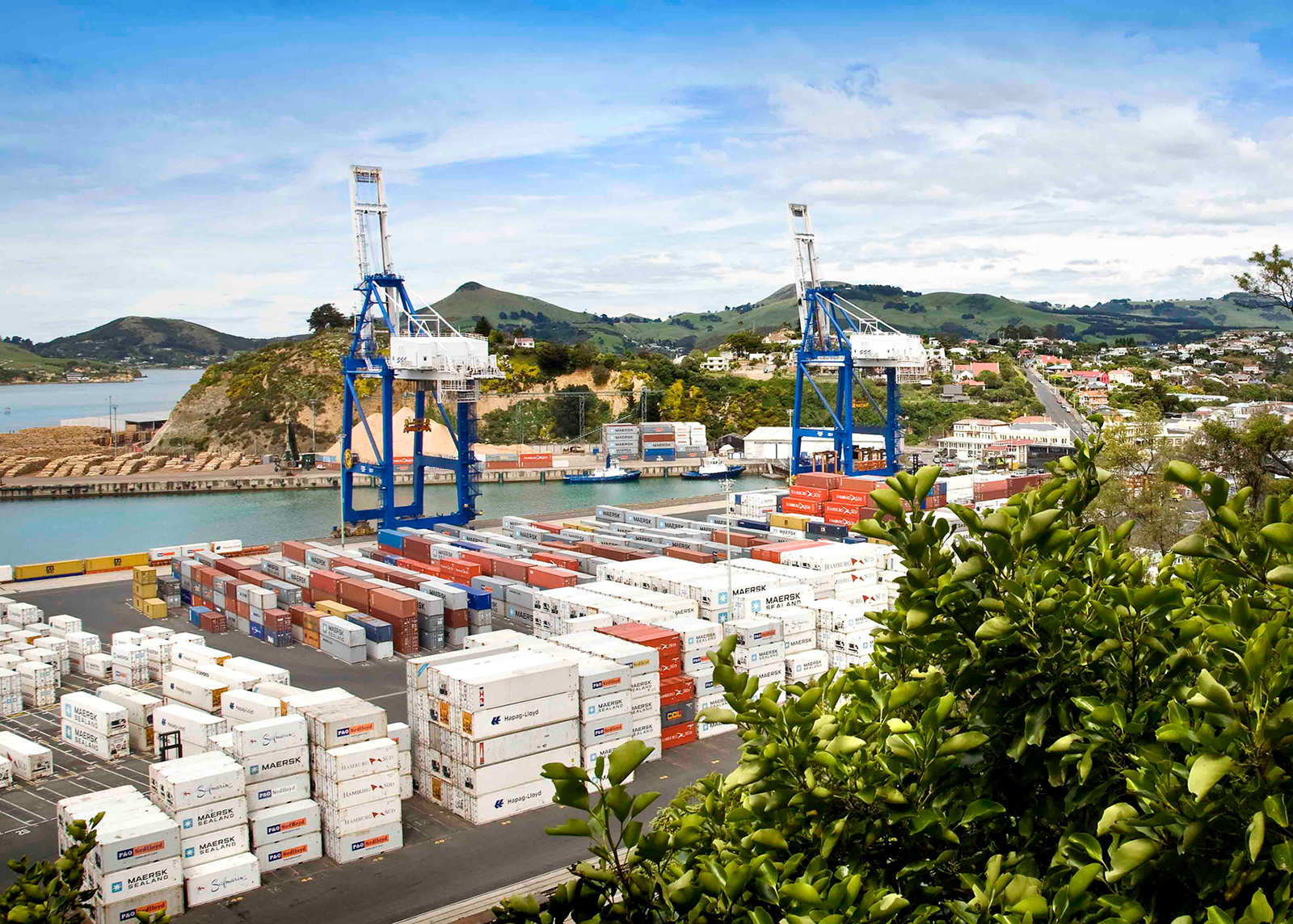
Port Chalmers
Situated 10 kilometres inside Otago Harbour, 15 kilometres northeast of Dunedin’s city centre, is the small hilly peninsula suburb of Port Chalmers. Port Chalmers is the site of Dunedin’s container port, at the northern end of the suburb on a large reclaimed area.
Although the harbour beyond Port Chalmers is regularly dredged, most of the port activity is centred on Port Chalmers rather than on central Dunedin. Part of the reason for this is the narrowness of the Victoria Channel, the one part of the Otago Harbour navigable by large ships, which makes it far easier for berthing to take place at Port Chalmers, closer to the open sea. Any big ships venturing into the upper harbour wharfs need to be piloted in with the help of tugs.
Port Chalmers was also the appellation of a ship which sailed between England, Australia and New Zealand at the beginning of the 20th century. It was torpedoed in mid-October 1940 and sunk, with some crew surviving 14 days at sea on the lifeboat.
In 1844 Captain Wing anchored the Deborah in the bay now bearing its name where he was joined by Frederick Tuckett who selected an adjoining block of land (the Otago Block) as the site for the Scottish New Edinburgh settlement. He nominated Koputai as its deep water port to be called 'Port Chalmers' after the Presbyterian Free Church leader Thomas Chalmers. The sale of the Otago Block from Māori to the Otago Association was concluded at Port Chalmers 31 July 1844. In December 1844 Alexander McKay and his wife arrived to open the first public house, the 'Surveyors' Arms'. The town was surveyed by Charles Kettle in 1846 and a Town Board was formed in that year. The first ships of Otago Association settlers, the John Wickliffe and the Philip Laing, anchored at Port Chalmers in March and April 1848.
Thereafter the town developed as a port for the city and the province, superseding the earlier Otago (modern Otakou) as the harbour's international port. It was first connected by lighter with Dunedin at the head of the harbour, then also by a steep road from North East Valley to Sawyers Bay, a spur of the main road north. By the 1860s a harbourside road from the central city had been formed. In 1866 the Town Board was superseded by a Borough. On 1 January 1873, the first 1,067 mm narrow gauge railway in New Zealand opened: the Port Chalmers Branch, linking Dunedin and Port Chalmers. It was subsequently incorporated into the national rail network through a connection to the Main South Line, which was opened through to Christchurch on 7 September 1878 and Invercargill on 22 January 1879. 1881 saw the opening of the Victoria Ship Channel allowing ocean-going vessels passage up the harbour to central Dunedin. 1882 saw the inauguration of New Zealand's refrigerated meat trade when the ship Dunedin left Port Chalmers with the first such cargo.
Port Chalmers was a port of call for several notable expeditions during the heroic era of Antarctic exploration, including Robert Falcon Scott before heading south on his final expedition to Antarctica. A large stone monument now stands above the town dedicated to Scott's final expedition. Following the 1923 transfer of the Ross Dependency (Antarctica) to New Zealand, and the New Zealand Government's lease of rights, the giant Norwegian whaler, C.A. Larsen, became the largest vessel serviced in the Otago Dock, Port Chalmers, in April 1928.
A harbourside road from the city was completed in 1965. Passenger services from the port ended in 1967. However the selection of Port Chalmers as the South Island's first container terminal in 1971 demonstrated its advantages over Lyttelton and gave Dunedin the major South Island container port. In 1979, passenger trains between Port Chalmers and the west harbour suburbs to the city centre ceased after 106 years of operation.
The container traffic has continued to expand and a new expanding trade in timber developed in parallel but the greatly reduced labour needs of these trades saw the town's population contract. The Otago Harbour Board, established in 1874, was replaced by a quasi-autonomous local government entity, Port Otago Ltd, in 1988. In 1989 the borough of Port Chalmers and the whole surrounding district were absorbed into an enlarged City of Dunedin.
From the 1970s an artists' colony grew up in Port Chalmers and Carey's Bay contributing to tensions over the port's continuing industrial development and giving a different flavour to the town. In the 1990s a new trade in visiting cruise ships added another element and continues to expand.
The creative arts are also important to the area's economy; Port Chalmers and the surrounding suburbs of Careys Bay, Roseneath and Sawyers Bay have a thriving arts community, and the town is regarded as a haven for alternative lifestylers.
Many artists and musicians call or have called Port Chalmers their home, most notably late Māori artist Ralph Hotere. Hotere's former studio was on land at the tip of Observation Point, the large bluff overlooking the container terminal. When the port's facilities were expanded, part of the bluff was removed, including the area of Hotere's studio (after strenuous objection from many of the town's residents). Part of the bluff close to the removed portion is now an award-winning sculpture garden, organised in 2005 by Hotere and featuring works by both him and by other noted New Zealand modern sculptors.
Image courtesy of Open2View
Portobello
The small village of Portobello sits halfway down the Otago Peninsula, surrounded by some of the country’s most spectacular scenery and only 25 minutes from central Dunedin.
Despite its small resident population, Portobello punches above its weight for amenities, bolstered by the steady flow of visitors heading out to see the peninsula’s wildlife up close. There’s a restaurant, pub, art gallery, museum, boating club, camping ground and motels. The University of Otago’s marine research station occupies the end of the Portobello Peninsula and the landmark, Quarantine Island, sits directly out in the harbour.
Established in 1857, Portobello School teaches primary school children, from years 1 to 8, and has a strong relationship with the local Maori community.
More details:
www.portobello.org.nz
Photo credit: Christopher Crouzet, www.flickr.com