The Edinburgh Realty Blog
Dunedin Central
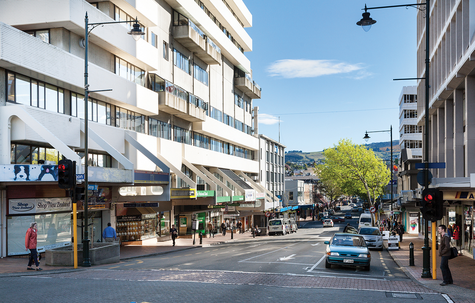
In the early years of Dunedin's settlement, much of the city's growth was on two areas of reasonably flat land close to the harbour, separated by the large Bell Hill and an area of low swampy land. As the city grew the swamp was drained to become the new city's centre, and the hill was lowered by excavation to allow access between the two areas of settlement. A street grid was set up with the main road split in two by the city centre (now The Octagon) - Princes Street to the south and George Street to the north. Both these names, along with many of the city's other street names, reflect those in Edinburgh, Scotland.
Bell Hill proved a major obstacle to travel south of the city centre, and major excavation work was carried out to provide access to the south. A cutting was made in the hill in 1858, and during the 1860s the hill was lowered by some 14 metres. Once the cut was completed, allowing for the passage of transport between the two parts of town, Princes Street quickly became the city's central business district, especially the area between the original docks (now the Exchange area).
Consequently, Princes Street is one of New Zealand's most historic streets, with about 70 buildings in close proximity listed on the New Zealand Historic Places Trust Register. Several notable companies have either been founded or had their headquarters in Princes Street. Notable among these were The Drapery and General Importing Company of New Zealand, later simply known as The D.I.C., Hallenstein's, and H.E. Shacklock. The first New Zealand headquarters of Briscoes were also located on Princes Street. Princes Street was at one point the location of a bridge across a small stream, the Toitu Stream, now diverted underground. A spring which fed the stream is still used as the source of water for Speight's Brewery, on Rattray Street.
The southern flank of the hill was also completely removed (that area now being occupied by Queen's Gardens). The stone removed from the hill was used as construction material for many of the city's first permanent buildings, and also to form the Southern Endowment, a large area of land reclaimed from the Otago Harbour. This reclamation work added a considerable area to the central city; the original docks, close to the Exchange area of Princes Street, are now several hundred metres inland.
A combination of money, good building stones and the then Scottish international pre-eminence in architecture saw a remarkable flowering of substantial and ornamental buildings, unusual for such a young and distant colony. R.A. Lawson's First Church of Otago and Knox Church are notable examples. Maxwell Bury's clock tower complex for the University (University of Otago Clocktower complex) and F.W. Petre's St Joseph's Roman Catholic Cathedral are others started in this time. Merchants like Edward Theomin built his grand town house Olveston and the Dunedin Railway Station was an opulent building, both completed in 1906. More companies and institutions were founded in these years, the Dunedin Public Art Gallery in 1884, the Otago Settlers Museum in 1898 and the Hocken Collections in 1910, all first of their types in New Zealand. After the war Modernist buildings appeared, such as the Dental School and Ted McCoy's Otago Boys' High School and Richardson building. By 1990 Dunedin had re-invented itself as the 'heritage city' with its main streets refurbished in Victorian style and R.A Lawson's Municipal Chambers in the Octagon handsomely restored.
The Octagon was first laid out during Charles Kettle's surveying of the city in 1846. The first major structure of any kind in the Octagon's reserve area was a monument erected in 1864 to the memory of Cargill. This was moved several hundred metres to The Exchange in 1872 to allow for the construction of a central roadway. In 1887 a statue of the poet Robert Burns was unveiled. In the early 1890s several improvements were made to The Octagon, including fencing, and the planting of plane trees along the edge of the central roadway.
In 1963, the council was given £5,000 by the Evening Star newspaper to build a fountain in the Octagon. The Star Fountain featured synchronised lighting, music and water displays, which played at regular times of the morning and evening. During the late 1980s, the Dunedin City Council substantially renovated the Octagon. The "new look" Octagon was in many ways an "old look", with covered walkways and Edwardian-style streetlights and fittings giving an antique look to the central city. The renovation of The Octagon, and particularly the addition of a plaza area, has seen an increase in al fresco dining in the Octagon, which is now a major hub for Dunedin's restaurant and cafe culture.
Image courtesy of Open2View
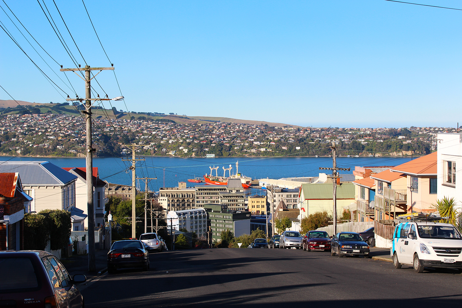
City Rise
City Rise is one of Dunedin’s oldest suburbs, as is evident by the number of grand old homes and established schools that fall within its boundaries. There are fabulous views to be enjoyed from many houses in this suburb – some of these views are as good as you will find anywhere in Dunedin.
Situated above The Exchange, City Rise sits on the upper side of Princes Street, with Stuart Street marking its northern boundary, and Maitland Street and the town belt defining its outermost southern and western points.
City Rise is predominantly residential, but – reflecting its age – it also includes Otago Boys’ and Girls’ High Schools, the old King Edward Technical College and Arthur Street Primary School.
Notable buildings include St Joseph’s Catholic Cathedral, Sew Hoy importers and, of course, Speight’s Brewery.
If you enjoy a window into history, the Arthur Street Cemetery is the oldest in Dunedin, discreetly situated alongside the townbelt.
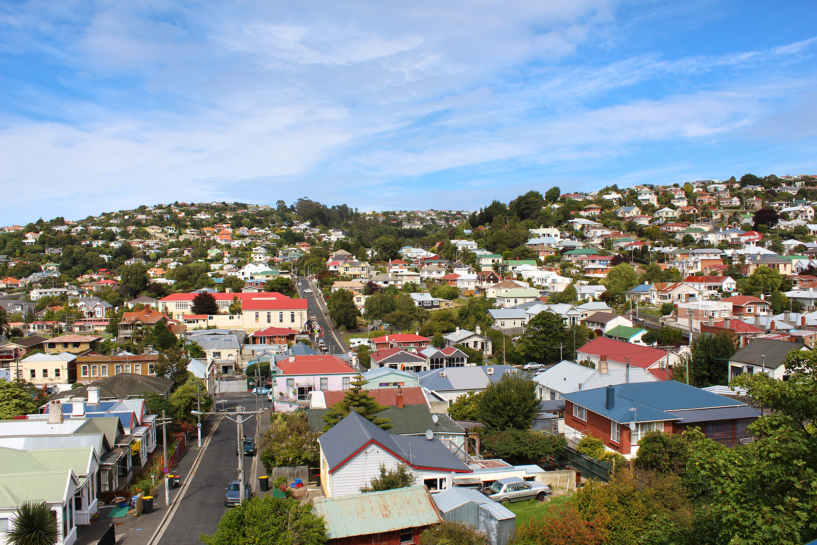
Caversham
Caversham is one of New Zealand’s oldest suburbs and home to nearly 5,000 people.
The suburb grew out of the Central Otago gold rush, by virtue of its location on the way to the goldfields. For decades, it was a thriving hub of activity and industry. Today, the suburb is mostly residential, with a handful of retail shops on South Road and some light industrial business activity.
There are two primary schools – Caversham Primary and College Street School – and secondary schooling is also handy, at nearby St Clair.
Such an old suburb includes some gems of buildings. Among the most beautiful is Lisburn House, built in 1865 for a wealthy farming family and now run as a bed and breakfast. And, at the more curious end of the spectrum is the Donaghys building bordering Bathgate Park. The ropemakers’ building is 4m wide and 380m long.
The Caversham Project
The suburb’s historical significance is such that the University of Otago has a long-standing study – The Caversham Project – concentrating on the period between 1890 and 1940, when about 90,000 people lived in Dunedin’s southern suburbs. “These 50 years were a critical period in the country’s history, a time of rapid industrialisation and urbanisation. Dunedin led the way as New Zealand’s first major industrial centre. ‘Modern’ ways of organising work and society were pioneered here. The experience of the city's southern suburbs is a microcosm of what was happening across the country.”*
Major roading upgrade
The Caversham Valley road safety improvement project is nearing completion. It is designed to improve traffic flows, increase safety and reduce travel times for motorists using the three-kilometre arterial route between Andersons Bay Road and Lookout Point.
Phase one involved four-laning the stretch of road between the King Edward Street overbridge and Barnes Drive, while phase two has concentrated on Barnes Dive to Lookout Point. Construction work will be completed mid year, although final surfacing work may be held over until spring. The current show stopper for motorists is the construction of the large piles, which will support the Lookout Point overbridge. Pedestrians and cyclists are not forgotten and will share a looped pathway linking South Road and Riselaw Road.
*caversham.otago.ac.nz/resource
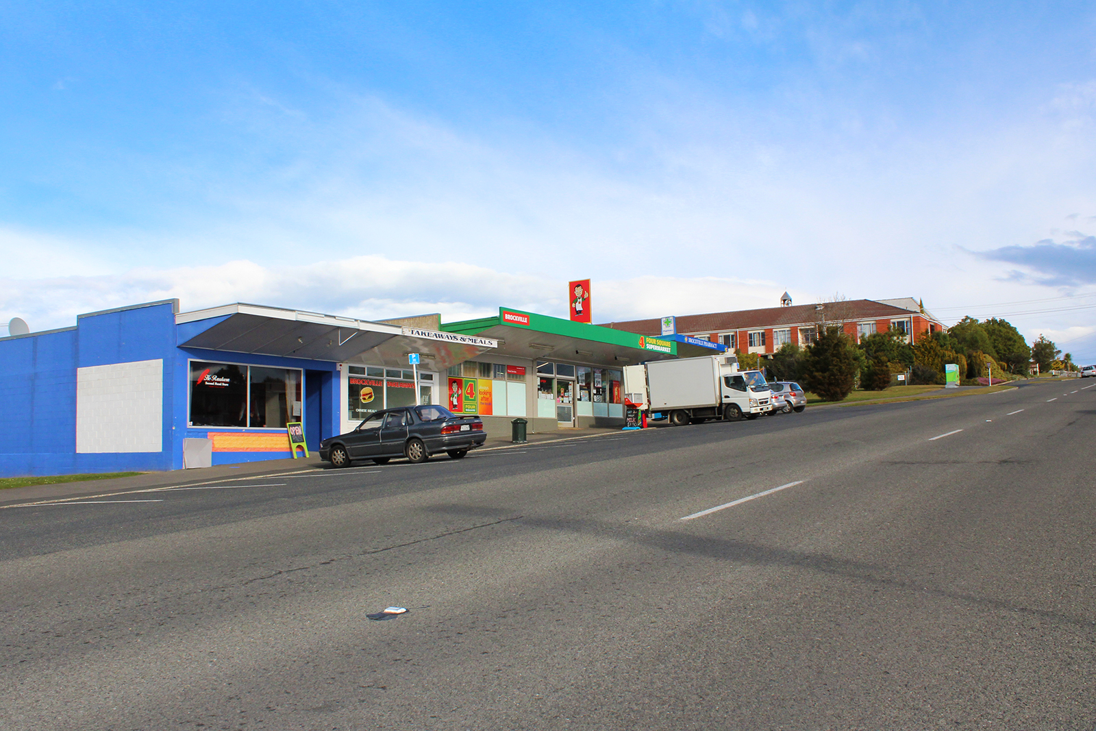
Brockville
Brockville lies about 5km north west of the Octagon and is home to 3300 people.
Brockville road runs from near the top of Kaikorai Valley Road, through to Dalziel Road.
The residential suburb includes a small cluster of shops, the Brockville Full Primary School and Bilingual Unit, a kindergarten and the Little Sisters of the Poor rest home.
Brockville has plenty of green areas, with two parks, a football and cricket ground and community park and playground.
Read Statistics New Zealand’s “Quick Stats” on Brockville
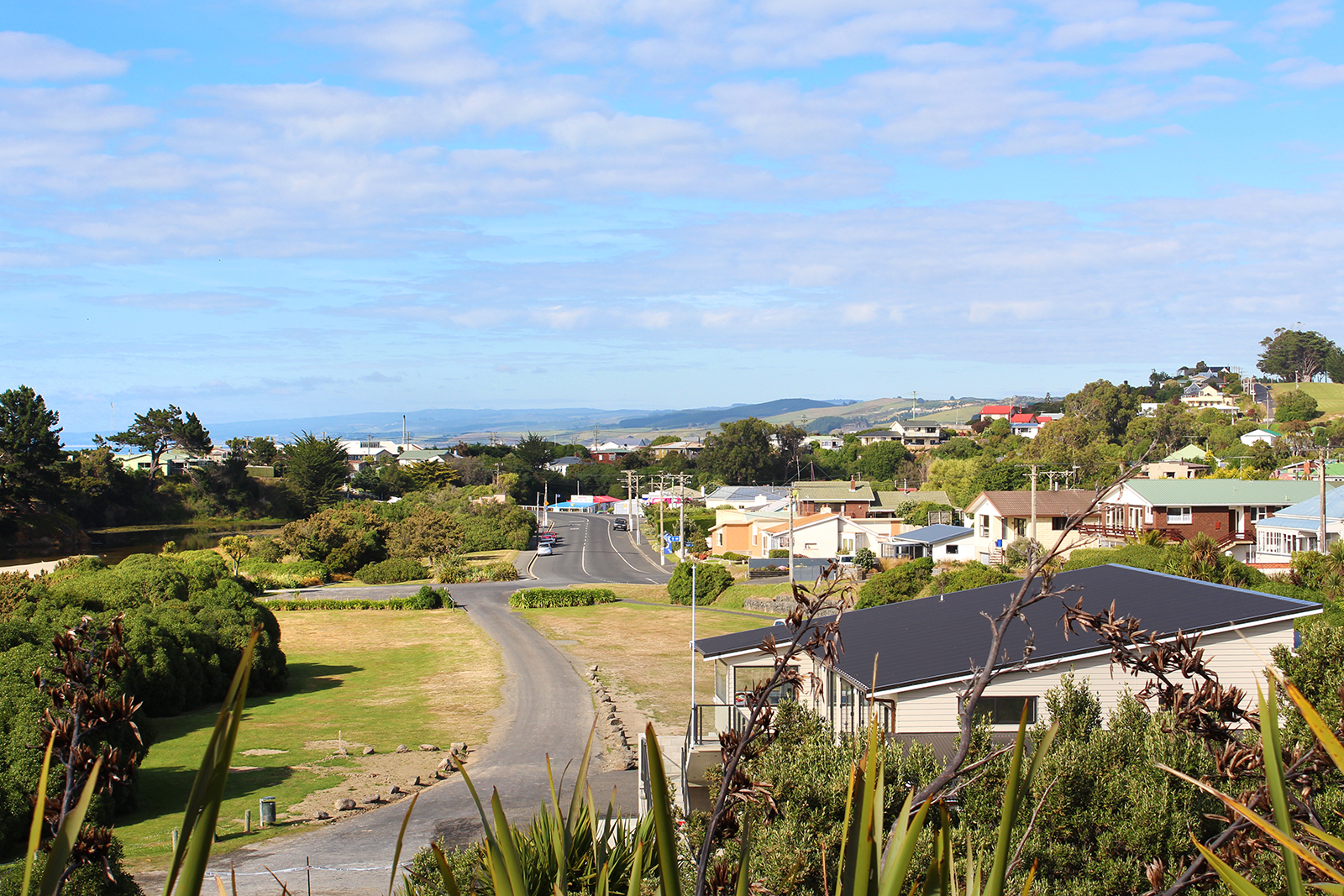
Brighton
About 16km south of central Dunedin, Brighton has long been a popular beach for both Dunedinites and holidaymakers alike.
The Brighton Surf Life Saving Club provides a strong community focus and just opened its new facility, which cost nearly $500,000 and was made possible thanks to five years of community fund raising. Reflecting the club’s position in the community, the building also serves as a multi-purpose community facility.
The small seaside village is also home to the Brighton Caravan Park and boat hire, a busy dairy and the South Seas Gallery.
Caravan Park owner Antony Burtenshaw has lived in Brighton for 18 months and loves the lifestyle that comes with living alongside a popular and safe swimming beach. “It’s a really friendly community, with everyone looking out for each other. It’s far enough from town, that it’s a nice drive home – and it’s warmer than in town. The lifestyle is great.”